Category:Rapenburg 87, Leiden
Jump to navigation
Jump to search
| Object location | | View all coordinates using: OpenStreetMap |
|---|
 | |||||
| Upload media | |||||
| Instance of |
| ||||
|---|---|---|---|---|---|
| Location | Leiden, South Holland, Netherlands | ||||
| Heritage designation |
| ||||
 | |||||
|
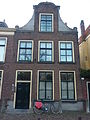
This is a category about rijksmonument number 25510
|
| Address |
|
Media in category "Rapenburg 87, Leiden"
The following 6 files are in this category, out of 6 total.
-
 Gevels - Leiden - 20137300 - RCE.jpg 1,200 × 802; 186 KB
-
 Leiden - Rapenburg 87 v2.JPG 1,906 × 2,952; 2.17 MB
-
 Leiden - Rapenburg 87 v2.jpg 3,456 × 5,184; 1.15 MB
-
 Leiden - Rapenburg 87 v3.jpg 3,456 × 5,184; 1.05 MB
-
 Leiden - Rapenburg 87.jpg 2,736 × 3,648; 4.06 MB
-
 Leiden - Rapenburg 87.JPG 2,456 × 3,274; 2.78 MB


