Category:Rapenburg 50, Leiden
Jump to navigation
Jump to search
| Object location | | View all coordinates using: OpenStreetMap |
|---|
 | |||||
| Upload media | |||||
| Instance of |
| ||||
|---|---|---|---|---|---|
| Location | Leiden, South Holland, Netherlands | ||||
| Heritage designation |
| ||||
 | |||||
|
This is a category about rijksmonument number 25551
|
| Address |
|
Media in category "Rapenburg 50, Leiden"
The following 6 files are in this category, out of 6 total.
-
 Gevels - Leiden - 20137223 - RCE.jpg 803 × 1,200; 209 KB
-
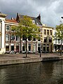
 Leiden - Rapenburg 42-44-46-48-50.jpg 5,184 × 3,456; 1.5 MB
-
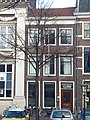 Leiden - Rapenburg 50.jpg 2,736 × 3,648; 4.97 MB
-
 Leiden - WLM2017 - Rapenburg 50 - 52 - 54.jpg 3,024 × 4,032; 2.32 MB
-
 Rapenburg 50 - Leiden 2015-03-21.jpg 3,456 × 5,184; 1.35 MB
-
 Voorgevel - Leiden - 20137226 - RCE.jpg 961 × 1,200; 258 KB


