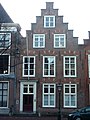
Category:Rapenburg 39, Leiden
Jump to navigation
Jump to search
| Object location | | View all coordinates using: OpenStreetMap |
|---|
 | |||||
| Upload media | |||||
| Instance of |
| ||||
|---|---|---|---|---|---|
| Location | Leiden, South Holland, Netherlands | ||||
| Heritage designation |
| ||||
 | |||||
|
This is a category about rijksmonument number 25486
|
| Address |
|
Media in category "Rapenburg 39, Leiden"
The following 5 files are in this category, out of 5 total.
-
 Gevels - Leiden - 20137205 - RCE.jpg 802 × 1,200; 184 KB
-
 Leiden - Rapenburg 39.jpg 2,736 × 3,648; 3.72 MB
-
 Leiden - Twee trapgevels aan het Rapenburg.jpg 4,032 × 3,024; 2.64 MB
-
 Overzicht van gevelwand - Leiden - 20382200 - RCE.jpg 1,200 × 1,196; 312 KB
-
 Voorgevel - Leiden - 20137212 - RCE.jpg 1,200 × 896; 275 KB


