Category:Rapenburg 12, Leiden
Jump to navigation
Jump to search
| Object location | | View all coordinates using: OpenStreetMap |
|---|
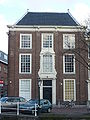
building in Leiden, Netherlands  | |||||
| Upload media | |||||
| Instance of | |||||
|---|---|---|---|---|---|
| Location | Leiden, South Holland, Netherlands | ||||
| Heritage designation |
| ||||
 | |||||
|
This is a category about rijksmonument number 25535
|
| Address |
|
Media in category "Rapenburg 12, Leiden"
The following 9 files are in this category, out of 9 total.
-
 Gevel - Leiden - 20137108 - RCE.jpg 802 × 1,200; 168 KB
-
 Gevels - Leiden - 20137089 - RCE.jpg 1,200 × 889; 184 KB
-
 Leiden - Rapenburg 12.jpg 2,736 × 3,648; 4.52 MB
-
 Overzicht met grachtenhuizen - Leiden - 20343431 - RCE.jpg 1,200 × 790; 213 KB
-
 Plafond met stucdecoratie - Leiden - 20137111 - RCE.jpg 884 × 1,200; 268 KB
-
 Trap - Leiden - 20137110 - RCE.jpg 884 × 1,200; 173 KB
-
 Voor- en zijgevel - Leiden - 20137109 - RCE.jpg 1,017 × 1,200; 277 KB
-
 Voorgevel - Leiden - 20137106 - RCE.jpg 936 × 1,200; 250 KB
-
 Voorgevel - Leiden - 20137107 - RCE.jpg 946 × 1,200; 241 KB


