Category:Ranmore Common
Jump to navigation
Jump to search
English: Ranmore Common is a linear group of fives homes with an isolated church and escarpment above of meadow and wooded, common land on the upper part of the North Downs, northwest of Dorking in the English county of Surrey. It is in the civil parish of Wotton and is also in the Surrey Hills Area of Outstanding Natural Beauty. Arguably its extent, which has colloquially exceeds that of its eponymous Site of Special Scientific Interest (SSSI), includes Denbies Vineyard which takes up some of the eastern projection of the escarpment. Most of the common is the SSSI, a habitat for rare grasses, woodland shrubs, invertebrates such as butterflies and mammals such as bats.
village in United Kingdom .JPG) | |||||
| Upload media | |||||
| Instance of | |||||
|---|---|---|---|---|---|
| Location | Wotton, Mole Valley, Surrey, South East England, England | ||||
 | |||||
Subcategories
This category has the following 3 subcategories, out of 3 total.
R
- Ranmore Common SSSI (9 F)
T
- Tanner's Hatch (7 F)
Media in category "Ranmore Common"
The following 34 files are in this category, out of 34 total.
-
 Butterfly sculpture, Pilgrims' Way, Ranmore.jpg 1,331 × 2,000; 1.31 MB
-
 Crossroads on Ranmore Common - geograph.org.uk - 2137794.jpg 800 × 600; 187 KB
-

-
 Entrance to Steers Field - geograph.org.uk - 1505009.jpg 640 × 427; 101 KB
-
 Flickr - don macauley - Deadly Nightshade.jpg 3,686 × 2,496; 3.92 MB
-
 Houses on Ranmore Common, Surrey - geograph.org.uk - 1395189.jpg 640 × 428; 87 KB
-
 Lane past North Downs viewpoint - geograph.org.uk - 1585461.jpg 640 × 480; 128 KB
-
 Mouse seat, Steers Field, Ranmore.jpg 2,500 × 1,666; 941 KB
-
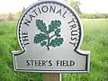 National Trust sign, Steer's Field.jpg 2,816 × 2,112; 1.42 MB
-
 Pilgrim's Way on Ranmore Common - geograph.org.uk - 1395307.jpg 640 × 428; 78 KB
-
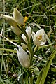 Rammore Common, white helleborine (Cephalanthera damasonium) flowers.jpg 2,333 × 3,500; 1.36 MB
-
 Rammore Common, white helleborine (Cephalanthera damasonium).jpg 2,664 × 4,000; 1.82 MB
-
 Ranmore - geograph.org.uk - 788722.jpg 640 × 429; 83 KB
-
 Ranmore Camp Site - geograph.org.uk - 1849740.jpg 640 × 426; 146 KB
-
 Ranmore Common, Dorking - geograph.org.uk - 2221417.jpg 1,600 × 1,200; 580 KB
-
 Ranmore Common, Great Copse, Bluebell woods.jpg 4,000 × 2,660; 5.68 MB
-
 Ranmore Common, North Downs Way.jpg 2,660 × 4,000; 5.34 MB
-
 Ranmore Common, woods along the North Downs Way.jpg 4,000 × 2,669; 5.5 MB
-
 Ranmore Rectory - geograph.org.uk - 2426802.jpg 1,920 × 2,560; 2.43 MB
-
 Stonyrock car park - geograph.org.uk - 1509223.jpg 640 × 427; 256 KB
-

-
 View From Ranmore Common, Surrey (1) - geograph.org.uk - 1395238.jpg 640 × 360; 59 KB
-
 View From Ranmore Common, Surrey (3) - geograph.org.uk - 1395294.jpg 640 × 360; 56 KB
-
 View from Steers Field, Ranmore, towards Dorking.jpg 6,000 × 1,981; 3.19 MB
-
 View from Steers Field, Ranmore, towards White Downs.jpg 4,000 × 2,669; 2.57 MB
-

-

-

-

-

-
 View Towards Ranmore Common - geograph.org.uk - 1395993.jpg 640 × 360; 45 KB
-
 View Towards Ranmore Common - geograph.org.uk - 1396001.jpg 640 × 360; 56 KB
-
 Westcott - geograph.org.uk - 59600.jpg 640 × 480; 130 KB
-
 White and blue - geograph.org.uk - 1290278.jpg 640 × 426; 86 KB


_flowers.jpg)
.jpg)


_-_geograph.org.uk_-_1395238.jpg)
_-_geograph.org.uk_-_1395294.jpg)

_(1).JPG)
_(2).JPG)
_(3).JPG)
_(4).JPG)
_(5).JPG)


