Category:Rangitata Diversion Race
Jump to navigation
Jump to search
canal in New Zealand  | |||||
| Upload media | |||||
| Instance of | |||||
|---|---|---|---|---|---|
| Location |
| ||||
| Elevation above sea level |
| ||||
 | |||||
English: Irrigation canal in mid-Canterbury, in the South Island of New Zealand.
Media in category "Rangitata Diversion Race"
The following 43 files are in this category, out of 43 total.
-
 Rangitata Diversion Race route map.svg 3,202 × 2,175; 6.04 MB
-
 RDR at South Branch of Ashburton river - overflow channel.jpg 4,032 × 3,024; 6.83 MB
-
 RDR at South Branch of Ashburton river syphon 1.jpg 4,032 × 3,024; 6.02 MB
-
 RDR at South Branch of Ashburton river syphon 2.jpg 4,032 × 3,024; 6.34 MB
-
 RDR at South Branch of Ashburton river syphon 3.jpg 4,032 × 3,024; 5.63 MB
-
 RDR at South Branch of Ashburton river syphon 4.jpg 4,032 × 3,024; 6.53 MB
-
 RDR at South Branch of Ashburton river syphon 5.jpg 4,032 × 3,024; 6.45 MB
-
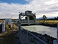
 RDR Control gates - Dip road offtake 1.jpg 4,032 × 3,024; 4.15 MB
-
 RDR Control gates - Dip road offtake 2.jpg 4,032 × 3,024; 5.61 MB
-
 RDR Control gates - Dip road offtake 3.jpg 4,032 × 3,024; 4.62 MB
-
 RDR Dip road offtake drops 1.jpg 4,032 × 3,024; 5.94 MB
-
 RDR Dip road offtake drops 2.jpg 4,032 × 3,024; 5.12 MB
-
 RDR Dip road offtake drops 3.jpg 4,032 × 3,024; 5.12 MB
-
 RDR Dip road offtake drops 4.jpg 4,032 × 3,024; 4.3 MB
-
 RDR Dry Creek syphon.jpg 4,032 × 3,024; 5.19 MB
-
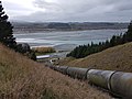
 RDR end at Highbank 1.jpg 4,032 × 3,024; 5.1 MB
-
 RDR end at Highbank 2.jpg 4,032 × 3,024; 4.48 MB
-
 RDR end at Highbank 3.jpg 3,024 × 4,032; 4.66 MB
-
 RDR end at Highbank 4.jpg 3,024 × 4,032; 4.67 MB
-
 RDR end at Highbank 5.jpg 4,032 × 3,024; 6.07 MB
-
 RDR end at Highbank 6.jpg 4,032 × 3,024; 5.04 MB
-
 RDR end at Highbank 7.jpg 4,032 × 3,024; 4.4 MB
-
 RDR end at Highbank 8.jpg 4,032 × 3,024; 5.44 MB
-
 RDR end at Highbank 9.jpg 4,032 × 3,024; 5.31 MB
-
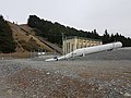
 RDR Highbank Power station 1.jpg 4,032 × 3,024; 5.67 MB
-
 RDR Highbank Power station 10.jpg 4,032 × 3,024; 5.86 MB
-
 RDR Highbank Power station 2.jpg 3,024 × 4,032; 6.01 MB
-
 RDR Highbank Power station 3.jpg 4,032 × 3,024; 5.87 MB
-
 RDR Highbank Power station 4.jpg 4,032 × 3,024; 6.77 MB
-
 RDR Highbank Power station 5.jpg 4,032 × 3,024; 5.77 MB
-
 RDR Highbank Power station 6.jpg 4,032 × 3,024; 5.68 MB
-
 RDR Highbank Power station 7.jpg 4,032 × 3,024; 5.89 MB
-
 RDR Highbank Power station 8.jpg 4,032 × 3,024; 5.35 MB
-
 RDR Highbank Power station 9.jpg 4,032 × 3,024; 6.05 MB
-
 RDR Information Sign 1.jpg 4,032 × 3,024; 4.91 MB
-
 RDR Information Sign 2.jpg 4,032 × 3,024; 4.92 MB
-
 RDR near Methven looking South.jpg 4,032 × 3,024; 6.95 MB
-
 RDR Near South Branch of Ashburton river.jpg 4,032 × 3,024; 6.84 MB
-
 RDR neat Methven looking North.jpg 4,032 × 3,024; 6.41 MB
-
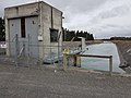
 RDR Pipe Shed Information.jpg 5,312 × 2,988; 6.07 MB
-
 RDR Plaque.jpg 4,032 × 3,024; 7.51 MB
-
 RDR vies from Staveley Ridge Mt Somers - ennlarged.jpg 1,369 × 382; 212 KB
-
 RDR view from Staveley Ridge Mt Somers.jpg 4,032 × 3,024; 5.73 MB


