Category:Ramshorn
Jump to navigation
Jump to search
English: The tiny hamlet of Ramsor (Methodist spelling) in North Staffordshire played a significant part in the origins of Primitive Methodism. Listed in the Domesday Book as Ramshorn, this ancient hamlet is a typical example of the depopulation of the countryside. Very little now remains of this village apart from Wootton Lodge and a few farms and cottages. The Primitive Methodist Chapel is the only surviving public building.
human settlement in United Kingdom  | |||||
| Upload media | |||||
| Instance of | |||||
|---|---|---|---|---|---|
| Location | East Staffordshire, Staffordshire, West Midlands, England | ||||
| Population |
| ||||
 | |||||
Media in category "Ramshorn"
The following 23 files are in this category, out of 23 total.
-
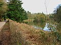
 Brookleys Lake, Wootton Lodge Estate - geograph.org.uk - 2250753.jpg 640 × 480; 119 KB
-
 Chickens and sheds - geograph.org.uk - 5098811.jpg 1,280 × 960; 390 KB
-
 Entrance to JCB Lafarge Tarmac Kevin Quarry - geograph.org.uk - 4303347.jpg 1,200 × 900; 235 KB
-
 Footpath junction and squeeze stile - geograph.org.uk - 5287926.jpg 1,280 × 960; 667 KB
-
 Former track through Ramshorn - geograph.org.uk - 4314894.jpg 1,200 × 900; 275 KB
-
 Limestone Quarry - geograph.org.uk - 4458767.jpg 4,320 × 3,240; 4.36 MB
-
 Parkside in Wootton Park - geograph.org.uk - 4618259.jpg 3,072 × 1,728; 1.11 MB
-
 Parkside in Wootton Park - geograph.org.uk - 4618270.jpg 3,072 × 1,728; 1.11 MB
-
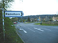 Ramshorn Signpost.JPG 2,304 × 1,728; 1.16 MB
-
 Ramshorn snail on the wood.jpg 6,016 × 4,000; 5.25 MB
-
 Ramsor PM Chapel 200703.jpg 1,091 × 703; 637 KB
-
 Ramsor PM interior.JPG 1,728 × 2,304; 1.84 MB
-
 Sandy Lane - geograph.org.uk - 5098831.jpg 1,280 × 960; 740 KB
-

-
 SnailRamshorn snail on the wood with calcium deficiency.png 6,016 × 4,000; 34.69 MB
-
 Storage bins - geograph.org.uk - 1166430.jpg 640 × 479; 115 KB
-
 Wootton Lodge - geograph.org.uk - 2250743.jpg 640 × 480; 63 KB
-
 Dew pond on the Weaver Hills - geograph.org.uk - 364961.jpg 640 × 431; 127 KB
-
 Parkside Farm - geograph.org.uk - 549331.jpg 640 × 480; 89 KB
-
 Southeastern edge of Wardlow Quarry - geograph.org.uk - 366141.jpg 640 × 428; 133 KB
-
 Southeastern end of Wardlow quarry - geograph.org.uk - 366152.jpg 640 × 423; 128 KB
-
 Triangulation pillar on the Weaver Hills - geograph.org.uk - 364938.jpg 640 × 428; 125 KB
-
 Wooton Lake - geograph.org.uk - 366167.jpg 640 × 480; 115 KB


