Category:Ramsholt
Jump to navigation
Jump to search
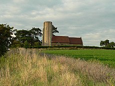
English: Ramsholt is a small village in Suffolk, England. It is situated on the northern shore of the River Deben.
village and civil parish in Suffolk, UK | |||||
| Upload media | |||||
| Instance of | |||||
|---|---|---|---|---|---|
| Location |
| ||||
| Population |
| ||||
 | |||||
Subcategories
This category has the following 4 subcategories, out of 4 total.
Media in category "Ramsholt"
The following 140 files are in this category, out of 140 total.
-
A beach on the Deben - geograph.org.uk - 5484815.jpg 1,024 × 768; 747 KB
-
A creek on the River Deben - geograph.org.uk - 5883988.jpg 1,024 × 768; 837 KB
-
About To Launch - geograph.org.uk - 3953032.jpg 1,024 × 768; 125 KB
-
Anchor at Ramsholt - geograph.org.uk - 2615635.jpg 2,304 × 3,072; 1.6 MB
-
Anchored off The Rocks - geograph.org.uk - 5884217.jpg 819 × 1,024; 816 KB
-
Arable fields above the River Deben - geograph.org.uk - 3554507.jpg 3,648 × 2,736; 1.78 MB
-
Arable fields south of Dock Lane - geograph.org.uk - 3554433.jpg 3,648 × 2,736; 2.01 MB
-
Bank of River Deben - geograph.org.uk - 815912.jpg 640 × 427; 74 KB
-
Bank of the River Deben - geograph.org.uk - 816389.jpg 640 × 427; 98 KB
-
Barley field, Ramsholt - geograph.org.uk - 816108.jpg 640 × 427; 86 KB
-
Barns at Valley Farm - geograph.org.uk - 3729268.jpg 3,648 × 2,736; 2.49 MB
-
Boats on the quayside at Ramsholt - geograph.org.uk - 1803170.jpg 2,816 × 2,112; 1.48 MB
-
Bridleway and Entrance to Ramsholt Lodge Farm - geograph.org.uk - 2626801.jpg 3,072 × 2,304; 1.4 MB
-
Bridleway and Entrance to Ramsholt Lodge Farm - geograph.org.uk - 2626807.jpg 3,072 × 2,304; 1.4 MB
-
Bridleway near Alderton walks - geograph.org.uk - 4182827.jpg 640 × 480; 104 KB
-
Bridleway near Ramsholt - geograph.org.uk - 6916795.jpg 768 × 1,024; 244 KB
-
Bridleway to All Saints, Ramsholt - geograph.org.uk - 6225878.jpg 720 × 480; 91 KB
-
Bridleway to Heath Cottage - geograph.org.uk - 2615152.jpg 3,072 × 2,304; 1.59 MB
-
Bridleway to Ramsholt Dock - geograph.org.uk - 2626792.jpg 3,072 × 2,304; 1.6 MB
-
Bridleway to Ramsholt Dock - geograph.org.uk - 2626793.jpg 2,304 × 3,072; 1.25 MB
-
Bridleway to Ramsholt Lodge Farm - geograph.org.uk - 2615330.jpg 3,072 × 2,304; 1.47 MB
-
Bridleway to Ramsholt ^ Entrance to Valley Farm - geograph.org.uk - 2626393.jpg 3,072 × 2,304; 1.28 MB
-
Bridleway to Ramsholt ^ Entrance to Valley Farm - geograph.org.uk - 2626394.jpg 3,072 × 2,304; 1.32 MB
-
Bridleway to Ramsholt ^ Entrance to Valley Farm - geograph.org.uk - 2626395.jpg 3,072 × 2,304; 1.28 MB
-
Bridleway to Rowan Hill Wood - geograph.org.uk - 2626776.jpg 3,072 × 2,304; 1.44 MB
-
Bridleway to Rowan Hill Wood - geograph.org.uk - 2626778.jpg 3,072 × 2,304; 1.4 MB
-
Bridleway to Tom's Wood - geograph.org.uk - 2626853.jpg 3,072 × 2,304; 1.38 MB
-
Catching crabs at Ramsholt - geograph.org.uk - 815183.jpg 640 × 427; 103 KB
-
Church Lane junction - geograph.org.uk - 2626849.jpg 3,072 × 2,304; 1.28 MB
-
Cottage in Ramsholt - geograph.org.uk - 3027336.jpg 3,648 × 2,736; 2.97 MB
-
Dead-end road to the Ramsholt Arms - geograph.org.uk - 4182737.jpg 640 × 480; 113 KB
-
Deben View - geograph.org.uk - 6916792.jpg 768 × 1,024; 184 KB
-
Drain near Ramsholt Lodge Farm - geograph.org.uk - 3878562.jpg 3,648 × 2,736; 2.63 MB
-
Elm Row, near Ramsholt - geograph.org.uk - 624815.jpg 640 × 427; 84 KB
-
Entrance To Ramsholt Arms - geograph.org.uk - 3953046.jpg 1,024 × 768; 364 KB
-
Farmland near Ramsholt - geograph.org.uk - 816395.jpg 640 × 427; 72 KB
-
Field Of Wheat - geograph.org.uk - 5530402.jpg 1,024 × 768; 234 KB
-
Flood bank of the River Deben - geograph.org.uk - 816408.jpg 427 × 640; 96 KB
-
Footpath - geograph.org.uk - 3953101.jpg 1,024 × 768; 190 KB
-
Forest Track - geograph.org.uk - 3953094.jpg 1,024 × 768; 342 KB
-
Green Field And Track - geograph.org.uk - 3953114.jpg 1,024 × 768; 210 KB
-
Groynes at Ramsholt - geograph.org.uk - 60655.jpg 640 × 427; 190 KB
-
Harbourmaster's Office, Ramsholt - geograph.org.uk - 815171.jpg 640 × 427; 88 KB
-
Heath Wood - geograph.org.uk - 3878527.jpg 3,648 × 2,736; 3.15 MB
-
In Cragpit Plantation - geograph.org.uk - 6916793.jpg 768 × 1,024; 378 KB
-
Keeper's Cottage Sluice - geograph.org.uk - 815945.jpg 640 × 427; 99 KB
-
Lodge Farm Sluice - geograph.org.uk - 3878583.jpg 3,648 × 2,736; 4 MB
-
Lodge Plantation, Ramsholt - geograph.org.uk - 2746355.jpg 4,393 × 2,989; 3.99 MB
-
Looking Across The River - geograph.org.uk - 3901008.jpg 1,024 × 768; 134 KB
-
Moored on the Deben - geograph.org.uk - 5484833.jpg 1,024 × 768; 879 KB
-
Muddy Channel - geograph.org.uk - 5530395.jpg 1,024 × 768; 212 KB
-
Muddy Deben river bank - geograph.org.uk - 815918.jpg 640 × 416; 88 KB
-
Near Ramsholt Dock - geograph.org.uk - 5484859.jpg 1,024 × 768; 835 KB
-
Newly sown crops off Church Lane, Ramsholt - geograph.org.uk - 2626412.jpg 3,072 × 2,304; 1.43 MB
-
No crabbing allowed - geograph.org.uk - 815178.jpg 640 × 421; 67 KB
-
Old River Bank Defences - geograph.org.uk - 3953025.jpg 1,024 × 768; 221 KB
-
On the Deben estuary near Ramsholt - geograph.org.uk - 5484853.jpg 1,024 × 768; 819 KB
-
Path through Lodge Plantation - geograph.org.uk - 3878612.jpg 2,736 × 3,648; 5.77 MB
-
Pill Box - geograph.org.uk - 377446.jpg 640 × 480; 58 KB
-
Pillbox - geograph.org.uk - 377438.jpg 640 × 480; 49 KB
-
Ploughed Field - geograph.org.uk - 3953047.jpg 1,024 × 768; 244 KB
-
Proud parents - geograph.org.uk - 452517.jpg 640 × 480; 151 KB
-
Ramsholt church - geograph.org.uk - 6916794.jpg 768 × 1,024; 222 KB
-
Ramsholt Dock - geograph.org.uk - 3018019.jpg 3,648 × 2,736; 2.5 MB
-
Ramsholt Dock - geograph.org.uk - 3554439.jpg 3,471 × 2,675; 1.2 MB
-
Ramsholt Dock on Boxing Day - geograph.org.uk - 6008971.jpg 1,024 × 768; 740 KB
-
Ramsholt Dock, River Deben - geograph.org.uk - 5914910.jpg 3,456 × 2,592; 5.27 MB
-
Ramsholt Lodge Farm - geograph.org.uk - 3878571.jpg 3,648 × 2,736; 2.28 MB
-
Ramsholt Quay - geograph.org.uk - 788237.jpg 640 × 480; 61 KB
-
Ramsholt Quay - geograph.org.uk - 815200.jpg 640 × 427; 82 KB
-
Ramsholt Road junction - geograph.org.uk - 2615151.jpg 3,072 × 2,304; 1.61 MB
-
Ramsholt, a Boxing Day walk past Valley Cottage - geograph.org.uk - 6008963.jpg 1,024 × 1,024; 1.4 MB
-
Ramsholt, bridle ways and The Old School House - geograph.org.uk - 6008940.jpg 1,024 × 768; 964 KB
-
Ramsholt, standing water on Boxing Day - geograph.org.uk - 6008961.jpg 1,024 × 732; 731 KB
-
Ramsholt, Suffolk - geograph.org.uk - 5353511.jpg 4,000 × 3,000; 4.46 MB
-
Ramsholt, the Harbourmaster's Office - geograph.org.uk - 6009005.jpg 1,024 × 682; 660 KB
-
Ramsholt, the lane to the church - geograph.org.uk - 6008946.jpg 1,024 × 768; 893 KB
-
Ramsholt, towards the river - geograph.org.uk - 6008938.jpg 1,024 × 768; 940 KB
-
Ramshot Road to the B1083 Alderton Road - geograph.org.uk - 2626372.jpg 3,072 × 2,304; 1.46 MB
-
River Deben - geograph.org.uk - 1913452.jpg 640 × 480; 37 KB
-
River Deben - geograph.org.uk - 6225863.jpg 1,024 × 576; 110 KB
-
River Deben at Ramsholt Quay - geograph.org.uk - 2615200.jpg 3,072 × 2,304; 1.32 MB
-
River Deben at Ramsholt Quay - geograph.org.uk - 2615205.jpg 3,072 × 2,304; 1.31 MB
-
River Deben from Ramsholt Quay - geograph.org.uk - 6833874.jpg 3,349 × 2,512; 2.11 MB
-
River Deben from Ramsholt Quay - geograph.org.uk - 6833877.jpg 3,456 × 2,592; 2.23 MB
-
River Deben near Ramsholt - geograph.org.uk - 456118.jpg 640 × 425; 44 KB
-
River defences at Ramsholt - geograph.org.uk - 815926.jpg 640 × 428; 100 KB
-
Riverside, River Deben - geograph.org.uk - 6225881.jpg 1,024 × 576; 91 KB
-
Road Junction - geograph.org.uk - 3953080.jpg 1,024 × 768; 195 KB
-
Road Junction - geograph.org.uk - 3953083.jpg 1,024 × 768; 172 KB
-
Road junction with Church Lane, Ramsholt - geograph.org.uk - 2626366.jpg 3,072 × 2,304; 1.46 MB
-
Road to Ramsholt Church - geograph.org.uk - 3878532.jpg 3,648 × 2,736; 2.57 MB
-
Roadsign at Church Lane junction - geograph.org.uk - 2626368.jpg 2,304 × 3,072; 1.41 MB
-
Roadsigns on Dock Road - geograph.org.uk - 2615164.jpg 2,304 × 3,072; 1.6 MB
-
Sailing from Ramsholt Quay - geograph.org.uk - 815186.jpg 640 × 427; 66 KB
-
Saltmarsh and farmland, Ramsholt - geograph.org.uk - 816429.jpg 640 × 427; 92 KB
-
Saltmarsh near Ramsholt - geograph.org.uk - 816420.jpg 640 × 427; 86 KB
-
Samphire island - geograph.org.uk - 815157.jpg 640 × 413; 91 KB
-
Sandy Track - geograph.org.uk - 3953110.jpg 1,024 × 768; 227 KB
-
Ships anchor at Ramsholt - geograph.org.uk - 1803712.jpg 2,816 × 2,112; 1.53 MB
-
Shottisham Creek - geograph.org.uk - 3878135.jpg 3,648 × 2,736; 2.62 MB
-
Shottisham Creek Sluice - geograph.org.uk - 6225860.jpg 1,024 × 576; 121 KB
-
Sign pointing to Ramsholt Church - geograph.org.uk - 3878538.jpg 3,648 × 2,736; 2.57 MB
-
Sluice Cottage - geograph.org.uk - 3878636.jpg 3,648 × 2,736; 2.79 MB
-
Sunset over the River Deben, Ramsholt - geograph.org.uk - 6355659.jpg 1,600 × 1,064; 274 KB
-
Sunset over the River Deben, Ramsholt - geograph.org.uk - 6358637.jpg 1,600 × 1,064; 221 KB
-
The Old School, Ramsholt - geograph.org.uk - 3018053.jpg 3,648 × 2,736; 3.17 MB
-
Towards Ramsholt Lodge Farm - geograph.org.uk - 5484824.jpg 1,024 × 768; 799 KB
-
Track and Farmland with River Deben beyond - geograph.org.uk - 6225855.jpg 576 × 1,024; 115 KB
-
Track in Ramsholt - geograph.org.uk - 3021592.jpg 3,648 × 2,736; 2.65 MB
-
Track near Shottisham Creek Sluice - geograph.org.uk - 3878140.jpg 3,648 × 2,736; 3.07 MB
-
Track to Ramsholt Quay - geograph.org.uk - 815195.jpg 640 × 427; 85 KB
-
Tracks across barley field - geograph.org.uk - 816109.jpg 427 × 640; 101 KB
-
Tree Stump - geograph.org.uk - 3953181.jpg 1,024 × 768; 342 KB
-
Un-named lane junction with Dock Road - geograph.org.uk - 3554417.jpg 3,567 × 2,475; 1.85 MB
-
Un-named lane northwest of Heath Wood - geograph.org.uk - 3554512.jpg 3,648 × 2,736; 1.34 MB
-
Valley Farm - geograph.org.uk - 3953078.jpg 1,024 × 767; 138 KB
-
Valley Farm buildings - geograph.org.uk - 3554427.jpg 3,648 × 2,736; 2.11 MB
-
Valley Farm, Ramsholt - geograph.org.uk - 816436.jpg 640 × 427; 108 KB
-
View from Ramsholt car park - geograph.org.uk - 3027356.jpg 3,648 × 2,048; 1.92 MB
-
View southeast from Ramsholt car-park - geograph.org.uk - 6358635.jpg 1,600 × 1,064; 333 KB
-
Waiting For A High Tide - geograph.org.uk - 3953174.jpg 1,024 × 768; 253 KB
-
Watching the tide come in - geograph.org.uk - 815191.jpg 640 × 433; 61 KB
-
Yellow Field - geograph.org.uk - 3953180.jpg 1,024 × 768; 277 KB
-
Alderton House, near Ramsholt - geograph.org.uk - 624823.jpg 640 × 427; 96 KB
-
Farm track, Ramsholt, Suffolk - geograph.org.uk - 72628.jpg 480 × 640; 89 KB
-
Fleece-covered furrows - geograph.org.uk - 377443.jpg 640 × 480; 38 KB
-
Grassy dyke - geograph.org.uk - 444634.jpg 640 × 480; 97 KB
-
Kings Fleet On The Left - geograph.org.uk - 471233.jpg 640 × 480; 83 KB
-
Mudflats at Falkenham Creek - geograph.org.uk - 452511.jpg 640 × 480; 69 KB
-
Pasture - geograph.org.uk - 377433.jpg 640 × 480; 49 KB
-
Pictures in the sky - geograph.org.uk - 452525.jpg 640 × 480; 62 KB
-
Ramsholt from across the river - geograph.org.uk - 452508.jpg 640 × 480; 100 KB
-
Ramsholt, Suffolk - geograph.org.uk - 72629.jpg 640 × 480; 72 KB
-
River Deben marshland - geograph.org.uk - 444630.jpg 640 × 480; 99 KB
-
View from the sea dyke - geograph.org.uk - 452505.jpg 640 × 480; 90 KB


