Category:Ramsden, London
Jump to navigation
Jump to search
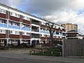
English: Ramsden is an area of London in the unparished area of Orpington, in the London borough of Bromley, in the county of Greater London, England.
council estate in Orpington, South East London  | |||||
| Upload media | |||||
| Instance of | |||||
|---|---|---|---|---|---|
| Location | Orpington, London Borough of Bromley, Greater London, London, England | ||||
 | |||||
Media in category "Ramsden, London"
The following 11 files are in this category, out of 11 total.
-
 Church of Unity, Ramsden - geograph.org.uk - 688524.jpg 640 × 480; 99 KB
-
 Cuckmere Way - geograph.org.uk - 691151.jpg 640 × 480; 83 KB
-
 Eldred Drive, Orpington - geograph.org.uk - 1227620.jpg 640 × 480; 73 KB
-
 Flats, Petten Grove, Orpington, Kent - geograph.org.uk - 159067.jpg 640 × 480; 73 KB
-
 Peckham House - geograph.org.uk - 688852.jpg 640 × 480; 90 KB
-
 Ramsden revival plaque - geograph.org.uk - 1527993.jpg 640 × 480; 116 KB
-
 Ramsden's revival plaque - geograph.org.uk - 1527992.jpg 480 × 640; 76 KB
-
 Shops in Eldred Drive - geograph.org.uk - 688483.jpg 640 × 480; 74 KB
-
 Stour Court - geograph.org.uk - 688526.jpg 480 × 640; 105 KB
-
 Tintagel Road - geograph.org.uk - 1528019.jpg 640 × 480; 95 KB
-
 William Petty Way - geograph.org.uk - 1527938.jpg 640 × 486; 104 KB


