Category:Rampisham
Jump to navigation
Jump to search
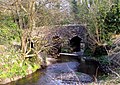
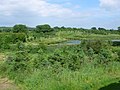
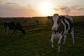
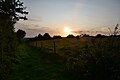
English: Rampisham is a village in west Dorset, England, situated in a steep valley ten miles north west of Dorchester. The village has a population of 102 . The principal means of making a living is agricultural, mainly grain production.
village and civil parish in Dorset, United Kingdom  | |||||
| Upload media | |||||
| Instance of | |||||
|---|---|---|---|---|---|
| Location | Dorset, South West England, England | ||||
| Population |
| ||||
 | |||||
Subcategories
This category has the following 3 subcategories, out of 3 total.
Media in category "Rampisham"
The following 84 files are in this category, out of 84 total.
-
 A356 southeast bound - geograph.org.uk - 3283696.jpg 640 × 480; 41 KB
-
 A356 towards Maiden Newton - geograph.org.uk - 6216631.jpg 1,024 × 684; 322 KB
-
 A356 towards Maiden Newton - geograph.org.uk - 6216641.jpg 1,024 × 684; 278 KB
-
 A356 towards Maiden Newton - geograph.org.uk - 6216650.jpg 1,024 × 684; 294 KB
-
 A356, Rampisham - geograph.org.uk - 3283675.jpg 640 × 480; 31 KB
-
 A356, Rampisham masts - geograph.org.uk - 3283686.jpg 640 × 480; 49 KB
-

-
 AppRm.jpg 1,600 × 1,200; 1.12 MB
-
 Belted Galloways near Rampisham - geograph.org.uk - 2212100.jpg 640 × 480; 131 KB
-
 Bridleway to A356 - geograph.org.uk - 5643410.jpg 640 × 480; 47 KB
-

-
 Buildings at Rampisham Transmitting Station - geograph.org.uk - 4413652.jpg 1,024 × 683; 210 KB
-
 Countryside near Linnet Farm - geograph.org.uk - 2209497.jpg 640 × 458; 35 KB
-
 Countryside near Rampisham - geograph.org.uk - 2212104.jpg 640 × 480; 91 KB
-
 Countryside near Rampisham - geograph.org.uk - 842476.jpg 640 × 480; 80 KB
-
 Countryside, Horsey Knap , Evershot - geograph.org.uk - 1009950.jpg 640 × 428; 69 KB
-
 Direction Sign – Signpost - geograph.org.uk - 6513061.jpg 960 × 720; 169 KB
-
 Dorset Countryside near Rampisham - geograph.org.uk - 842477.jpg 640 × 480; 50 KB
-
 Earthworks in Aunt Mary's Bottom^ - geograph.org.uk - 5643419.jpg 640 × 480; 77 KB
-
 Farmland west of Evershot - geograph.org.uk - 5312703.jpg 640 × 427; 41 KB
-
 Fields near Lower Coombe Farm - geograph.org.uk - 5312694.jpg 640 × 427; 48 KB
-
 Grazing sheep - geograph.org.uk - 5416787.jpg 640 × 428; 89 KB
-
 Horsey Farm - geograph.org.uk - 5540643.jpg 1,024 × 768; 198 KB
-
 Horsey Farm - geograph.org.uk - 5616938.jpg 640 × 427; 49 KB
-
 ICYArrays3.jpg 1,994 × 2,991; 5.87 MB
-
 Lane to Common Farm - geograph.org.uk - 5416798.jpg 640 × 480; 191 KB
-
 New Building at Rampisham Hill Farm - geograph.org.uk - 2841582.jpg 640 × 480; 67 KB
-
 Old School, Rampisham - geograph.org.uk - 5312700.jpg 640 × 427; 88 KB
-
 Ordnance Survey Cut Mark - geograph.org.uk - 4419053.jpg 480 × 640; 110 KB
-

-
 Rampisham Down radio transmitting station - geograph.org.uk - 6596157.jpg 1,600 × 1,200; 657 KB
-
 Rampisham Down Transmitting Station - geograph.org.uk - 2253620.jpg 4,416 × 3,312; 641 KB
-
 Rampisham Ford - geograph.org.uk - 4874405.jpg 1,600 × 1,067; 1.89 MB
-
 Rampisham Hill Farm - geograph.org.uk - 2841570.jpg 640 × 535; 46 KB
-
 Rampisham Radio Aerial Array - geograph.org.uk - 2923842.jpg 640 × 509; 95 KB
-
 Rampisham snow2.jpg 3,072 × 2,304; 2.67 MB
-
 Rampisham sunset.jpg 1,491 × 1,118; 1.06 MB
-
 Rampisham Village - geograph.org.uk - 842391.jpg 640 × 480; 88 KB
-
 Rampisham, old post office - geograph.org.uk - 521907.jpg 640 × 429; 135 KB
-
 Rampisham, postbox № DT2 170 - geograph.org.uk - 3361472.jpg 640 × 480; 131 KB
-
 Rampisham, Road by the Radio Station - geograph.org.uk - 1810647.jpg 800 × 535; 286 KB
-
 Rampisham, signpost detail - geograph.org.uk - 3361469.jpg 640 × 480; 87 KB
-

-

-
 Road junction in Rampisham - geograph.org.uk - 4413797.jpg 1,024 × 683; 249 KB
-
 Rush hour in Rampisham - geograph.org.uk - 3199813.jpg 640 × 480; 89 KB
-
 SenderAEG.jpg 1,760 × 1,168; 1.41 MB
-

-
 The centre of Rampisham - geograph.org.uk - 1215223.jpg 640 × 454; 143 KB
-

-
 The old village post office - Rampisham - geograph.org.uk - 1215231.jpg 640 × 480; 114 KB
-
 The radio masts on Rampisham Down - geograph.org.uk - 3029611.jpg 800 × 600; 76 KB
-
 Tiger's Head House, Rampisham - geograph.org.uk - 5416792.jpg 640 × 428; 99 KB
-
 Topiary hedge - Rampisham - geograph.org.uk - 1215235.jpg 473 × 640; 96 KB
-

-
 Turn off to Rampisham from the A356 - geograph.org.uk - 5643420.jpg 640 × 480; 55 KB
-
 View east from Rampisham - geograph.org.uk - 842392.jpg 640 × 480; 94 KB
-
 View of Rampisham transmitter site, Dorset, England.jpg 2,048 × 1,536; 675 KB
-
 West Dorset , Country Lane - geograph.org.uk - 5509047.jpg 6,000 × 4,000; 5.57 MB
-
 West Dorset , Country Lane - geograph.org.uk - 5509049.jpg 6,000 × 4,000; 6.87 MB
-
 West Dorset , Countryside Scenery - geograph.org.uk - 5509043.jpg 6,000 × 4,000; 7.12 MB
-
 West Dorset , Countryside Scenery - geograph.org.uk - 5517404.jpg 6,000 × 4,000; 5.66 MB
-
 West Dorset , Grassy Field - geograph.org.uk - 5509046.jpg 6,000 × 4,000; 6.22 MB
-
 West Dorset , Grassy Field ^ Cattle - geograph.org.uk - 5509044.jpg 5,549 × 3,699; 6.95 MB
-
 West Dorset , Grassy Field ^ Cattle - geograph.org.uk - 5509045.jpg 6,000 × 4,000; 6.53 MB
-
 West Dorset , Grassy Field ^ Gate - geograph.org.uk - 5509048.jpg 5,824 × 3,883; 7.39 MB
-
 West Dorset , Grassy Path - geograph.org.uk - 5509042.jpg 6,000 × 4,000; 4.98 MB
-
 West Dorset , Rampisham Hill Farm - geograph.org.uk - 5509050.jpg 6,000 × 4,000; 6.5 MB
-
 Yard Lane - geograph.org.uk - 5416803.jpg 640 × 480; 154 KB
-
 Aunt Mary's Bottom - geograph.org.uk - 558520.jpg 640 × 480; 151 KB
-
 Aunt Mary's Bottom - geograph.org.uk - 560928.jpg 640 × 480; 170 KB
-
 Brook - geograph.org.uk - 402296.jpg 640 × 480; 130 KB
-
 Downland, Rampisham - geograph.org.uk - 558786.jpg 640 × 480; 119 KB
-
 Field and woods near Rampisham - geograph.org.uk - 642597.jpg 640 × 480; 44 KB
-
 Higher Combe Farm - geograph.org.uk - 642606.jpg 640 × 480; 68 KB
-
 Radio mast array, Rampisham - geograph.org.uk - 688100.jpg 640 × 480; 32 KB
-
 Radio Mast at Rampisham - geograph.org.uk - 686916.jpg 640 × 480; 33 KB
-
 Rampisham - geograph.org.uk - 405949.jpg 640 × 478; 132 KB
-
 Rampisham Down - geograph.org.uk - 558556.jpg 480 × 640; 133 KB
-
 Rampisham Down - geograph.org.uk - 558833.jpg 480 × 640; 111 KB
-
 Rampisham Down - geograph.org.uk - 560820.jpg 640 × 480; 117 KB
-
 Rampisham Down - geograph.org.uk - 560833.jpg 480 × 640; 95 KB
-
 Red Signpost near Benville Bridge - geograph.org.uk - 405922.jpg 640 × 466; 136 KB
-
 Sad Signpost at Sandhills - geograph.org.uk - 405762.jpg 640 × 480; 160 KB


