Category:Ramore Head, Portrush
Jump to navigation
Jump to search
Main Wikipedia article: Ramore Head.

headland in Northern Ireland  | |||||
| Upload media | |||||
| Instance of | |||||
|---|---|---|---|---|---|
| Location | County Antrim, Northern Ireland | ||||
 | |||||
Media in category "Ramore Head, Portrush"
The following 11 files are in this category, out of 11 total.
-
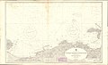 Admiralty Chart No 2798 Rathlin Island to Lough Foyle, Published 1966.jpg 18,355 × 11,179; 12.09 MB
-
 Atlantic wave, Portrush (1 of 3) - geograph.org.uk - 594597.jpg 640 × 427; 90 KB
-
 Cliff path, Portrush - geograph.org.uk - 594583.jpg 640 × 427; 92 KB
-
 Path, Ramore Head, Portrush - geograph.org.uk - 813196.jpg 640 × 408; 78 KB
-
 Ramore Head - geograph.org.uk - 474700.jpg 640 × 416; 252 KB
-
 Ramore Head, Portrush - geograph.org.uk - 386445.jpg 640 × 480; 43 KB
-
 Rock at Ramore Head, Portrush - geograph.org.uk - 386455.jpg 640 × 480; 54 KB
-
 Rock pool at Ramore Head, Portrush - geograph.org.uk - 386449.jpg 640 × 480; 42 KB
-
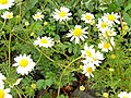 Sea mayweed, Portrush - geograph.org.uk - 1383936.jpg 594 × 447; 116 KB
-
 The coast at Ramore Head, Portrush - geograph.org.uk - 259963.jpg 640 × 426; 144 KB
-
 Thrift, Ramore Head, Portrush - geograph.org.uk - 813205.jpg 625 × 374; 92 KB

_-_geograph.org.uk_-_594597.jpg)


