Category:Rakewood
Jump to navigation
Jump to search

Media in category "Rakewood"
The following 39 files are in this category, out of 39 total.
-

-
 Benny Hill - geograph.org.uk - 1247309.jpg 640 × 426; 54 KB
-
 Booth Hollings Mill - geograph.org.uk - 3311173.jpg 2,048 × 1,536; 611 KB
-
 Booth Hollings Mill - geograph.org.uk - 3488473.jpg 3,888 × 2,592; 1.45 MB
-
 Booth Hollings Mill - geograph.org.uk - 3488478.jpg 3,888 × 2,592; 1.33 MB
-
 Bridleway nears Syke Nab by Benny Hill - geograph.org.uk - 3801517.jpg 1,024 × 768; 180 KB
-
 Bridleway towards Rakewood - geograph.org.uk - 5681572.jpg 1,600 × 1,200; 898 KB
-
 Cottage at Hollingworth Fold - geograph.org.uk - 3801570.jpg 1,024 × 768; 277 KB
-
 Cottages at Rakewood - geograph.org.uk - 680748.jpg 640 × 426; 195 KB
-
 Deep Lane - geograph.org.uk - 6597398.jpg 4,583 × 3,075; 3.14 MB
-
 Deep Lane, bridleway to Rakewood - geograph.org.uk - 2242679.jpg 640 × 480; 134 KB
-
 Deep Lane, bridleway to Rakewood - geograph.org.uk - 2242723.jpg 640 × 484; 111 KB
-
 Fiddler on the Hoof - geograph.org.uk - 1980268.jpg 640 × 480; 131 KB
-
 Higher Booth Hollins Hill - geograph.org.uk - 6387099.jpg 640 × 427; 97 KB
-
 Industrial dereliction at Rakewood - geograph.org.uk - 2325712.jpg 1,600 × 1,198; 421 KB
-
 Kissing Gate on path to Hollingwoth Fold - geograph.org.uk - 3801557.jpg 1,024 × 768; 195 KB
-
 Line of pylons on the side of the Pennines near Syke Moor - geograph.org.uk - 2372154.jpg 3,872 × 2,592; 3.15 MB
-
 Longden End Brook - geograph.org.uk - 2633144.jpg 640 × 451; 125 KB
-
 Longden End Valley - geograph.org.uk - 327045.jpg 640 × 480; 59 KB
-
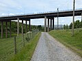
 M62 crossing Longden End Brook - geograph.org.uk - 1736073.jpg 640 × 480; 130 KB
-
 Mill race for Booth Hollings Mill - geograph.org.uk - 6386899.jpg 640 × 480; 83 KB
-

-
 Pasture South of the Lake - geograph.org.uk - 680685.jpg 640 × 426; 213 KB
-

-
 Pennine Bridleway, Rakewood - geograph.org.uk - 2301010.jpg 480 × 640; 147 KB
-
 Pennine Bridleway, Rakewood - geograph.org.uk - 2301024.jpg 640 × 492; 167 KB
-
 Rakewood Viaduct - geograph.org.uk - 1206527.jpg 640 × 480; 58 KB
-
 Rakewood Viaduct - geograph.org.uk - 4190169.jpg 4,048 × 3,040; 2.43 MB
-
 Rakewood Viaduct.jpg 1,600 × 1,200; 572 KB
-
 Rakewood, Greater Manchester - geograph.org.uk - 2404948.jpg 2,592 × 1,944; 670 KB
-
 Retaining wall, Longden End Brook - geograph.org.uk - 6386890.jpg 640 × 480; 93 KB
-

-
 The Pennine Bridleway near New Nook - geograph.org.uk - 6322657.jpg 4,000 × 3,000; 4.27 MB
-
 The Pennine Bridleway near the M62 - geograph.org.uk - 6322659.jpg 4,000 × 3,000; 4.89 MB
-
 The Wine Press, Hollingworth Lake.jpg 5,184 × 3,888; 8.04 MB
-
 Un-named slack south of Syke Moor - geograph.org.uk - 6387110.jpg 640 × 427; 93 KB
-

-
 View Towards Rakewood - geograph.org.uk - 2969458.jpg 640 × 481; 538 KB
-
 Waymarker at Syke Nab - geograph.org.uk - 3801527.jpg 1,024 × 768; 261 KB


