Category:Rake, West Sussex
Jump to navigation
Jump to search
village in Hampshire and West Sussex, England | |||||
| Upload media | |||||
| Instance of | |||||
|---|---|---|---|---|---|
| Location | |||||
 | |||||
Subcategories
This category has the following 3 subcategories, out of 3 total.
F
- Flying Bull pub, Rake (8 F)
R
- Rake Mission Church (4 F)
- Rake War Memorial (1 F)
Media in category "Rake, West Sussex"
The following 55 files are in this category, out of 55 total.
-
 18th Century Cottage, Rake - geograph.org.uk - 2715453.jpg 640 × 430; 83 KB
-
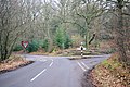 A Woodland Crossroads - geograph.org.uk - 342636.jpg 640 × 429; 154 KB
-

-
 B2070 east of Rake - geograph.org.uk - 2715494.jpg 640 × 430; 118 KB
-
 B2070, Rake - geograph.org.uk - 2715459.jpg 640 × 430; 67 KB
-
 Black Pond from Rake Hanger - geograph.org.uk - 300687.jpg 640 × 480; 110 KB
-
 Canhouse Lane towards Rake - geograph.org.uk - 2925296.jpg 4,000 × 3,000; 3.5 MB
-
 Cattle and Moles in a Field - geograph.org.uk - 342555.jpg 640 × 428; 137 KB
-
 Chapel Common - geograph.org.uk - 339122.jpg 640 × 427; 65 KB
-
 Chapel Common east of Rake - geograph.org.uk - 2930254.jpg 4,000 × 3,000; 3.61 MB
-
 Chapel Common on a Misty Day - geograph.org.uk - 24879.jpg 640 × 480; 49 KB
-
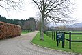
 Coldharbour Park Farm at Rake - geograph.org.uk - 2930283.jpg 4,000 × 3,000; 3.46 MB
-
 Cottage, Rake - geograph.org.uk - 2715452.jpg 640 × 430; 79 KB
-
 Drive to Bobbolds Farm - geograph.org.uk - 342651.jpg 640 × 428; 126 KB
-
 Flying Bull car park at Rake - geograph.org.uk - 1852959.jpg 640 × 480; 79 KB
-

-
 Industrial unit^ Rake - geograph.org.uk - 2715470.jpg 640 × 430; 66 KB
-
 Logging operations at Hambledon Piece - geograph.org.uk - 10896.jpg 640 × 426; 68 KB
-
 London Road, Rake - geograph.org.uk - 2542402.jpg 1,600 × 1,200; 536 KB
-
 London Road, Rake - geograph.org.uk - 2542413.jpg 1,600 × 1,200; 564 KB
-
 Maysleith - geograph.org.uk - 343056.jpg 640 × 428; 140 KB
-
 Nursery Entrance - geograph.org.uk - 342605.jpg 640 × 428; 100 KB
-
 Path through Rake Hanger - geograph.org.uk - 300684.jpg 640 × 480; 127 KB
-
 Rake CE First School - geograph.org.uk - 343050.jpg 640 × 428; 134 KB
-
 Rake Village Hall - geograph.org.uk - 1848660.jpg 640 × 480; 81 KB
-

-
 Temple - geograph.org.uk - 701663.jpg 7,199 × 4,463; 3.38 MB
-
 Tennis court at Rake Village Hall - geograph.org.uk - 1848760.jpg 640 × 480; 102 KB
-
 The Flying Bull at Rake - geograph.org.uk - 2930292.jpg 4,000 × 3,000; 3.45 MB
-
 The Flying Bull, Rake - geograph.org.uk - 2715458.jpg 640 × 430; 63 KB
-
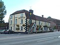
 The Sun Inn, Rake - geograph.org.uk - 350934.jpg 640 × 480; 95 KB
-
 Weavers Down - geograph.org.uk - 439666.jpg 640 × 480; 156 KB
-
 Carrols - geograph.org.uk - 11007.jpg 640 × 426; 36 KB
-
 Combe Pond, Rake, West Sussex - geograph.org.uk - 54112.jpg 640 × 480; 61 KB
-
 Galley Grove, Rogate, West Sussex - geograph.org.uk - 54126.jpg 640 × 480; 129 KB
-
 Gateway on Huntsbottom Lane - geograph.org.uk - 1437442.jpg 640 × 360; 97 KB
-
 Horses at New Barn Farm - geograph.org.uk - 17158.jpg 640 × 426; 35 KB
-
 Horses in Field - geograph.org.uk - 343077.jpg 640 × 428; 129 KB
-

-
 Logging operations at Coombe Hill - geograph.org.uk - 10897.jpg 640 × 426; 94 KB
-

-
 Looking across farmland to Tipsall - geograph.org.uk - 11008.jpg 640 × 426; 27 KB
-
 Old Quarry, Rogate, West Sussex - geograph.org.uk - 52719.jpg 640 × 480; 130 KB
-
 Pond at Palmers Farm - geograph.org.uk - 10901.jpg 640 × 426; 93 KB
-
 Ponds below Maysleith Wood - geograph.org.uk - 342565.jpg 640 × 428; 118 KB
-

-
 Private Bridge over Milland Lane - geograph.org.uk - 342538.jpg 640 × 428; 170 KB
-
 Rogate Common, West Sussex - geograph.org.uk - 52815.jpg 640 × 480; 103 KB
-
 Sand Pits, Rake, West Sussex - geograph.org.uk - 54120.jpg 640 × 480; 97 KB
-

-
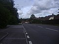
 The Old A3 approaching Rake. - geograph.org.uk - 342625.jpg 640 × 428; 111 KB
-
 The Sun Inn, Rake, West Sussex - geograph.org.uk - 54136.jpg 640 × 480; 59 KB
-

-
 Weavers Down - geograph.org.uk - 300460.jpg 640 × 480; 56 KB
-
 Weavers Down - geograph.org.uk - 439665.jpg 640 × 480; 180 KB


