
Category:Railway maps of JR Hokkaido
Media in category "Railway maps of JR Hokkaido"
The following 62 files are in this category, out of 62 total.
-
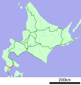
 2016年3月26日時点のJR北海道路線図.svg 1,052 × 744; 25.53 MB
-
 Chitose Line linemap.svg 1,052 × 744; 3.83 MB
-
 Furano Line linemap.svg 1,052 × 744; 3.81 MB
-
 Hakodate Main Line linemap.svg 1,052 × 744; 3.91 MB
-
 Hidaka Main Line linemap.svg 1,052 × 744; 3.81 MB
-
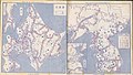 Japanese Government Railways Wartime Route Map.jpg 2,048 × 1,169; 373 KB
-
 JNR Haboro Line linemap.png 993 × 996; 221 KB
-
 JR Chitose Line linemap 2017.svg 744 × 524; 16.48 MB
-
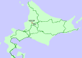
 JR Chitose Line linemap.svg 512 × 532; 13 KB
-
 JR Esashi Line linemap 2014.svg 800 × 832; 11 KB
-
 JR Esashi Line linemap.svg 800 × 832; 11 KB
-
 JR Furano Line linemap.svg 512 × 532; 13 KB
-
 JR Hakodate Main Line linemap.svg 512 × 532; 13 KB
-
 JR Hidaka Main Line linemap.svg 512 × 532; 13 KB
-
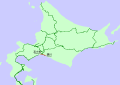
 JR Hokkaido linemap.svg 1,052 × 744; 4.41 MB
-
 JR Kaikyo Line linemap.svg 570 × 722; 4 KB
-
 JR Muroran Main Line linemap.svg 512 × 532; 13 KB
-
 JR Nemuro Main Line linemap.svg 512 × 532; 13 KB
-
 JR Rumoi Main Line linemap.svg 800 × 832; 11 KB
-
 JR Sassho Line linemap.svg 512 × 532; 13 KB
-
 JR Sekihoku Main Line linemap.svg 512 × 532; 13 KB
-
 JR Sekisho Line linemap.svg 512 × 532; 28 KB
-
 JR Senmo Main Line linemap.svg 512 × 532; 13 KB
-
 JR Shinmei Line linemap.png 996 × 1,035; 228 KB
-
 JR Soya Main Line linemap.svg 512 × 532; 13 KB
-
 Kaikyo Line linemap.svg 524 × 744; 4.08 MB
-
 LineMap JRhokkaido Color.png 800 × 800; 96 KB
-
 LineMap JRhokkaido jp.png 800 × 800; 153 KB
-
 Map of Hokkaido Shinkansen.png 820 × 1,600; 250 KB
-
 Muroran Main Line linemap.svg 1,052 × 744; 3.87 MB
-
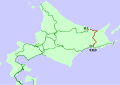
 Nemuro Main Line linemap.svg 1,052 × 744; 2.43 MB
-
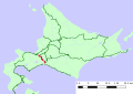
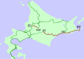
 Railway map of JR Hokkaido.svg 1,052 × 744; 4.39 MB
-
 Rumoi Main Line linemap.svg 1,052 × 744; 3.79 MB
-
 Sapporo-shinai.PNG 410 × 400; 28 KB
-
 Sassho Line linemap.svg 1,052 × 744; 3.82 MB
-
 Schematic map of Sekishō Line.png 1,890 × 945; 60 KB
-
 Seikantunnel - Tsugaru street detail.PNG 595 × 417; 74 KB
-
 Sekihoku Main Line linemap.svg 1,052 × 744; 3.87 MB
-
 Sekisho Line linemap.svg 1,052 × 744; 3.83 MB
-
 Senmo Main Line linemap.svg 1,052 × 744; 3.84 MB
-
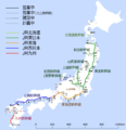
 Shinkansen map 201009.png 3,100 × 3,200; 373 KB
-
 Shinkansen map 20101204 en.png 3,100 × 3,200; 359 KB
-
 Shinkansen map 20101204 ja.png 3,100 × 3,200; 317 KB
-
 Shinkansen map 201101 en.png 3,100 × 3,200; 386 KB
-
 Shinkansen map 20110312 en.png 3,100 × 3,200; 370 KB
-
 Shinkansen map 20110312 ja.png 3,100 × 3,200; 301 KB
-
 Shinkansen map 201208 en.png 3,100 × 3,200; 329 KB
-
 Shinkansen map 201208 ja.png 3,100 × 3,200; 233 KB
-
 Shinkansen map 201208 zh.svg 670 × 837; 1.11 MB
-
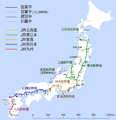
 Shinkansen map 201412 en.png 3,100 × 3,200; 1.09 MB
-
 Shinkansen map 201412 ja.png 3,100 × 3,200; 798 KB
-
 Shinkansen map 201412 zh-cn.png 3,100 × 3,200; 824 KB
-
 Shinkansen map 201412 zh-tw.png 3,100 × 3,200; 801 KB
-
 Shinkansen map 201503 en.png 3,100 × 3,200; 1.07 MB
-
 Shinkansen map 201503 ja.png 3,100 × 3,200; 783 KB
-
 Shinkansen map 201503 zh-hant.svg 670 × 837; 1.13 MB
-
 Shinkansen map 201603 zh-hant.svg 670 × 837; 1.15 MB
-
 Shinkansen map ja 201009.png 3,100 × 3,200; 322 KB
-
 Shinkansen Zukunft.svg 670 × 837; 207 KB
-
 Soya Main Line linemap.svg 1,052 × 744; 3.86 MB
-
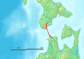
 Tsugaru Strait with Kaikyo Line and stations.png 669 × 695; 20 KB
-
 Twilight Express Route Map (as of its last service).png 1,417 × 1,771; 360 KB


.png)