Category:Railway bridges on the Pontefract Line
Jump to navigation
Jump to search
Media in category "Railway bridges on the Pontefract Line"
The following 16 files are in this category, out of 16 total.
-
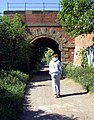 "Dark Lane" footpath under railway bridge - geograph.org.uk - 2391469.jpg 1,254 × 1,600; 695 KB
-
 Bridge NOC-51 - Station Road - geograph.org.uk - 2015262.jpg 640 × 480; 81 KB
-
 Footpath and Tunnel under railway - geograph.org.uk - 3680411.jpg 3,216 × 4,288; 2.94 MB
-
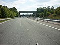 Looking south along the A162 - geograph.org.uk - 2555644.jpg 800 × 600; 263 KB
-
 Railway Bridge crossing Ferrybridge Road Pontefract - geograph.org.uk - 3298336.jpg 4,288 × 3,216; 2.85 MB
-
 Railway bridge over Ferrybridge Road - geograph.org.uk - 2476165.jpg 1,600 × 1,200; 513 KB
-
 Railway Bridge over Kirkgate, Wakefield - geograph.org.uk - 5402518.jpg 1,024 × 664; 172 KB
-
 Road and two railways - geograph.org.uk - 5674015.jpg 4,608 × 3,072; 2.69 MB
-
 Stump Cross Lane railway bridge - geograph.org.uk - 5669982.jpg 3,977 × 2,773; 2.45 MB
-
 The rail bridge on Water Lane - geograph.org.uk - 3118867.jpg 800 × 600; 341 KB
-
 The rail bridge on Water Lane - geograph.org.uk - 3118869.jpg 800 × 600; 358 KB
-

-
 Train crossing Stump Cross Lane bridge - geograph.org.uk - 3470336.jpg 3,348 × 2,511; 2.15 MB
-
 Two Bridges - geograph.org.uk - 5674018.jpg 4,608 × 3,072; 2.5 MB
-
 Water Lane Railway Bridge - geograph.org.uk - 2391424.jpg 1,296 × 1,600; 267 KB
-
 Water Lane Railway Bridge - geograph.org.uk - 2391434.jpg 1,343 × 1,600; 373 KB


