Category:Railway bridges in the City of Salford
Jump to navigation
Jump to search
Subcategories
This category has the following 4 subcategories, out of 4 total.
Media in category "Railway bridges in the City of Salford"
The following 42 files are in this category, out of 42 total.
-
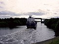 Boat on manchester ship canal.jpg 640 × 480; 74 KB
-
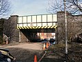
 Bridge at Walkden station.jpg 1,024 × 768; 169 KB
-
 Bridgewater foundary.gif 831 × 494; 317 KB
-
 Bridgewater Road Rail Bridge, Walkden - geograph.org.uk - 2110372.jpg 640 × 480; 124 KB
-
 Bridging the Irwell - geograph.org.uk - 282090.jpg 640 × 480; 118 KB
-
 Confluence of River Mersey and Manchester Ship Canal.jpg 6,180 × 2,232; 4.33 MB
-
 Disused Railway Bridges - Cadishead - geograph.org.uk - 2006653.jpg 4,224 × 3,168; 6.03 MB
-
 Hampson Street Railway Bridge - geograph.org.uk - 5294877.jpg 640 × 480; 427 KB
-
 Harding Street Railway Bridge - geograph.org.uk - 2283834.jpg 640 × 480; 217 KB
-
 Irlam MMB 01 Manchester Ship Canal.jpg 3,852 × 1,953; 1.8 MB
-
 Irlam MMB 03 Manchester Ship Canal.jpg 3,711 × 1,983; 1.88 MB
-
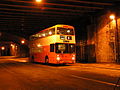 Lancashire United Transport bus 6990 (DWH 706W), 12 November 2006 (17).jpg 1,600 × 1,200; 550 KB
-
 Laundry Street Bridge - geograph.org.uk - 2283660.jpg 640 × 480; 164 KB
-
 Laundry Street Bridge and Arch - geograph.org.uk - 2283665.jpg 640 × 480; 184 KB
-
 Lumms lane aqueduct.jpg 2,048 × 1,536; 1.21 MB
-
 M&SJC looking north from the side.jpg 2,048 × 1,536; 1.03 MB
-
 M&SJC looking north.jpg 1,536 × 2,048; 866 KB
-

-
 Mbb canal middlewood locks new bridge railings.jpg 1,536 × 2,048; 633 KB
-
 Middlewood locks april 2008.jpg 4,007 × 1,664; 1.07 MB
-
 Middlewood locks4.jpg 2,048 × 1,536; 813 KB
-
 Middlewood locks5.jpg 2,048 × 1,536; 893 KB
-
 Mort Lane Railway Bridge - geograph.org.uk - 2076278.jpg 640 × 480; 148 KB
-
 Movement on the Manchester Ship Canal - geograph.org.uk - 58324.jpg 640 × 480; 83 KB
-
 Not on the map yet^ - geograph.org.uk - 50496.jpg 640 × 480; 72 KB
-
 Old Bridge at Irlam - geograph.org.uk - 47504.jpg 640 × 480; 135 KB
-
 Over the Canal - geograph.org.uk - 44674.jpg 640 × 480; 80 KB
-
 Path under the railway - geograph.org.uk - 3150026.jpg 3,872 × 2,592; 3.62 MB
-
 Railway Bridge - geograph.org.uk - 2786964.jpg 3,945 × 2,350; 4.1 MB
-
 Railway Bridge - geograph.org.uk - 5791978.jpg 1,024 × 763; 631 KB
-
 Railway bridge on Green Lane, Patricroft - geograph.org.uk - 680252.jpg 640 × 480; 170 KB
-
 Railway Bridge, Agecroft Road - geograph.org.uk - 1775941.jpg 2,816 × 2,112; 1.16 MB
-
 Railway Bridge, New Lane, Winton (geograph 1901284).jpg 4,224 × 3,168; 5.34 MB
-
 Railway Bridges, Cadishead - geograph.org.uk - 2314065.jpg 640 × 480; 210 KB
-
 Road block - geograph.org.uk - 681182.jpg 640 × 480; 164 KB
-
 Salford Central Railway Bridge - geograph.org.uk - 1414987.jpg 640 × 480; 104 KB
-
 TfGM - Walkden Railway Station - panoramio.jpg 4,608 × 3,456; 6.17 MB
-
 The Irwell - geograph.org.uk - 195485.jpg 640 × 480; 88 KB
-
 The rail bridge on Worsley Road, Salford - geograph.org.uk - 3057910.jpg 800 × 600; 139 KB
-
 Walkden disused railway.jpg 1,024 × 768; 347 KB
-
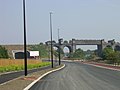
 Walkden Road, Walkden - panoramio.jpg 4,000 × 3,000; 5.06 MB
-
 Worsley Road Railway Bridge - geograph.org.uk - 2301228.jpg 1,280 × 960; 779 KB


.jpg)


.jpg)


,_12_November_2006_(17).jpg)