Category:Rail transport maps of Paris
Jump to navigation
Jump to search
Subcategories
This category has only the following subcategory.
Media in category "Rail transport maps of Paris"
The following 39 files are in this category, out of 39 total.
-
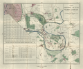
 A. Letellier, Parc Impérial de Vincennes, 1860.jpg 12,947 × 11,111; 39.43 MB
-
 CDF Paris versailles.jpg 3,235 × 2,223; 1.6 MB
-
 Garnier frères, Itinéraire des Omnibus et Tramways dans Paris, 1878.jpg 14,887 × 11,573; 51.34 MB
-
 Guibal & Taride, Plan du chemin de fer Métropolitain de Paris - Paris Musées.jpg 8,632 × 6,728; 39.09 MB
-
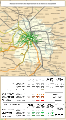
 International trains Paris-Brussels.svg 709 × 740; 7 KB
-
 International trains Paris-Zurich 2015.svg 1,122 × 899; 35 KB
-
 International trains Paris-Zurich.svg 1,122 × 899; 17 KB
-
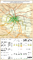
 Paris europe train map de.png 1,024 × 1,113; 63 KB
-
 Paris europe train map fr.png 552 × 600; 129 KB
-
 Paris europe train map.png 1,024 × 1,113; 62 KB
-
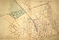
 Paris-vincennes 1859 jms.png 7,176 × 6,056; 75.22 MB
-
 Plan du faux paris 1917.jpg 416 × 485; 82 KB
-
-
 Projet de Chemin de fer Tivoli Saint-Ouen.png 1,920 × 1,080; 4.02 MB
-
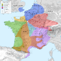
 Railway map of France - 75 - 1850 - fr - small.svg 564 × 1,020; 3.97 MB
-
 Railway map of France - 75 - 1860 - fr - small.svg 564 × 1,020; 4.02 MB
-
 Railway map of France - 75 - 1870 - fr - small.svg 564 × 1,020; 4.04 MB
-
 Railway map of France - 75 - 1880 - fr - small.svg 564 × 1,020; 4.08 MB
-
 Railway map of France - 75 - 1890 - fr - small.svg 564 × 1,020; 4.11 MB
-
 Railway map of France - 75 - 1900 - fr - small.svg 564 × 1,020; 4.17 MB
-
 Railway map of France - 75 - 1910 - fr - small.svg 564 × 1,020; 4.22 MB
-
 Railway map of France - 75 - 1913 - fr - small.svg 564 × 1,020; 4.25 MB
-
 Railway map of France - 75 - 1920 - fr - small.svg 564 × 1,020; 4.27 MB
-
 Railway map of France - 75 - 1930 - fr - small.svg 564 × 1,020; 4.31 MB
-
 Railway map of France - 75 - 1939 - fr - small.svg 564 × 1,020; 4.34 MB
-
 Railway map of France - 75 - 1950 - fr - small.svg 564 × 1,020; 4.34 MB
-
 Railway map of France - 75 - 1960 - fr - small.svg 564 × 1,020; 4.35 MB
-
 Railway map of France - 75 - 1970 - fr - small.svg 564 × 1,020; 4.44 MB
-
 Railway map of France - 75 - 1980 - fr - small.svg 564 × 1,020; 4.46 MB
-
 Railway map of France - 75 - 1990 - fr - small.svg 564 × 1,020; 4.47 MB
-
 Railway map of France - 75 - 2000 - fr - small.svg 564 × 1,020; 4.49 MB
-
 Railway map of France - 75 - 2010 - fr - small.svg 564 × 1,020; 4.5 MB
-
 Railway map of France - 75 - 2020 - fr - small.svg 564 × 1,020; 4.32 MB
-
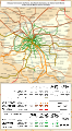
 Railway stations on departure from Paris map-en.svg 1,400 × 1,400; 1.92 MB
-
 Railway stations on departure from Paris map-fr.png 2,000 × 1,898; 3.39 MB
-
 Railway stations on departure from Paris map-fr.svg 1,400 × 1,400; 1.92 MB
-
 Réseau des Chemins de fer français (Paris).jpg 3,456 × 4,608; 5.1 MB
-
 Supplément au journal Le Temps du 14 avril 1886 - Gallica.jpg 8,050 × 5,252; 6.15 MB
-
 Фуникулёр в Париже.jpg 794 × 608; 10 KB


.jpg)

