Category:Rail transport maps of Meurthe-et-Moselle
Jump to navigation
Jump to search
Media in category "Rail transport maps of Meurthe-et-Moselle"
The following 11 files are in this category, out of 11 total.
-
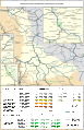 Railway map of France - 54 - 1900 - fr - small.svg 705 × 1,091; 9.01 MB
-
 Railway map of France - 54 - 1913 - fr - small.svg 705 × 1,091; 9.28 MB
-
 Railway map of France - 54 - 1919 - fr - small.svg 705 × 1,091; 9.51 MB
-
 Railway map of France - 54 - 1930 - fr - small.svg 705 × 1,091; 9.52 MB
-
 Railway map of France - 54 - 1939 - fr - small.svg 705 × 1,091; 9.46 MB
-
 Railway map of France - 54 - 1980 - fr - small.svg 705 × 1,091; 9.2 MB
-
 Railway map of France - 54 - 2020 - fr - small.svg 705 × 1,091; 9.27 MB
-
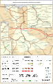
 Railway map of France - 54-57 - 1870 - fr - small.svg 811 × 1,126; 10.61 MB
-
 Railway map of France - 54-57 - 1900 - fr - small.svg 811 × 1,126; 10.68 MB
-
 Railway map of France - 54-57 - 1913 - fr - small.svg 811 × 1,126; 10.97 MB
-
 Railway map of France - 54-57 - 1919 - fr - small.svg 811 × 1,126; 11.32 MB


