Category:Rail transport maps of Hertfordshire
Jump to navigation
Jump to search
Media in category "Rail transport maps of Hertfordshire"
The following 19 files are in this category, out of 19 total.
-
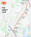
Abbey Line.png 1,767 × 2,057; 2.21 MB
-
Buckinghamshire railways, 1880.png 1,053 × 745; 171 KB
-
Bunt-rly.png 1,092 × 1,433; 45 KB
-
Cambridge line.png 1,422 × 1,325; 1.32 MB
-
Crossrail extensions.png 664 × 525; 563 KB
-
Crossrail2 Greater London.png 1,385 × 1,056; 448 KB
-
Dunmow line.png 1,522 × 410; 50 KB
-
East West Rail Consortium Eastern map.jpg 618 × 463; 43 KB
-
East West Rail Consortium Western map.jpg 1,280 × 800; 154 KB
-
East West Rail Link Stansted Option.jpg 766 × 512; 31 KB
-
Hertford East branch line.png 2,132 × 1,898; 1.81 MB
-
Hertford loop line.png 1,465 × 1,584; 2.2 MB
-
Hertford luton dunstable.png 1,542 × 663; 67 KB
-
Metropolitan Line & London map.svg 940 × 550; 374 KB
-
Rail transport infrastructure map - UK - East of England.svg 907 × 1,209; 5.78 MB
-
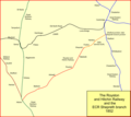
Royston & hitchin.png 1,208 × 1,075; 73 KB
-
Southbury Loop.png 1,455 × 1,869; 1.75 MB
-
The Victoria history of the County of Hertford Abbey Line.jpg 441 × 654; 143 KB
-
Watford DC line.png 2,455 × 1,858; 4.83 MB


