Category:Rail transport maps of Haute-Savoie
Jump to navigation
Jump to search
Media in category "Rail transport maps of Haute-Savoie"
The following 7 files are in this category, out of 7 total.
-
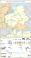 Railway map of France - 74 - 1900 - fr - small.svg 564 × 1,039; 6.01 MB
-
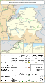
 Railway map of France - 74 - 1913 - fr - small.svg 564 × 1,039; 6.09 MB
-
 Railway map of France - 74 - 1930 - fr - small.svg 564 × 1,039; 6.09 MB
-
 Railway map of France - 74 - 1950 - fr - small.svg 564 × 1,039; 6.05 MB
-
 Railway map of France - 74 - 1980 - fr - small.svg 564 × 1,039; 6.03 MB
-
 Railway map of France - 74 - 2020 - fr - small.svg 564 × 1,039; 5.85 MB
-
 Railway map of France - 74 - animated - fr.gif 1,252 × 2,308; 4.94 MB


