Category:Rail transport maps of Haute-Loire
Jump to navigation
Jump to search
Media in category "Rail transport maps of Haute-Loire"
The following 6 files are in this category, out of 6 total.
-
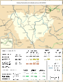
 Railway map of France - 43 - 1900 - fr - small.svg 705 × 914; 5.36 MB
-
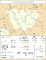
 Railway map of France - 43 - 1913 - fr - small.svg 705 × 914; 5.51 MB
-
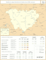
 Railway map of France - 43 - 1930 - fr - small.svg 705 × 914; 5.51 MB
-
 Railway map of France - 43 - 1980 - fr - small.svg 705 × 914; 5.44 MB
-
 Railway map of France - 43 - 2020 - fr - small.svg 705 × 914; 5.25 MB
-
 Railway map of France - 43 - animated - fr.gif 1,566 × 2,030; 4.75 MB


