Category:Rail transport maps of Hampshire
Jump to navigation
Jump to search
Media in category "Rail transport maps of Hampshire"
The following 17 files are in this category, out of 17 total.
-
Alton line.png 1,935 × 1,358; 2.02 MB
-
Ascot-Guildford line.png 1,506 × 1,930; 2.52 MB
-
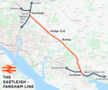
Eastleigh–Fareham line.png 1,856 × 1,542; 2.29 MB
-
Eastleigh–Romsey line.png 1,475 × 1,081; 1.34 MB
-
Lymington branch line.png 1,415 × 1,505; 945 KB
-
West Coastway line.png 2,771 × 1,134; 2.24 MB
-
Bas & alt rly.png 1,014 × 1,306; 56 KB
-
Fawley branch line.png 1,713 × 1,405; 1.95 MB
-
Lee-solent-rly.png 1,513 × 995; 67 KB
-
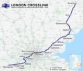
London Crosslink.png 2,353 × 1,992; 5.2 MB
-
Meon valley rly.png 848 × 1,519; 81 KB
-
Rail transport infrastructure map - UK - South East England.svg 1,247 × 983; 8.83 MB
-
Reading-Basingstoke Line.jpg 569 × 424; 49 KB
-
Reading–Basingstoke line.png 1,812 × 1,494; 1.97 MB
-
Southampton–Fareham line.png 2,000 × 1,405; 2.12 MB
-
Wessex Main Line.png 2,630 × 2,022; 3.83 MB
-
West of England line.png 2,578 × 1,481; 3.19 MB


