Category:Rail transport maps of Eure-et-Loir
Jump to navigation
Jump to search
Media in category "Rail transport maps of Eure-et-Loir"
The following 5 files are in this category, out of 5 total.
-
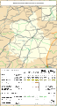
 Railway map of France - 28 - 1900 - fr - small.svg 564 × 1,039; 7.05 MB
-
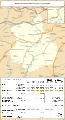
 Railway map of France - 28 - 1931 - fr - small.svg 564 × 1,039; 7.2 MB
-
 Railway map of France - 28 - 1980 - fr - small.svg 564 × 1,039; 7.19 MB
-
 Railway map of France - 28 - 2020 - fr - small.svg 564 × 1,039; 7 MB
-
 Railway map of France - 28 - animated - fr.gif 1,252 × 2,308; 5.22 MB


