Category:Rail transport maps of East Sussex
Jump to navigation
Jump to search
Media in category "Rail transport maps of East Sussex"
The following 11 files are in this category, out of 11 total.
-
 Hastings line.png 2,421 × 2,014; 3.41 MB
-
 West Coastway line.png 2,771 × 1,134; 2.24 MB
-
 Brighton Railway development.gif 600 × 427; 38 KB
-
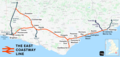 East Coastway line.png 3,192 × 1,512; 2.54 MB
-
 Hellingly railway route.png 800 × 600; 24 KB
-
 Hellingly station layout.png 800 × 800; 39 KB
-
 Max extent of brighton railways.png 603 × 431; 25 KB
-
 Oxted line.png 1,552 × 1,707; 2.6 MB
-
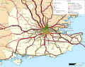 Rail transport infrastructure map - UK - South East England.svg 1,247 × 983; 8.83 MB
-
 Rye and Camber Map.png 1,088 × 598; 98 KB
-
 Seaford branch line.png 1,971 × 1,477; 1.17 MB


