Category:Rail transport maps of Cantal
Jump to navigation
Jump to search
Media in category "Rail transport maps of Cantal"
The following 4 files are in this category, out of 4 total.
-
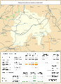
 Railway map of France - 15 - 1900 - fr - small.svg 705 × 975; 5.34 MB
-
 Railway map of France - 15 - 1932 - fr - small.svg 705 × 975; 5.41 MB
-
 Railway map of France - 15 - 1980 - fr - small.svg 705 × 975; 5.4 MB
-
 Railway map of France - 15 - 2020 - fr - small.svg 705 × 975; 5.2 MB


