Category:Rail transport maps of Bas-Rhin
Jump to navigation
Jump to search
Media in category "Rail transport maps of Bas-Rhin"
The following 11 files are in this category, out of 11 total.
-

-
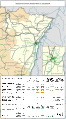
 Railway map of France - 67 - 1870 - fr - small.svg 564 × 1,020; 7.63 MB
-
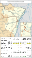
 Railway map of France - 67 - 1900 - fr - small.svg 564 × 1,020; 7.67 MB
-
 Railway map of France - 67 - 1913 - fr - small.svg 564 × 1,020; 7.78 MB
-
 Railway map of France - 67 - 1919 - fr - small.svg 564 × 1,020; 8.05 MB
-
 Railway map of France - 67 - 1930 - fr - small.svg 564 × 1,020; 8.08 MB
-
 Railway map of France - 67 - 1939 - fr - small.svg 564 × 1,020; 8.07 MB
-
 Railway map of France - 67 - 1980 - fr - small.svg 564 × 1,020; 7.99 MB
-
 Railway map of France - 67 - 2020 - fr - small.svg 564 × 1,020; 7.83 MB
-
 Railway map of France - 67 - animated - fr.gif 1,252 × 2,266; 5.88 MB
-
 Strasbourg ferroviaire.png 1,589 × 2,464; 6.83 MB


