Category:Rail transport maps of Alpes-de-Haute-Provence
Jump to navigation
Jump to search
Media in category "Rail transport maps of Alpes-de-Haute-Provence"
The following 5 files are in this category, out of 5 total.
-
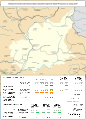
 Railway map of France - 04 - 1900 - fr - small.svg 705 × 985; 6.82 MB
-
 Railway map of France - 04 - 1930 - fr - small.svg 705 × 985; 6.93 MB
-
 Railway map of France - 04 - 1980 - fr - small.svg 705 × 985; 6.9 MB
-
 Railway map of France - 04 - 2020 - fr - small.svg 705 × 985; 6.71 MB
-
 Railway map of France - 04 - animated - fr.gif 1,566 × 2,188; 4.92 MB


