Category:Rail transport in Oxfordshire
Appearance
Ceremonial counties of England: Bedfordshire · Berkshire · Buckinghamshire · Cambridgeshire · Cheshire · Cornwall · Cumbria · Derbyshire · Devon · Dorset · Durham · East Riding of Yorkshire · East Sussex · Essex · Gloucestershire · Greater London · Greater Manchester · Hampshire · Herefordshire · Hertfordshire · Kent · Lancashire · Leicestershire · Lincolnshire · Merseyside · North Yorkshire · Northamptonshire · Northumberland · Nottinghamshire · Oxfordshire · Rutland · Shropshire · Somerset · South Yorkshire · Staffordshire · Suffolk · Surrey · Tyne and Wear · Warwickshire · West Midlands · West Sussex · West Yorkshire · Wiltshire · Worcestershire
City-counties: Bristol · City of London
Former historic counties: Huntingdonshire ·
Other former counties:
City-counties: Bristol · City of London
Former historic counties: Huntingdonshire ·
Other former counties:
Wikimedia category | |||||
| Upload media | |||||
| Instance of | |||||
|---|---|---|---|---|---|
| Category combines topics | |||||
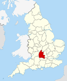
| Oxfordshire | |||||
county in England, UK | |||||
| Instance of |
| ||||
| Location |
| ||||
| Capital | |||||
| Legislative body |
| ||||
| Population |
| ||||
| Area |
| ||||
| Different from | |||||
| Said to be the same as | Oxfordshire (historic county of England, ceremonial county of England, 1844) | ||||
| official website | |||||
 | |||||
Subcategories
This category has the following 16 subcategories, out of 16 total.
Media in category "Rail transport in Oxfordshire"
The following 47 files are in this category, out of 47 total.
-
Down the line to Swindon - geograph.org.uk - 1544847.jpg 640 × 427; 78 KB
-
Crossovers at Lower Bourton - geograph.org.uk - 1544859.jpg 640 × 427; 87 KB
-
Car export wagons and a new mini. - geograph.org.uk - 5666646.jpg 5,202 × 3,465; 4.44 MB
-
Claydon Crossing - geograph.org.uk - 1330175.jpg 640 × 427; 98 KB
-
Curve by The Cleeves near Rousham - geograph.org.uk - 1324896.jpg 640 × 417; 100 KB
-
Down the line to Didcot station - geograph.org.uk - 1159945.jpg 400 × 600; 77 KB
-
Down the line to Swindon - geograph.org.uk - 1539370.jpg 640 × 427; 63 KB
-
Down the main line to Swindon - geograph.org.uk - 1537434.jpg 640 × 427; 79 KB
-
Down to Swindon - geograph.org.uk - 1537455.jpg 640 × 427; 64 KB
-
Drinkwater Crossing near Yarnton - geograph.org.uk - 1321951.jpg 640 × 415; 109 KB
-
East West Rail Consortium Central map.jpg 731 × 482; 37 KB
-
East West Rail Consortium Eastern map.jpg 618 × 463; 43 KB
-
East West Rail Consortium Western map.jpg 1,280 × 800; 154 KB
-
East West Rail Link Stansted Option.jpg 766 × 512; 31 KB
-
Foxhall Junction - geograph.org.uk - 1234010.jpg 640 × 427; 94 KB
-
Hinksey Stream and Railway - geograph.org.uk - 332690.jpg 640 × 480; 267 KB
-
Penalty £200 - geograph.org.uk - 1153494.jpg 640 × 426; 78 KB
-
Railway Bridge Over Botley Road, Oxford - geograph.org.uk - 3888046.jpg 2,784 × 1,568; 2.12 MB
-
Railway lines near Radley - geograph.org.uk - 110377.jpg 640 × 480; 253 KB
-
Railway Mileage Post at Kennington - geograph.org.uk - 1224823.jpg 640 × 456; 154 KB
-
Railway near Grove - geograph.org.uk - 698376.jpg 640 × 480; 179 KB
-
Railway, Didcot - geograph.org.uk - 181901.jpg 640 × 478; 140 KB
-
Signal gantry at Denchworth - geograph.org.uk - 1539438.jpg 640 × 427; 59 KB
-
Signal on the fast line - geograph.org.uk - 1153453.jpg 640 × 426; 71 KB
-
Spring Farm side - geograph.org.uk - 2749257.jpg 1,024 × 683; 252 KB
-
Spring farm side - geograph.org.uk - 2813989.jpg 1,024 × 683; 244 KB
-
The last shot - geograph.org.uk - 2225701.jpg 1,024 × 683; 172 KB
-
The railway, Cholsey - geograph.org.uk - 720497.jpg 480 × 640; 184 KB
-
Towards South Moreton - geograph.org.uk - 1154025.jpg 640 × 426; 47 KB
-
Under the bridge - geograph.org.uk - 2814057.jpg 1,024 × 683; 243 KB
-
Wider view of the bridge - geograph.org.uk - 2749264.jpg 1,024 × 683; 216 KB
-
Wider view of things - geograph.org.uk - 2223336.jpg 1,024 × 683; 232 KB
-
Didcot Junction (north) - geograph.org.uk - 181890.jpg 640 × 478; 181 KB
-
Grintleyhill Bridge - geograph.org.uk - 6843.jpg 640 × 480; 101 KB
-
Looking South - geograph.org.uk - 83507.jpg 640 × 481; 34 KB
-
Looking towards Didcot - geograph.org.uk - 78677.jpg 640 × 481; 37 KB
-
Railway - geograph.org.uk - 441469.jpg 640 × 480; 91 KB
-
Railway line, looking North - geograph.org.uk - 322541.jpg 640 × 480; 96 KB
-
Railway line, looking South - geograph.org.uk - 322539.jpg 640 × 480; 113 KB
-
Railwayline - geograph.org.uk - 441464.jpg 640 × 545; 107 KB


