Category:Radio maps of New Zealand
Jump to navigation
Jump to search
Media in category "Radio maps of New Zealand"
The following 21 files are in this category, out of 21 total.
-
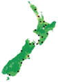
 Map of AM Network frequencies.png 398 × 563; 79 KB
-
 Map of Coast FM frequencies.png 399 × 563; 79 KB
-
 Map of Flava frequencies.png 398 × 563; 78 KB
-
 Map of George FM frequencies.png 398 × 563; 79 KB
-
 Map of Hokonui frequencies.png 398 × 563; 79 KB
-
 Map of Life FM frequencies.png 399 × 563; 78 KB
-
 Map of Mai FM frequencies.png 398 × 563; 78 KB
-
 Map of Mix frequencies.png 398 × 563; 79 KB
-
 Map of Newstalk ZB.png 398 × 563; 77 KB
-
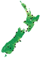
 Map of Pacific Media Network frequencies.png 399 × 563; 78 KB
-
 Map of Port FM frequencies.png 398 × 563; 79 KB
-
 Map of Radio Live.png 398 × 563; 77 KB
-
 Map of Radio Sport frequencies.png 398 × 563; 78 KB
-
 Map of Rhema frequencies.png 399 × 563; 77 KB
-
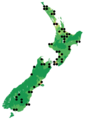
 Map of RNZ National relays.png 399 × 563; 80 KB
-
 Map of RNZ National.png 399 × 563; 76 KB
-
 Map of Star frequencies.png 398 × 563; 78 KB
-
 Map of TAB Trackside Radio frequencies.png 398 × 563; 77 KB
-
 Map of The Sound frequencies.png 398 × 563; 78 KB
-
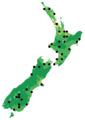
 New Zealand Population Density (Coast).png 398 × 563; 78 KB
-
 New Zealand Population Density (The Hits).png 398 × 563; 77 KB


.png)
.png)