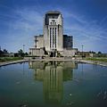
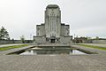
Category:Radio Kootwijk, Building A
Jump to navigation
Jump to search
| Object location | | View all coordinates using: OpenStreetMap |
|---|
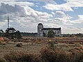
main building of Radio Kootwijk  | |||||
| Upload media | |||||
| Instance of | |||||
|---|---|---|---|---|---|
| Part of | |||||
| Location |
| ||||
| Street address |
| ||||
| Architectural style | |||||
| Architect | |||||
| Creator | |||||
| Owned by | |||||
| Heritage designation | |||||
| Inception |
| ||||
| Significant event |
| ||||
| official website | |||||
 | |||||
|
This is a category about rijksmonument number 46517
|
| Address |
|
Subcategories
This category has only the following subcategory.
I
Media in category "Radio Kootwijk, Building A"
The following 131 files are in this category, out of 131 total.
-
 14kootwijkradiovoorkant.jpg 2,000 × 651; 173 KB
-
 15kootwijkradioschuinpanorama.jpg 2,000 × 443; 63 KB
-
 2.2 radio Kootwijk.jpg 1,181 × 827; 241 KB
-
 20160926 De kathedraal (detail1) Radio Kootwijk.jpg 5,184 × 3,456; 4.53 MB
-
 20160926 De kathedraal (detail3) Radio Kootwijk.jpg 3,456 × 5,184; 3.12 MB
-
 20160926 De kathedraal1 Radio Kootwijk.jpg 5,184 × 3,456; 3.4 MB
-
 20160926 De kathedraal3 Radio Kootwijk.jpg 5,184 × 3,456; 2.85 MB
-
 20160926 De kathedraal4 Radio Kootwijk.jpg 3,384 × 5,076; 1.54 MB
-
 20160926 De kathedraal5 Radio Kootwijk.jpg 5,067 × 3,378; 2.22 MB
-
 20160926 Zicht op Radio Kootwijk1.jpg 4,975 × 3,317; 2.31 MB
-
 20160926 Zicht op Radio Kootwijk2.jpg 5,039 × 3,359; 2.41 MB
-
 Bouw van Radio kootwijk.jpg 642 × 397; 18 KB
-
 De Kathedraal van Radio Kootwijk - panoramio.jpg 3,872 × 2,592; 3.37 MB
-
 Detail westgevel - Kootwijk - 20127018 - RCE.jpg 1,200 × 1,195; 243 KB
-
 Detail zuidgevel - Kootwijk - 20127022 - RCE.jpg 1,200 × 1,192; 356 KB
-
 Detail zuidgevel - Kootwijk - 20127023 - RCE.jpg 1,200 × 1,200; 332 KB
-

-
 Entree gebouw A Radio Kootwijk.jpg 2,350 × 2,864; 1.31 MB
-
 Exterieur OVERZICHT - Kootwijk - 20313898 - RCE.jpg 1,188 × 1,200; 309 KB
-
 Exterieur OVERZICHT - Kootwijk - 20313899 - RCE.jpg 1,186 × 1,200; 265 KB
-
 Exterieur OVERZICHT - Kootwijk - 20313900 - RCE.jpg 1,178 × 1,200; 314 KB
-
 Exterieur OVERZICHT - Kootwijk - 20313901 - RCE.jpg 1,184 × 1,200; 307 KB
-
 Fluorescent Light Cube.jpg 3,580 × 2,721; 1.75 MB
-
 Gebouw A Building A (5698254229).jpg 4,550 × 5,506; 7.73 MB
-
 Gebouw A Building A (Explore) (6219953573).jpg 4,212 × 2,737; 6.91 MB
-
 Gebouw A Building A.jpg 4,433 × 5,401; 1.95 MB
-

-
 Gebouw A Radio Kootwijk volle lengte, recht.jpg 2,864 × 1,903; 806 KB
-
 Gebouw A Radio Kootwijk volle lengte, schuin.jpg 3,792 × 2,190; 1.35 MB
-
 Gebouw A van radiozendstation Kootwijk op de Veluwe, SFA003006625.jpg 2,663 × 3,487; 1.08 MB
-
 Hoog Buurlo - Radio Kootwijk - 46517 -10.jpg 1,024 × 683; 568 KB
-
 Hoog Buurlo - Radio Kootwijk - 46517 -11.jpg 683 × 1,024; 530 KB
-
 Hoog Buurlo - Radio Kootwijk - 46517 -12.jpg 683 × 1,024; 416 KB
-
 Hoog Buurlo - Radio Kootwijk - 46517 -3.jpg 1,024 × 683; 502 KB
-
 Hoog Buurlo - Radio Kootwijk - 46517 -4.jpg 683 × 1,024; 570 KB
-
 Hoog Buurlo - Radio Kootwijk - 46517 -5.jpg 683 × 1,024; 667 KB
-
 Hoog Buurlo - Radio Kootwijk - 46517 -8.jpg 1,024 × 683; 754 KB
-
 Hoog Buurlo - Radio Kootwijk - 46517 -9.jpg 683 × 1,024; 447 KB
-
 Hoog Buurlo, 7348 Apeldoorn, Netherlands - panoramio (1).jpg 2,048 × 1,375; 268 KB
-
 Hoog Buurlo, 7348 Apeldoorn, Netherlands - panoramio (2).jpg 2,048 × 1,375; 437 KB
-
 Hoog Buurlo, 7348 Apeldoorn, Netherlands - panoramio (4).jpg 1,148 × 2,048; 364 KB
-
 Hoog Buurlo, 7348 Apeldoorn, Netherlands - panoramio (6).jpg 2,048 × 1,148; 303 KB
-
 Hoog Buurlo, 7348 Apeldoorn, Netherlands - panoramio - Ben Bender (2).jpg 4,896 × 3,264; 6.4 MB
-
 Hoog Buurlo, 7348 Apeldoorn, Netherlands - panoramio.jpg 4,896 × 3,264; 6.66 MB
-
 Huwelijk Leonie en Eelke (5892908233).jpg 4,288 × 2,337; 2.55 MB
-
 Ingang noordgevel - Kootwijk - 20127014 - RCE.jpg 1,195 × 1,200; 348 KB
-
 Ingang zuidgevel - Kootwijk - 20127021 - RCE.jpg 1,192 × 1,200; 300 KB
-
 Ingangspartij oostgevel - Kootwijk - 20127015 - RCE.jpg 1,200 × 1,197; 355 KB
-
 Koelvijver oostzijde - Kootwijk - 20127016 - RCE.jpg 1,200 × 1,197; 249 KB
-
 Maquette - Kootwijk - 20127009 - RCE.jpg 1,188 × 1,200; 186 KB
-
 Maquette - Kootwijk - 20127010 - RCE.jpg 1,200 × 665; 118 KB
-
 Maquette - Kootwijk - 20127011 - RCE.jpg 1,200 × 990; 194 KB
-
 Monument zendgebouw Radio Kootwijk.jpg 2,000 × 3,008; 1.75 MB
-
 Monument zendstation Radio Kootwijk .jpg 1,959 × 2,565; 776 KB
-
 Monument zendstation Radio Kootwijk.jpg 1,968 × 2,988; 1.03 MB
-
 Museumbussen bij Radio Kootwijk.jpg 1,536 × 1,024; 767 KB
-
 Overzicht - Kootwijk - 20127012 - RCE.jpg 1,195 × 1,200; 302 KB
-
 Overzicht - Kootwijk - 20356825 - RCE.jpg 1,200 × 1,199; 158 KB
-

-

-

-
 Overzicht van de voorzijde - Kootwijk - 20425638 - RCE.jpg 1,200 × 1,200; 254 KB
-
-
 Overzicht voorzijde - Radio Kootwijk - 20001448 - RCE.jpg 928 × 1,200; 151 KB
-

-
-

-
 Panorama Radio Kootwijk.jpg 3,791 × 1,170; 729 KB
-
 Radio - Kootwijk - 2014 -004.JPG 3,623 × 2,417; 2.77 MB
-
 Radio - Kootwijk - 2014 -010.JPG 4,752 × 3,168; 4.25 MB
-
 Radio - Kootwijk - 2014 -014.JPG 3,168 × 4,752; 3.87 MB
-
 Radio - Kootwijk - 2014 -017.JPG 2,892 × 4,342; 3 MB
-
 Radio - Kootwijk - 2014 -021.JPG 4,071 × 2,715; 2.46 MB
-
 Radio - Kootwijk - 2014 -024.JPG 3,350 × 2,233; 3.65 MB
-
 Radio - Kootwijk - 2014 -029.JPG 3,430 × 2,288; 1.62 MB
-
 Radio Kootwijk (5093365698).jpg 5,593 × 6,060; 8.4 MB
-
 Radio Kootwijk (aangezicht).jpg 900 × 600; 424 KB
-
 Radio Kootwijk - 07.jpg 2,632 × 1,735; 967 KB
-
 Radio Kootwijk - 08.jpg 3,072 × 2,040; 831 KB
-
 Radio Kootwijk - 09.jpg 3,023 × 1,967; 427 KB
-
 Radio Kootwijk - 10.jpg 2,040 × 3,072; 863 KB
-
 Radio Kootwijk - Building A (51215792516).jpg 5,568 × 1,962; 6.16 MB
-
 Radio Kootwijk - Kootwijk - 20127024 - RCE.jpg 1,200 × 1,195; 120 KB
-
 Radio kootwijk 043.JPG 2,896 × 1,944; 1.35 MB
-
 Radio kootwijk 049.JPG 1,944 × 2,896; 1.32 MB
-
 Radio kootwijk 1.jpg 899 × 1,599; 142 KB
-
 Radio Kootwijk Building A East facade 1.jpg 4,008 × 6,008; 15.38 MB
-
 Radio Kootwijk Building A East facade 2.jpg 6,008 × 4,008; 17.73 MB
-
 Radio Kootwijk Building A from the north.jpg 5,672 × 4,008; 12.99 MB
-
 Radio Kootwijk Building A from the northeast.jpg 5,416 × 4,008; 17.01 MB
-
 Radio Kootwijk Building A from the northwest 1.jpg 6,008 × 4,008; 15.6 MB
-
 Radio Kootwijk Building A from the northwest 2.jpg 6,008 × 4,008; 16.64 MB
-
 Radio Kootwijk Building A from the northwest 3.jpg 6,008 × 4,008; 15.57 MB
-
 Radio Kootwijk Building A West facade.jpg 4,008 × 6,008; 18.89 MB
-
 Radio kootwijk gebouw a achter.jpg 3,648 × 2,736; 828 KB
-
 Radio kootwijk gebouw a detail.jpg 2,736 × 3,648; 1.2 MB
-
 Radio kootwijk gebouw a en b.jpg 3,648 × 2,736; 1.37 MB
-
 Radio kootwijk gebouw a zijkant.jpg 2,736 × 3,648; 1.19 MB
-
 Radio kootwijk gebouw a.jpg 3,648 × 2,736; 1.2 MB
-
 Radio Kootwijk Gebouw A.jpg 5,257 × 5,724; 8.57 MB
-
 Radio Kootwijk hoofdgebouw.jpg 3,282 × 5,184; 2.38 MB
-
 Radio Kootwijk in 2015.jpg 5,320 × 3,546; 2.54 MB
-
 Radio Kootwijk met fontein.jpg 2,448 × 3,264; 1.12 MB
-
 Radio Kootwijk Moorland west of Radio Kootwijk Building A.jpg 6,008 × 4,008; 20.79 MB
-
 Radio Kootwijk Zendgebouw.jpg 2,986 × 1,688; 1.49 MB
-
 Radio Kootwijk, Building A (October 2018).jpg 4,931 × 3,287; 3.11 MB
-
 Radio Kootwijk, uitzicht.jpg 2,989 × 2,245; 1.88 MB
-
 Radio Kootwijk, voorgevel.jpg 2,624 × 1,968; 1.53 MB
-
 Radio Kootwijk.jpg 2,993 × 2,260; 2.81 MB
-
 Radio kootwijk.JPG 2,896 × 1,944; 1.39 MB
-
 RadioKootwijk.A.Voor.JPG 2,304 × 2,029; 302 KB
-
 RadioKootwijk.A.Zij.JPG 3,072 × 2,304; 465 KB
-
 RadioKootwijk1.jpg 2,816 × 2,112; 2.51 MB
-
 RadioKootwijk2.jpg 2,816 × 1,798; 950 KB
-
 RadioKootwijk3.jpg 2,112 × 2,816; 1.94 MB
-
 RadioKootwijk4.jpg 2,112 × 2,816; 1.69 MB
-
 RadioKootwijk5.jpg 2,112 × 2,816; 1.6 MB
-
 Radiokootwijka.JPG 3,264 × 2,448; 1.79 MB
-
 Radiostation Veluwe.jpg 2,816 × 2,112; 642 KB
-
 Radiozendstation Radio Kootwijk.jpg 2,112 × 2,816; 1.19 MB
-

-
 Sfinx (43407339190).jpg 4,790 × 3,194; 2.72 MB
-
 Telefunken-steigers.jpg 2,325 × 1,398; 1.77 MB
-
 Vooraanzicht zendgebouw Radio Kootwijk.jpg 6,068 × 8,059; 8.51 MB
-
 Voorgevel - Kootwijk - 20127013 - RCE.jpg 1,200 × 1,195; 258 KB
-
 Westgevel - Kootwijk - 20127017 - RCE.jpg 1,200 × 1,200; 311 KB
-
 Zendgebouw Radio Kootwijk.jpg 1,971 × 2,989; 1.04 MB
-
 Zendstation Radio Kootwijk.jpg 2,993 × 1,979; 1.1 MB
-
 Zijaanzicht zendgebouw Radio Kootwijk.jpg 8,050 × 6,061; 7.5 MB
-
 Zuidgevel - Kootwijk - 20127019 - RCE.jpg 1,200 × 1,200; 299 KB
-
 Zuidgevel - Kootwijk - 20127020 - RCE.jpg 1,200 × 1,200; 312 KB

_Radio_Kootwijk.jpg)
_Radio_Kootwijk.jpg)


.jpg)
_(6219953573).jpg)


.jpg)
.jpg)
.jpg)
.jpg)
.jpg)

.jpg)


_,_gelegen_aan_het_voorhof_-_Radio_Kootwijk_-_20410275_-_RCE.jpg)

,_gelegen_aan_het_voorhof_-_Radio_Kootwijk_-_20410274_-_RCE.jpg)


_gezien_over_het_voorhof_met_aan_beide_zijden_entreezuilen_-_Radio_Kootwijk_-_20410271_-_RCE.jpg)
_met_de_koelvijver_op_de_voorgrond_-_Radio_Kootwijk_-_20410272_-_RCE.jpg)
_met_koelvijver_-_Radio_Kootwijk_-_20410273_-_RCE.jpg)


.jpg)
.jpg)


.jpg)


.jpg)


.jpg)