Category:Radar stations in the United States
Jump to navigation
Jump to search
United States of America | ||
|---|---|---|
|
Subcategories
This category has the following 5 subcategories, out of 5 total.
Media in category "Radar stations in the United States"
The following 26 files are in this category, out of 26 total.
-
 A-6E Intruder of VA-75 at NAS Oceana.jpg 2,100 × 1,208; 1.32 MB
-
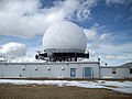 AMradarsite.jpg 3,296 × 2,472; 984 KB
-
 Angel Peak FAA Radar Site - Dec 2018.jpg 4,272 × 2,848; 3.73 MB
-
 ASR-11.jpg 200 × 255; 9 KB
-
 Black Mountain summit.jpg 3,552 × 2,000; 1.09 MB
-
 Cape Henry - Radar station.jpg 771 × 771; 123 KB
-
 FAA Joint Surveillance Site Canton Michigan.JPG 4,752 × 3,168; 5.76 MB
-
 Fort Lawton 12.jpg 2,592 × 1,944; 777 KB
-
 Fort Lawton 17.jpg 2,592 × 1,944; 776 KB
-

-

-
 Mount Kaala Radar Station, Waialua (503607) (20439154412).jpg 4,675 × 2,635; 1.32 MB
-
 Mount Umunhum - NEXRAD Weather Radar.jpg 4,032 × 3,024; 3.36 MB
-
 Mount Umunhum Cube from close up.jpg 616 × 821; 123 KB
-
 MtLagunaFAAStationByPhilKonstantin.jpg 3,264 × 2,448; 627 KB
-
 Point Lay Alaska DEW Line.jpg 2,820 × 1,870; 1.8 MB
-
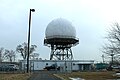
 Radar Facility - panoramio.jpg 4,000 × 3,000; 4.75 MB
-
 Radar Plot from Station Opana, Pearl Harbor, Hawaii - NARA - 2600930.jpg 526 × 756; 158 KB
-
 Radar Site at Fort Lawton WA circa 1962.jpg 2,593 × 1,157; 1.65 MB
-
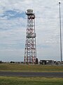 Radar tower at Memphis International Airport.jpg 1,024 × 1,365; 807 KB
-
 Remote radar integration station.jpg 575 × 441; 43 KB
-
 San Pedro JSS site California.jpg 600 × 584; 118 KB
-
 Seattle - Discovery Park 18.jpg 4,288 × 2,848; 6.66 MB
-
 Seattle - Discovery Park 21.jpg 4,288 × 2,848; 6.93 MB
-

-
 View of radar tower on Mount Umunhum.jpg 1,095 × 821; 269 KB


_(klaDA0144).jpg)
,_A_UNIQUE_MULTI-AGENCY_AIR_POLLUTION_RESEARCH_STUDY_SPONSORED_BY_THE..._-_NARA_-_552377.jpg)
_(20439154412).jpg)


_departs_Pearl_Harbor,_en_route_to_its_homeport_in_Adak,_Alaska_in_the_Aleutian_Islands.jpg)
