Category:Radar antenna at Liverpool John Lennon Airport
Jump to navigation
Jump to search
| Object location | | View all coordinates using: OpenStreetMap |
|---|
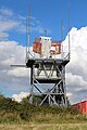
Located to the south of the runway, on land formerly (possibly still) Oglet Farm.
Media in category "Radar antenna at Liverpool John Lennon Airport"
The following 3 files are in this category, out of 3 total.
-
 Radar antenna, Liverpool John Lennon Airport 1.jpg 3,456 × 5,184; 9.11 MB
-
 Radar antenna, Liverpool John Lennon Airport 2.jpg 3,456 × 5,184; 9.06 MB
-
 Radar antenna, Liverpool John Lennon Airport 3.jpg 5,184 × 3,456; 9.16 MB


