Category:RAF Abingdon
Jump to navigation
Jump to search
| Object location | | View all coordinates using: OpenStreetMap |
|---|
English: This airfield in Oxfordshire, England, was operated by the Royal Air Force as RAF Abingdon from 1932 to 1992. Since 1992 it has been operated by the British Army's Royal Logistics Corps as Dalton Barracks.
For simplicity, images covering the facilty's entire history are included under Category:RAF Abingdon.
For simplicity, images covering the facilty's entire history are included under Category:RAF Abingdon.
former Royal Air Force station near Abingdon, Oxfordshire  | |||||
| Upload media | |||||
| Instance of |
| ||||
|---|---|---|---|---|---|
| Location |
| ||||
| Operator | |||||
| Inception |
| ||||
| Dissolved, abolished or demolished date |
| ||||
| Elevation above sea level |
| ||||
| IATA airport code |
| ||||
| ICAO airport code |
| ||||
 | |||||
Subcategories
This category has the following 4 subcategories, out of 4 total.
Media in category "RAF Abingdon"
The following 16 files are in this category, out of 16 total.
-
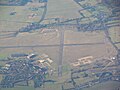
 Airfield in the distance - geograph.org.uk - 1264910.jpg 640 × 426; 57 KB
-
 Arable field next to Dalton Barracks - geograph.org.uk - 1299003.jpg 640 × 427; 81 KB
-
 Danger. Keep out^ - geograph.org.uk - 1404669.jpg 640 × 427; 76 KB
-

-
 EGUD - AeroSPARX - Flickr - lynothehammer1978.jpg 5,889 × 3,618; 9.71 MB
-
 Entrance to Dalton Barracks - geograph.org.uk - 60907.jpg 640 × 480; 77 KB
-
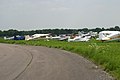 Fifth air fayre at RAF Abingdon - geograph.org.uk - 2296484.jpg 3,072 × 2,048; 2.88 MB
-

-

-
 Hangars at Dalton Barracks - geograph.org.uk - 1404667.jpg 640 × 415; 76 KB
-

-
 RAF Abingdon (30493182674).jpg 4,000 × 3,000; 1.96 MB
-
 Royal Air Force Abingdon c1972 - geograph.org.uk - 1428233.jpg 640 × 402; 69 KB
-
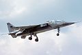 Sepecat Jaguar T2A, UK - Air Force AN2272469.jpg 1,024 × 683; 154 KB
-

-
 Wind sock at Abingdon airfield - geograph.org.uk - 60913.jpg 480 × 640; 91 KB


.jpg)


