Category:Römisch-katholische Pfarrkirche St. Michael (Würenlingen)
Jump to navigation
Jump to search
| Object location | | View all coordinates using: OpenStreetMap |
|---|
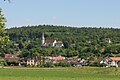
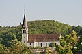
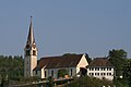
church building in Würenlingen in the canton of Aargau, Switzerland  | |||||
| Upload media | |||||
| Instance of | |||||
|---|---|---|---|---|---|
| Part of | |||||
| Location | Würenlingen, Baden District, Aargau, Switzerland | ||||
| Street address |
| ||||
| Heritage designation | |||||
 | |||||
Media in category "Römisch-katholische Pfarrkirche St. Michael (Würenlingen)"
The following 9 files are in this category, out of 9 total.
-
 Kirche Würenlingen - panoramio.jpg 3,648 × 2,736; 2.87 MB
-
 Kirchturm von 1896 - panoramio.jpg 1,704 × 2,556; 1.17 MB
-
 Würenlingen 2346.jpg 1,024 × 683; 415 KB
-
 Würenlingen 2347.jpg 1,024 × 683; 365 KB
-
 Würenlingen AG rk Kirche.jpg 2,448 × 3,264; 2.1 MB
-
 Würenlingen Kirche 063.JPG 3,888 × 2,592; 3.43 MB
-
 Würenlingen Kirche 064.JPG 3,888 × 2,592; 2.74 MB
-
 Würenlingen-Roman Catholic church edit.jpg 2,048 × 1,536; 871 KB
-
 Würenlingen-Roman Catholic church.jpg 2,048 × 1,536; 683 KB


