Category:Queensferry, Flintshire
Jump to navigation
Jump to search
Cymraeg: Tref yn Sir y Fflint yw Queensferry (sydd weithiau'n cael ei galw'n Y Fferi Isaf hefyd yn Gymraeg). Mae'n gorwedd ar yr A494 yn agos i'r ffin â Lloegr ger groesfan bwysig ar afon Dyfrdwy.
English: Queensferry is a town in Flintshire, North Wales, lying on the River Dee near the border with England.
town and community in Flintshire, North Wales, United Kingdom   | |||||
| Upload media | |||||
| Pronunciation audio | |||||
|---|---|---|---|---|---|
| Instance of | |||||
| Location | Flintshire, Wales | ||||
| Heritage designation |
| ||||
| Population |
| ||||
| Different from | |||||
 | |||||
Subcategories
This category has the following 3 subcategories, out of 3 total.
Media in category "Queensferry, Flintshire"
The following 200 files are in this category, out of 204 total.
(previous page) (next page)-
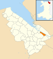 2010 Wales Flintshire Community Queensferry map.svg 512 × 568; 494 KB
-
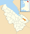 2024 Wales Flintshire Community Queensferry map.svg 512 × 568; 394 KB
-
 A rivet bench mark alongside Chester Road (East) - geograph.org.uk - 4852705.jpg 4,024 × 3,014; 3.59 MB
-
 A track and pylons by the River Dee - geograph.org.uk - 2121944.jpg 640 × 480; 144 KB
-
 A494 - geograph.org.uk - 4493268.jpg 640 × 330; 45 KB
-
 A494 approaching the Pentre flyover - geograph.org.uk - 2252294.jpg 640 × 480; 52 KB
-
 A494 bridge over the River Dee - geograph.org.uk - 6184933.jpg 800 × 600; 97 KB
-
 A550 - the new Queensferry Bridge - geograph.org.uk - 2252301.jpg 640 × 480; 44 KB
-

-
 A550 north of the Pentre flyover - geograph.org.uk - 2252297.jpg 640 × 480; 58 KB
-

-
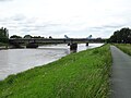
 Across the River Dee - geograph.org.uk - 6654453.jpg 1,024 × 683; 452 KB
-
 Across the River Dee - geograph.org.uk - 6654523.jpg 1,024 × 683; 410 KB
-
 Across the River Dee - geograph.org.uk - 6654549.jpg 1,024 × 683; 388 KB
-
 Airbus A380 wing awaiting transportation - geograph.org.uk - 1137682.jpg 640 × 453; 144 KB
-

-

-

-
 B5441 road 5.JPG 3,648 × 2,736; 3.6 MB
-
 B5441 road 6.JPG 3,648 × 2,736; 3.65 MB
-
 B5441 road 7.JPG 3,648 × 2,736; 3.65 MB
-
 B5441 road 8.JPG 3,648 × 2,736; 3.51 MB
-
 B5441, Queensferry - geograph.org.uk - 4493275.jpg 640 × 559; 73 KB
-
 Barn, Beeches Farm - geograph.org.uk - 4493237.jpg 640 × 435; 45 KB
-
 Beeches Farm - geograph.org.uk - 46744.jpg 640 × 480; 154 KB
-
 Bench mark in Hurlbutts Drive, Queensferry, Clwyd - geograph.org.uk - 4866188.jpg 3,166 × 4,228; 2.69 MB
-
 Bench mark on Queensferry railway bridge - geograph.org.uk - 2120189.jpg 480 × 640; 137 KB
-
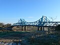
 Blue Bridge (Jubilee Bridge), River Dee - geograph.org.uk - 2431874.jpg 1,280 × 960; 687 KB
-
 Bridge Villas, Queensferry - geograph.org.uk - 5314842.jpg 640 × 480; 89 KB
-
 Car in the River Dee - geograph.org.uk - 387698.jpg 600 × 480; 141 KB
-
 Castellated gateway to Old Hall Farm - geograph.org.uk - 2933259.jpg 1,600 × 1,200; 531 KB
-
 Centre of the Queensferry Blue Bridge - geograph.org.uk - 1135316.jpg 480 × 640; 105 KB
-

-
 Chester Road West - geograph.org.uk - 1341037.jpg 640 × 457; 288 KB
-
 Chester Road West, Deeside 1.JPG 3,648 × 2,736; 3.66 MB
-
 Chester Street west, from Station Road - geograph.org.uk - 2722236.jpg 800 × 600; 285 KB
-
-
 Crane base in the River Dee - geograph.org.uk - 2121694.jpg 640 × 480; 116 KB
-
 Culvert alongside Chester Road (East), Queensferry - geograph.org.uk - 4852720.jpg 3,456 × 4,608; 4.77 MB
-
 Cycleway junction by the River Dee - geograph.org.uk - 1135548.jpg 640 × 480; 118 KB
-
 Dee Marsh Junction Box - geograph.org.uk - 542122.jpg 640 × 480; 79 KB
-
 Deeside Leisure Centre 1.JPG 3,648 × 2,736; 3.56 MB
-
 Deeside Leisure Centre, Queensferry.JPG 4,320 × 3,240; 3.08 MB
-

-
 Distribution warehouse - geograph.org.uk - 2934956.jpg 1,600 × 1,200; 288 KB
-
 Drainage ditch - geograph.org.uk - 1277368.jpg 640 × 457; 416 KB
-
 Drainage Ditch and the River Dee - geograph.org.uk - 380553.jpg 640 × 480; 169 KB
-
 Elizabeth II postbox on Station Road, Queensferry - geograph.org.uk - 6165922.jpg 2,867 × 4,766; 2.09 MB
-
 Elizabeth II postbox on Station Road, Queensferry - geograph.org.uk - 6165924.jpg 2,999 × 4,870; 2.88 MB
-
 Entering Garden City - geograph.org.uk - 1135528.jpg 640 × 452; 120 KB
-
 Factory near the Dee at Sandycroft - geograph.org.uk - 2827501.jpg 640 × 480; 75 KB
-

-
 Farm buildings at Old Hall Farm - geograph.org.uk - 2933265.jpg 1,600 × 1,200; 526 KB
-
 Farmland - geograph.org.uk - 4493249.jpg 640 × 411; 45 KB
-
 Farmland by the railway - geograph.org.uk - 4556968.jpg 640 × 426; 29 KB
-
 Farmland near Sandycroft - geograph.org.uk - 4493252.jpg 640 × 403; 52 KB
-
 Farmland near Sandycroft - geograph.org.uk - 4493254.jpg 640 × 426; 48 KB
-
 Farmland, Beeches Farm - geograph.org.uk - 4493241.jpg 640 × 426; 50 KB
-
 Flat farmland - geograph.org.uk - 4556964.jpg 640 × 426; 35 KB
-
 Floodbank of the River Dee - geograph.org.uk - 2121256.jpg 640 × 480; 118 KB
-
 Floodbank of the River Dee - geograph.org.uk - 2121738.jpg 640 × 480; 131 KB
-
 Footpath and Building in Sandycroft - geograph.org.uk - 382103.jpg 640 × 480; 241 KB
-
 Footpath and Iron Stile by the River Dee - geograph.org.uk - 382057.jpg 640 × 480; 243 KB
-
 Footpath by the River Dee - geograph.org.uk - 382149.jpg 640 × 480; 156 KB
-
 Footpath in Sandycroft - geograph.org.uk - 382100.jpg 640 × 480; 265 KB
-
 Footpath to the River Dee - geograph.org.uk - 382114.jpg 480 × 640; 216 KB
-
 Fuel pumps at ASDA - geograph.org.uk - 5738702.jpg 3,264 × 2,448; 2.88 MB
-

-
 Half a pillbox by the River Dee - geograph.org.uk - 2121678.jpg 640 × 480; 195 KB
-
 Hawarden Bridge - geograph.org.uk - 2431940.jpg 1,280 × 960; 628 KB
-
 Hawarden Castle Hotel, Queensferry (1).JPG 4,320 × 3,240; 3.08 MB
-
 Hawarden Castle Hotel, Queensferry - geograph.org.uk - 2827157.jpg 640 × 473; 67 KB
-
 Hay barn, Beeches Farm - geograph.org.uk - 4556971.jpg 640 × 338; 28 KB
-

-
 Houses on Station Road, Queensferry - geograph.org.uk - 6164546.jpg 800 × 600; 101 KB
-
 Hurlbutts Drive Railway Bridge - geograph.org.uk - 4866200.jpg 4,136 × 3,104; 3.38 MB
-
 Industrial building, Sandycroft - geograph.org.uk - 4493260.jpg 640 × 311; 49 KB
-
 Inside a WW2 Pillbox by the River Dee - geograph.org.uk - 382478.jpg 640 × 480; 156 KB
-
 Iron Gate, Railings and Rowleys Drive - geograph.org.uk - 410943.jpg 640 × 480; 249 KB
-
 Iron Stile and the River Dee - geograph.org.uk - 382097.jpg 640 × 480; 211 KB
-
 Jubilee Bridge - geograph.org.uk - 5315064.jpg 640 × 480; 64 KB
-
 Kissing gate on the Wales Coast Path - geograph.org.uk - 5315432.jpg 640 × 447; 113 KB
-

-

-
 Natural drainage from Sandycroft - geograph.org.uk - 2935005.jpg 1,600 × 1,200; 238 KB
-
 New Caravans for Sale - geograph.org.uk - 2428392.jpg 640 × 471; 63 KB
-
 North abutment to the old Queensferry bridge - geograph.org.uk - 2933278.jpg 1,600 × 1,200; 416 KB
-
-

-

-
 Part of the Queensferry Blue Bridge - geograph.org.uk - 1133752.jpg 480 × 640; 143 KB
-
 Phoenix Street, Sandycroft - geograph.org.uk - 4947056.jpg 4,000 × 3,000; 3 MB
-
 Pieces of a pillbox by the River Dee - geograph.org.uk - 2121275.jpg 640 × 480; 145 KB
-
 Pillbox site by the River Dee - geograph.org.uk - 2121707.jpg 640 × 480; 157 KB
-

-
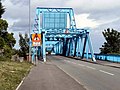
 Queensferry Blue Bridge - geograph.org.uk - 2431915.jpg 1,280 × 960; 604 KB
-
 Queensferry Blue Bridge - geograph.org.uk - 5315411.jpg 640 × 480; 65 KB
-
 Queensferry Blue Bridge - geograph.org.uk - 6164554.jpg 800 × 551; 78 KB
-

-
 Queensferry Bridge - geograph.org.uk - 6654556.jpg 1,024 × 683; 446 KB
-

-
 Queensferry Retail Park.jpg 640 × 480; 49 KB
-
 QueensferryLB01.JPG 2,048 × 1,536; 685 KB
-
 Rail Bridge - geograph.org.uk - 2431580.jpg 1,280 × 960; 571 KB
-
 Rail bridge, Queensferry 1.JPG 3,648 × 2,736; 3.61 MB
-
 Rail bridge, Queensferry 2.JPG 3,648 × 2,736; 3.58 MB
-

-

-
 Red sky over green farmland - geograph.org.uk - 4556967.jpg 640 × 426; 33 KB
-
 River Dee - geograph.org.uk - 2431932.jpg 1,280 × 960; 668 KB
-
 River Dee and 'New' Queensferry Bridge - geograph.org.uk - 2431911.jpg 1,280 × 960; 508 KB
-
 River Dee at Queensferry - geograph.org.uk - 870926.jpg 637 × 480; 102 KB
-
 River Dee at Queensferry - geograph.org.uk - 870943.jpg 637 × 480; 118 KB
-
 River Dee Bank - geograph.org.uk - 2431946.jpg 1,280 × 960; 759 KB
-
 River Dee near Queensferry - geograph.org.uk - 6654560.jpg 1,024 × 683; 414 KB
-
 River Dee, Queensferry 1.JPG 3,648 × 2,736; 3.66 MB
-
 River Dee, Queensferry 3.JPG 3,648 × 2,736; 3.54 MB
-
 Row of houses by the railway - geograph.org.uk - 4556956.jpg 640 × 426; 43 KB
-
 Ruined Jetty by the River Dee - geograph.org.uk - 382183.jpg 640 × 480; 55 KB
-
 Ruined Jetty by the River Dee - geograph.org.uk - 387732.jpg 640 × 480; 129 KB
-
 Ruined Jetty by the River Dee ^1 - geograph.org.uk - 387683.jpg 640 × 480; 186 KB
-
 Ruined Jetty by the River Dee ^2 - geograph.org.uk - 387687.jpg 480 × 640; 206 KB
-
 Ruined pillbox by the River Dee - geograph.org.uk - 2121246.jpg 640 × 480; 138 KB
-
 Sandycroft Methodist Chapel - geograph.org.uk - 4947050.jpg 3,798 × 2,766; 1.86 MB
-

-
 Service station exit, Queensferry - geograph.org.uk - 5738713.jpg 3,264 × 2,448; 3.31 MB
-
 Shops on Station Road, Queensferry - geograph.org.uk - 6164456.jpg 800 × 600; 96 KB
-
 Shotton Low Level - geograph.org.uk - 507143.jpg 640 × 480; 112 KB
-
 Slipway for the Airbus Wings Barge - geograph.org.uk - 387761.jpg 640 × 480; 99 KB
-
 Snowy Day at Queensferry - geograph.org.uk - 1470474.jpg 640 × 480; 89 KB
-
 Station Road - geograph.org.uk - 1277386.jpg 640 × 457; 284 KB
-
 Station Road - geograph.org.uk - 1277390.jpg 640 × 457; 311 KB
-
 Station Road, Queensferry - geograph.org.uk - 2073128.jpg 640 × 479; 63 KB
-
 Station Road, Queensferry - geograph.org.uk - 6165927.jpg 5,184 × 3,888; 3.48 MB
-
 Sunny day in spring - geograph.org.uk - 2933240.jpg 1,600 × 1,200; 427 KB
-
 The B5129 near Beeches Farm - geograph.org.uk - 4947018.jpg 4,000 × 3,000; 3.55 MB
-
 The Blue Bridge at Queensferry - geograph.org.uk - 1133368.jpg 640 × 480; 135 KB
-
 The Bridge Inn, Sandycroft - geograph.org.uk - 4948168.jpg 4,000 × 3,000; 3.42 MB
-
 The Bridge Inn, Sandycroft - geograph.org.uk - 4948170.jpg 4,000 × 3,000; 3.12 MB
-

-

-
 The Dee Coastal Path near Queensferry - geograph.org.uk - 1136142.jpg 640 × 480; 108 KB
-
 The old orchard at Old Hall Farm - geograph.org.uk - 2933249.jpg 1,600 × 1,200; 464 KB
-
 The Old Queensferry Bridge - geograph.org.uk - 872542.jpg 640 × 480; 94 KB
-
-
 The Queensferry Bridges - geograph.org.uk - 410758.jpg 640 × 480; 200 KB
-

-
 The river Dee - geograph.org.uk - 2827340.jpg 640 × 480; 37 KB
-
 The River Dee - geograph.org.uk - 6164557.jpg 800 × 600; 50 KB
-
 The River Dee - geograph.org.uk - 6184901.jpg 800 × 600; 68 KB
-

-
 The river Dee at Queensferry - geograph.org.uk - 5315068.jpg 640 × 480; 58 KB
-
-
 The River Dee near Sandycroft - geograph.org.uk - 382174.jpg 640 × 480; 122 KB
-
 The River Dee, Sandycroft - geograph.org.uk - 6184912.jpg 800 × 600; 74 KB
-
 The two Queensferry bridges and a swan - geograph.org.uk - 1135976.jpg 640 × 452; 135 KB
-
 Two pylons by the River Dee - geograph.org.uk - 2121762.jpg 480 × 640; 111 KB
-
 Upstream on the River Dee - geograph.org.uk - 6654528.jpg 1,024 × 683; 386 KB
-

-
 View from a Chester-Holyhead train - Beeches Farm - geograph.org.uk - 5781933.jpg 1,600 × 1,200; 461 KB
-
 View from a Chester-Holyhead train - crossing the A494 - geograph.org.uk - 5781984.jpg 1,600 × 1,200; 311 KB
-
-
-

-
 Wales Coast Path - geograph.org.uk - 5315056.jpg 640 × 474; 102 KB
-
 Wales Coast Path - geograph.org.uk - 5315451.jpg 640 × 480; 75 KB
-
-
 Wales coast path start at Queensferry.jpg 2,915 × 2,077; 2.74 MB
-
 Waste ground - geograph.org.uk - 4556962.jpg 640 × 426; 36 KB
-
 Welsh Road - geograph.org.uk - 1341046.jpg 640 × 457; 287 KB
-
 WW2 Pillbox by the River Dee - geograph.org.uk - 382239.jpg 640 × 480; 175 KB
-
 WW2 Pillbox by the River Dee - geograph.org.uk - 382470.jpg 640 × 480; 164 KB
-

-
 Caution, Toad Crossing - geograph.org.uk - 407432.jpg 600 × 480; 158 KB
-
 Drainage Ditch and Stile by the River Dee - geograph.org.uk - 380541.jpg 640 × 480; 181 KB
-
 Drainage Sump by the River Dee - geograph.org.uk - 410346.jpg 640 × 480; 172 KB
-
 Farmland - geograph.org.uk - 46745.jpg 640 × 480; 163 KB
-

-
 Footpath from the River Dee to Sandycroft - geograph.org.uk - 382123.jpg 480 × 640; 200 KB
-
 Footpath from the River Dee to Sandycroft - geograph.org.uk - 382143.jpg 480 × 600; 102 KB
-

-
 Hawarden Castle Hotel, Queensferry - geograph.org.uk - 410486.jpg 640 × 480; 179 KB
-
 Landing Stage in the River Dee - geograph.org.uk - 411106.jpg 640 × 480; 127 KB
-
 Landing Stage on the River Dee 2 - geograph.org.uk - 411108.jpg 640 × 480; 134 KB
-
 Old Queensferry Bridge Abutment - geograph.org.uk - 409955.jpg 640 × 480; 155 KB
-
 Ornamental Doorway by Old Hall Farm - geograph.org.uk - 410436.jpg 640 × 480; 256 KB
-
 Ornamental Doorway by Old Hall Farm - geograph.org.uk - 410458.jpg 480 × 640; 90 KB
-
 Preparing the Ground - geograph.org.uk - 409385.jpg 600 × 480; 131 KB
-

-
 Queensferry Bridge - geograph.org.uk - 387751.jpg 640 × 480; 196 KB
-
 Queensferry Land Drainage Pumping Station - geograph.org.uk - 410877.jpg 640 × 480; 233 KB
-
 Queensferry Old Bridge Abutment - geograph.org.uk - 410257.jpg 480 × 640; 212 KB
-
 Railings and a view across the River Dee - geograph.org.uk - 404738.jpg 640 × 480; 138 KB
-
 Ruined Chimney^ - geograph.org.uk - 382108.jpg 640 × 480; 245 KB
-
 Ruined Jetty by the River Dee ^3 - geograph.org.uk - 387693.jpg 640 × 480; 160 KB
-
 Sealand Land Drainage Pumping Station - geograph.org.uk - 382084.jpg 480 × 640; 105 KB
-
-
 Sunken Boat and the River Dee - geograph.org.uk - 382093.jpg 640 × 480; 81 KB
-
 The Modern Queensferry Bridge - geograph.org.uk - 387743.jpg 640 × 480; 130 KB
-
 The Modern Queensferry Road Bridge - geograph.org.uk - 409780.jpg 640 × 480; 46 KB

_-_geograph.org.uk_-_4852705.jpg)


,_River_Dee_-_geograph.org.uk_-_2431874.jpg)


,_Queensferry_-_geograph.org.uk_-_4852720.jpg)


.JPG)


_-_geograph.org.uk_-_2484938.jpg)


_-_geograph.org.uk_-_4972983.jpg)
_-_geograph.org.uk_-_4973002.jpg)


