Category:Quebec City in the 18th century
Jump to navigation
Jump to search
Wikimedia category | |||||
| Upload media | |||||
| Instance of | |||||
|---|---|---|---|---|---|
| Category combines topics | |||||
| Followed by | |||||
| 18th century | |||||
time period between January 1, 1701, and December 31, 1800  | |||||
| Instance of | |||||
| Part of | |||||
| Has part(s) | |||||
| Point in time |
| ||||
| Start time |
| ||||
| End time |
| ||||
| Follows | |||||
| Followed by | |||||
| Quebec City | |||||
capital city of the province of Quebec, Canada     .svg)  | |||||
| Pronunciation audio | |||||
| Instance of |
| ||||
| Named after |
| ||||
| Location | Quebec, Capitale-Nationale, Quebec, Canada | ||||
| Located in or next to body of water | |||||
| Legislative body |
| ||||
| Head of government |
| ||||
| Present in work |
| ||||
| Founded by |
| ||||
| Inception |
| ||||
| Significant event |
| ||||
| Population |
| ||||
| Area |
| ||||
| Elevation above sea level |
| ||||
| Different from | |||||
| official website | |||||
 | |||||
Subcategories
This category has the following 11 subcategories, out of 11 total.
- Quebec City in the 1700s (10 F)
- Quebec City in the 1710s (2 F)
- Quebec City in the 1730s (1 F)
- Quebec City in the 1740s (1 F)
*
- 18th-century maps of Quebec City (25 F)
S
- Pedro da Silva (3 F)
Media in category "Quebec City in the 18th century"
The following 13 files are in this category, out of 13 total.
-
 A plan of Quebec (4231159347).jpg 2,000 × 1,321; 2.98 MB
-
 A view of Quebec from the south east. RMG K0326.jpg 1,280 × 954; 714 KB
-
 A view of Quebec from the south east. RMG K0327.jpg 1,280 × 962; 679 KB
-

-

-
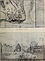 La vieille capitale - Québec historique, 1608-1908 (1908) (14780736612).jpg 2,604 × 3,530; 3.45 MB
-

-

-
 Plan de l Intendance de Quebec - 1750.JPG 7,678 × 5,416; 18.95 MB
-
 Plan de la ville de Quebec - 1755.jpg 6,089 × 4,280; 10.5 MB
-
 Québec, capitale de la Nouvelle France au XVIIIème siècle.jpg 1,200 × 812; 246 KB
-

-
 Vue générale de Québec en 1755 sur le Saint Laurent.jpg 3,004 × 2,076; 2.23 MB
.jpg)


_(14780736612).jpg)
_(14761642006).jpg)


