Category:Quarries in Herefordshire
Jump to navigation
Jump to search
Ceremonial counties of England: Bedfordshire · Berkshire · Buckinghamshire · Cambridgeshire · Cheshire · Cornwall · Cumbria · Derbyshire · Devon · Dorset · Durham · East Riding of Yorkshire · East Sussex · Essex · Gloucestershire · Greater Manchester · Hampshire · Herefordshire · Hertfordshire · Kent · Lancashire · Leicestershire · Lincolnshire · Merseyside · Norfolk · North Yorkshire · Northamptonshire · Northumberland · Nottinghamshire · Oxfordshire · Rutland · Shropshire · Somerset · South Yorkshire · Staffordshire · Suffolk · Surrey · Tyne and Wear · Warwickshire · West Midlands · West Sussex · West Yorkshire · Wiltshire · Worcestershire
City-counties: Bristol ·
Former historic counties:
Other former counties:
City-counties: Bristol ·
Former historic counties:
Other former counties:
Subcategories
This category has only the following subcategory.
G
- Gullet Quarry, Malvern Hills (34 F)
Media in category "Quarries in Herefordshire"
The following 31 files are in this category, out of 31 total.
-

-
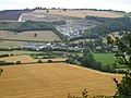
 Grazing land below Nash Scar - geograph.org.uk - 901792.jpg 640 × 480; 85 KB
-
 Leinthall Earls Quarry and Gatley Park - geograph.org.uk - 71536.jpg 640 × 480; 57 KB
-

-
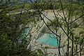
 Linton Quarry SSSI - geograph.org.uk - 1471929.jpg 640 × 426; 121 KB
-
 Nash Scar - 1 - geograph.org.uk - 901652.jpg 640 × 480; 91 KB
-
 Nash Scar - 2 - geograph.org.uk - 901656.jpg 640 × 480; 100 KB
-
 Nash Scar - 3 - geograph.org.uk - 901658.jpg 640 × 480; 75 KB
-
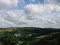
 Northern edge of Croft Ambrey - geograph.org.uk - 1449969.jpg 640 × 480; 100 KB
-
 Old quarry in Barnett Wood - geograph.org.uk - 1175301.jpg 640 × 480; 169 KB
-
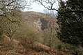
 Old quarry, Midsummer Hill - geograph.org.uk - 1628779.jpg 640 × 426; 105 KB
-
 Quarry above Deerfold - geograph.org.uk - 315061.jpg 640 × 480; 155 KB
-
 Quarry at Storridge - geograph.org.uk - 795987.jpg 640 × 426; 112 KB
-
 Quarry spoil tip at Nash Quarry - geograph.org.uk - 901616.jpg 640 × 480; 126 KB
-
 Warning sign at Nash Quarry - geograph.org.uk - 901665.jpg 640 × 480; 106 KB
-

-
 Berrington's Quarry, Black Hill - geograph.org.uk - 369336.jpg 640 × 427; 276 KB
-
 Bodenham gravel pits - geograph.org.uk - 146396.jpg 640 × 480; 110 KB
-
 Disused quarry - geograph.org.uk - 128284.jpg 640 × 480; 142 KB
-
 Hereford Quarry - geograph.org.uk - 151332.jpg 640 × 479; 67 KB
-
 Hollybush East Quarry - geograph.org.uk - 15805.jpg 640 × 480; 141 KB
-
 Hollybush Quarry - geograph.org.uk - 690066.jpg 640 × 427; 301 KB
-
-
 Midsummer Hill - geograph.org.uk - 367298.jpg 640 × 426; 141 KB
-
 Old quarry west of Birtley - geograph.org.uk - 44239.jpg 640 × 480; 154 KB
-
 Old Quarry, Coombe Hill - geograph.org.uk - 286216.jpg 640 × 427; 338 KB
-
 Perton Quarry - geograph.org.uk - 67151.jpg 640 × 426; 111 KB
-
 Quarry near Durstone Farm - geograph.org.uk - 117664.jpg 640 × 479; 161 KB
-
 Quarry on Cockshot Hill - geograph.org.uk - 323440.jpg 640 × 427; 294 KB
-
 Slashers Quarry, Hollybush. - geograph.org.uk - 20938.jpg 640 × 443; 155 KB
-
 Smokey Quarry - geograph.org.uk - 315119.jpg 480 × 640; 178 KB


