Category:Quarrier's Village
Jump to navigation
Jump to search
village in Inverclyde, Scotland, UK  | |||||
| Upload media | |||||
| Instance of | |||||
|---|---|---|---|---|---|
| Location |
| ||||
| Population |
| ||||
 | |||||
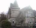
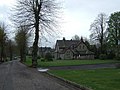
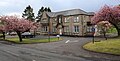
English: Quarrier's Village is a small settlement in Inverclyde, Scotland. It lies within the Gryffe Valley, falling into the civil parish of Kilmacolm, although geographically slightly closer to Bridge of Weir. It is now a residential commuter village, with many residents working in and around Glasgow. The community itself sits very much on the border with the Renfrewshire council area. The village formerly served as the Orphans Homes of Scotland.
Subcategories
This category has the following 5 subcategories, out of 5 total.
Media in category "Quarrier's Village"
The following 145 files are in this category, out of 145 total.
-
 "How faur tae Glesgae" - 18 - geograph.org.uk - 1561318.jpg 480 × 640; 61 KB
-
 Access track leading to National Cycle Network Route 75 - geograph.org.uk - 4150498.jpg 1,600 × 1,067; 568 KB
-
 Approaching Quarriers Village - geograph.org.uk - 3884769.jpg 640 × 480; 58 KB
-

-
 Barnshake farm road - geograph.org.uk - 4150836.jpg 1,600 × 1,067; 861 KB
-
 Barnshake farm road - geograph.org.uk - 4150841.jpg 1,600 × 1,067; 461 KB
-
 Barnshake farm road - geograph.org.uk - 4150847.jpg 1,600 × 1,067; 474 KB
-
 Barnshake farm road - geograph.org.uk - 4150855.jpg 5,184 × 3,456; 7.57 MB
-
 Boundary trees near Quarriers Village - geograph.org.uk - 4859242.jpg 1,024 × 683; 240 KB
-
 Bridge in Quarriers Village - geograph.org.uk - 44913.jpg 640 × 480; 139 KB
-
 Bridge of Weir Spring Lambs - geograph.org.uk - 751914.jpg 640 × 417; 79 KB
-
 Cattle feed on Killochries Farm - geograph.org.uk - 4859238.jpg 800 × 533; 91 KB
-
 Corner of Church Road ^ Faith Avenue, Quarriers Village - geograph.org.uk - 4150726.jpg 1,600 × 1,067; 597 KB
-
 Cottages at Hattrick Farm - geograph.org.uk - 6449246.jpg 1,024 × 565; 261 KB
-
 Countryview at Quarriers Village - geograph.org.uk - 6471436.jpg 1,024 × 683; 275 KB
-
 Craigbet Gates - geograph.org.uk - 6449747.jpg 1,024 × 641; 469 KB
-
 Craigbet Gates - geograph.org.uk - 6449749.jpg 1,024 × 683; 503 KB
-
 Craigends Dennistoun Farm - geograph.org.uk - 4973804.jpg 640 × 480; 127 KB
-
 Crucifix at Mount Zion Church - geograph.org.uk - 6471309.jpg 776 × 1,024; 434 KB
-
 Defibrillator at Quarriers Village - geograph.org.uk - 6450458.jpg 762 × 1,024; 327 KB
-
 Defibrillator at Quarriers Village - geograph.org.uk - 6471441.jpg 856 × 1,024; 409 KB
-
 Faith Avenue, Quarriers Village - geograph.org.uk - 4150746.jpg 1,600 × 1,067; 688 KB
-
 Farm Machinery - geograph.org.uk - 1471718.jpg 640 × 480; 112 KB
-
 Farmland near Quarriers Village - geograph.org.uk - 6449808.jpg 1,024 × 573; 259 KB
-
 Farmland near Quarriers Village - geograph.org.uk - 6449811.jpg 1,024 × 650; 263 KB
-
 Farmland near Quarriers Village - geograph.org.uk - 6449819.jpg 1,024 × 606; 263 KB
-
 Farmland near Quarriers Village - geograph.org.uk - 6471313.jpg 1,024 × 503; 225 KB
-
 Farmland near Quarriers Village - geograph.org.uk - 6471314.jpg 1,024 × 596; 289 KB
-
 Field gate near Hardridge Farm - geograph.org.uk - 4859229.jpg 1,024 × 683; 239 KB
-
 Fields, Hattrick - geograph.org.uk - 6686125.jpg 1,024 × 684; 217 KB
-
 Former Bridge of Weir Hospital - geograph.org.uk - 6449804.jpg 1,024 × 512; 266 KB
-
 Former Bridge of Weir Hospital - geograph.org.uk - 6453425.jpg 1,024 × 402; 174 KB
-
 Former Bridge of Weir Hospital - geograph.org.uk - 6471936.jpg 1,024 × 683; 326 KB
-
 Former Bridge of Weir Hospital - geograph.org.uk - 6471939.jpg 1,024 × 762; 373 KB
-
 Former Bridge of Weir Hospital - geograph.org.uk - 6471941.jpg 1,024 × 662; 285 KB
-
 Former Bridge of Weir Hospital - geograph.org.uk - 6471942.jpg 1,024 × 683; 307 KB
-
 Former Bridge of Weir Hospital - geograph.org.uk - 6471944.jpg 1,024 × 683; 288 KB
-
 Former Bridge of Weir Hospital - geograph.org.uk - 6471945.jpg 1,024 × 592; 246 KB
-
 Former Bridge of Weir Hospital - geograph.org.uk - 6471950.jpg 1,024 × 683; 392 KB
-
 Former Bridge of Weir Hospital - geograph.org.uk - 6471952.jpg 872 × 1,024; 478 KB
-
 Former Elise Hospital, Quarriers Village - geograph.org.uk - 6450813.jpg 1,024 × 500; 256 KB
-
 Former Fire Station, Torr Avenue, Quarriers Village - geograph.org.uk - 4150758.jpg 1,600 × 1,067; 507 KB
-
 Former Quarriers epilepsy centre - geograph.org.uk - 6471283.jpg 1,024 × 465; 173 KB
-
 Former Quarriers epilepsy centre - geograph.org.uk - 6471295.jpg 1,024 × 412; 182 KB
-
 Former Quarriers epilepsy centre - geograph.org.uk - 6471319.jpg 1,024 × 586; 286 KB
-
 Former Woodside Care Home - geograph.org.uk - 6471445.jpg 1,024 × 683; 523 KB
-
 Former Woodside Care Home - geograph.org.uk - 6471446.jpg 1,024 × 683; 463 KB
-
 Fungi - geograph.org.uk - 567986.jpg 640 × 480; 130 KB
-
 Hattrick - geograph.org.uk - 6686126.jpg 1,024 × 684; 240 KB
-
 Hattrick Farm - geograph.org.uk - 6449239.jpg 1,024 × 683; 242 KB
-
 Hattrick Farm - geograph.org.uk - 6449243.jpg 1,024 × 480; 196 KB
-
 Hattrick Farm - geograph.org.uk - 6449245.jpg 1,024 × 683; 343 KB
-
 Holmlea, Quarriers Village - geograph.org.uk - 6450451.jpg 1,024 × 683; 354 KB
-
 Hope Lodge - geograph.org.uk - 6449751.jpg 1,024 × 616; 354 KB
-
 Hope Lodge - geograph.org.uk - 6449752.jpg 1,024 × 705; 482 KB
-
 House at Carruth Bridge - geograph.org.uk - 194199.jpg 640 × 480; 93 KB
-
 Inverclyde - 'Alan Dick Home', 17 Quarrier's Village - 20230929144439.jpg 3,872 × 2,592; 3.69 MB
-
 Inverclyde - 'Overtoun', 14 Quarrier's Village - 20230929144156.jpg 3,001 × 2,279; 4.65 MB
-
 Inverclyde - 'Overtoun', 14 Quarrier's Village - 20230929144219.jpg 3,872 × 2,592; 3.49 MB
-
 Inverclyde - (Glenfarg), 34 Quarrier's Village - 20230929143321.jpg 3,872 × 2,592; 3.88 MB
-
 Inverclyde - (Sabbath School Home), 28 Quarrier's Village - 20230929144624.jpg 3,346 × 2,305; 6.89 MB
-
 Inverclyde - (Sabbath School Home), 28 Quarrier's Village - 20230929144720.jpg 3,438 × 2,572; 7.33 MB
-
 Inverclyde - Bethesda, 45 Quarrier's Village - 20230929143844.jpg 3,691 × 2,138; 4.87 MB
-
 Inverclyde - Homelea, Faith Avenue, Quarriers Village - 20230929143919.jpg 3,323 × 2,201; 5.13 MB
-

-
 Law View Road, Quarriers Village - geograph.org.uk - 3884865.jpg 640 × 480; 85 KB
-
 Law View Road, Quarriers Village - geograph.org.uk - 6685892.jpg 1,024 × 684; 408 KB
-
 Looking towards Hattrick Farm - geograph.org.uk - 3884870.jpg 640 × 480; 63 KB
-
 Love Avenue, Quarriers Village - geograph.org.uk - 4150712.jpg 1,600 × 1,067; 560 KB
-
 Love Avenue, Quarriers Village - geograph.org.uk - 4150720.jpg 1,600 × 1,067; 578 KB
-
 Mid Gibblaston driveway in spring sunshine - geograph.org.uk - 4859245.jpg 1,024 × 683; 237 KB
-
 Minor road near Quarriers Village - geograph.org.uk - 6449226.jpg 1,024 × 683; 264 KB
-
 Minor road near Quarriers Village - geograph.org.uk - 6449232.jpg 1,024 × 494; 224 KB
-
 Minor road to Quarriers Village - geograph.org.uk - 6449754.jpg 1,024 × 683; 346 KB
-
 Minor road to Quarriers Village - geograph.org.uk - 6471267.jpg 1,024 × 683; 291 KB
-
 Minor road to Quarriers Village - geograph.org.uk - 6471299.jpg 1,024 × 683; 337 KB
-
 Minor road to Quarriers Village - geograph.org.uk - 6471300.jpg 683 × 1,024; 316 KB
-
 Molehills - geograph.org.uk - 117242.jpg 640 × 479; 98 KB
-
 Mount Zion Church - geograph.org.uk - 6471291.jpg 1,024 × 567; 240 KB
-
 Mount Zion Church - geograph.org.uk - 6471307.jpg 1,024 × 485; 209 KB
-
 Mount Zion Church - geograph.org.uk - 6471312.jpg 1,024 × 683; 305 KB
-
 Mount Zion Church, Quarriers Village - geograph.org.uk - 4150676.jpg 3,456 × 5,184; 7.67 MB
-
 Old grass road to Blackwater - geograph.org.uk - 4859221.jpg 1,024 × 683; 252 KB
-
 Old Style Stile - geograph.org.uk - 567991.jpg 480 × 640; 115 KB
-
 Ornate new sign for North Newton - geograph.org.uk - 4859234.jpg 683 × 1,024; 249 KB
-
 Parklands House - geograph.org.uk - 6471426.jpg 1,024 × 683; 324 KB
-
 Peace Avenue - geograph.org.uk - 6449831.jpg 1,024 × 683; 483 KB
-
 Plaque at Holmlea, Quarriers Village - geograph.org.uk - 6450463.jpg 1,024 × 613; 335 KB
-
 Postbox at Quarriers Village - geograph.org.uk - 6471417.jpg 683 × 1,024; 494 KB
-
 Postbox at Quarriers Village - geograph.org.uk - 6471419.jpg 683 × 1,024; 346 KB
-
 Pylons - geograph.org.uk - 117240.jpg 640 × 479; 78 KB
-
 Quarrier's Village - geograph.org.uk - 3527754.jpg 640 × 393; 111 KB
-
 Quarrier's Village - geograph.org.uk - 3527764.jpg 640 × 395; 103 KB
-
 Quarrier's Village - geograph.org.uk - 3884778.jpg 640 × 480; 61 KB
-
 Quarrier's Village Heritage Path - geograph.org.uk - 1561302.jpg 640 × 480; 94 KB
-
 Quarriers Sabbath School Home.jpg 1,081 × 854; 143 KB
-
 Quarriers Schoolhouse.jpg 1,280 × 960; 283 KB
-
 Quarriers Village - geograph.org.uk - 1523446.jpg 640 × 480; 78 KB
-
 Quarriers Village - geograph.org.uk - 454583.jpg 640 × 480; 91 KB
-
 Quarriers Village - geograph.org.uk - 454589.jpg 640 × 480; 99 KB
-
 Quarriers Village - geograph.org.uk - 454617.jpg 640 × 480; 112 KB
-
 Quarriers Village - geograph.org.uk - 454619.jpg 640 × 480; 94 KB
-
 Quarriers Village - geograph.org.uk - 454624.jpg 640 × 480; 60 KB
-
 Quarriers Village - geograph.org.uk - 6449794.jpg 1,024 × 393; 168 KB
-
 Quarriers Village - geograph.org.uk - 6449797.jpg 1,024 × 399; 187 KB
-
 Quarriers Village - geograph.org.uk - 6449827.jpg 1,024 × 374; 142 KB
-
 Quarriers Village - geograph.org.uk - 6449828.jpg 1,024 × 620; 331 KB
-
 Quarriers Village - geograph.org.uk - 6449847.jpg 1,024 × 551; 364 KB
-
 Quarriers Village - geograph.org.uk - 6449857.jpg 1,024 × 598; 320 KB
-
 Quarriers Village - geograph.org.uk - 6450101.jpg 1,024 × 683; 355 KB
-
 Quarriers Village - geograph.org.uk - 6450837.jpg 1,024 × 683; 412 KB
-
 Quarriers Village - geograph.org.uk - 6453387.jpg 1,024 × 433; 178 KB
-
 Quarriers Village - geograph.org.uk - 6471456.jpg 1,024 × 518; 277 KB
-
 Quarriers Village - geograph.org.uk - 6471457.jpg 1,024 × 610; 361 KB
-
 Quarriers Village fire station - geograph.org.uk - 6449834.jpg 1,024 × 544; 301 KB
-
 Quarriers Village fire station - geograph.org.uk - 6449838.jpg 977 × 1,024; 458 KB
-
 Quarriers Village fire station - geograph.org.uk - 6449842.jpg 759 × 1,024; 373 KB
-
 Revamped Stile - geograph.org.uk - 567948.jpg 640 × 480; 127 KB
-
 River Gryfe - geograph.org.uk - 1156642.jpg 640 × 480; 95 KB
-
 Road junction at Craigends Dennistoun - geograph.org.uk - 4973880.jpg 640 × 480; 126 KB
-
 Road junction at Quarriers Village - geograph.org.uk - 6450839.jpg 1,024 × 683; 360 KB
-
 Road junction at Quarriers Village - geograph.org.uk - 6450840.jpg 1,024 × 683; 347 KB
-
 Road to Bankbrae - geograph.org.uk - 4859248.jpg 1,024 × 683; 234 KB
-
 Road to Muirhouse - geograph.org.uk - 4859208.jpg 1,024 × 683; 209 KB
-
 Scart from the northwest - geograph.org.uk - 3884764.jpg 640 × 480; 74 KB
-
 Sheep and lamb - geograph.org.uk - 454642.jpg 640 × 542; 112 KB
-
 Site of Bridge of Weir Hospital - geograph.org.uk - 6685841.jpg 1,024 × 684; 281 KB
-
 Small Wind Turbine - geograph.org.uk - 567908.jpg 480 × 640; 91 KB
-
 Spot Height 205 - geograph.org.uk - 567893.jpg 640 × 480; 90 KB
-
 Spot Height 205 - geograph.org.uk - 567899.jpg 640 × 480; 85 KB
-
 Tandle Brae - geograph.org.uk - 1523426.jpg 640 × 480; 98 KB
-
 The Grange, site of Bridge of Weir Hospital - geograph.org.uk - 6685840.jpg 1,024 × 684; 381 KB
-
 The Lost XVII - geograph.org.uk - 3527828.jpg 640 × 480; 171 KB
-
 The Lost XVII - geograph.org.uk - 3527831.jpg 506 × 640; 193 KB
-
 The Lost XVII - geograph.org.uk - 3527834.jpg 640 × 480; 123 KB
-
 The Lost XVII - geograph.org.uk - 3527836.jpg 640 × 480; 130 KB
-
 The Lost XVII - geograph.org.uk - 3527839.jpg 640 × 480; 127 KB
-
 The Lost XVII - geograph.org.uk - 3527842.jpg 480 × 640; 122 KB
-
 The Lost XVII - geograph.org.uk - 3527845.jpg 640 × 438; 124 KB
-
 View towards Mount Zion Church, Quarriers Village - geograph.org.uk - 4150697.jpg 1,600 × 1,067; 475 KB
-
 View towards Peace Avenue, Quarriers Village - geograph.org.uk - 4150798.jpg 5,184 × 3,456; 7.27 MB
-
 War Memorial, Faith Avenue, Quarriers Village - geograph.org.uk - 4150735.jpg 1,600 × 1,067; 512 KB
-
 War Memorial, Faith Avenue, Quarriers Village - geograph.org.uk - 4150740.jpg 1,600 × 1,067; 692 KB
-
 William Quarrier centenary arch - geograph.org.uk - 6450341.jpg 791 × 1,024; 456 KB
-
 Wraes - geograph.org.uk - 567941.jpg 640 × 480; 103 KB


,_34_Quarrier%27s_Village_-_20230929143321.jpg)
,_28_Quarrier%27s_Village_-_20230929144624.jpg)
,_28_Quarrier%27s_Village_-_20230929144720.jpg)


,_48_Quarrier%27s_Village_-_20230929145222.jpg)


