Category:Quality images of the Altai Republic
Jump to navigation
Jump to search
|
The images in this collection have been assessed according to Images guidelines and are considered Quality images. |
Federal subjects of the Russian Federation:
Republics: Adygea · Altai · Altai · Bashkortostan · Buryatia · Chechnya · Chuvashia · (Crimea) · Dagestan · Ingushetia · Kabardino-Balkaria · Kalmykia · Karachay–Cherkessia · Karelia · Mari El · North Ossetia — Alania · Sakha (Yakutia) · Tatarstan · UdmurtiaKrais: Altai · Kamchatka · Khabarovsk · Krasnodar · Krasnoyarsk · Perm · Primorsky · Stavropol · Zabaykalsky
Oblasts: Arkhangelsk · Astrakhan · Belgorod · Bryansk · Chelyabinsk · Irkutsk · Ivanovo · Kaliningrad · Kaluga · Kemerovo · Kirov · Kostroma · Kursk · Leningrad · Lipetsk · Moscow · Murmansk · Nizhny Novgorod · Novgorod · Novosibirsk · Omsk · Oryol · Penza · Pskov · Rostov · Ryazan · Sakhalin · Samara · Saratov · Smolensk · Sverdlovsk · Tambov · Tomsk · Tula · Tver · Tyumen · Ulyanovsk · Vladimir · Volgograd · Vologda · Voronezh · Yaroslavl
Federal cities: Moscow · Saint Petersburg · (Sevastopol)
Autonomous oblast:
Autonomous okrugs:

Media in category "Quality images of the Altai Republic"
The following 60 files are in this category, out of 60 total.
-
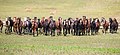 Altai horses 03.jpg 4,032 × 1,832; 6.33 MB
-
 Camels in the Altai Mountains 01.jpg 4,336 × 3,128; 12.51 MB
-
 Death cult of the horse 03.jpg 5,616 × 3,744; 17.68 MB
-
 Dryas octopetala seeds 02.jpg 4,036 × 2,700; 7.02 MB
-
 Gentiana decumbens в Кош-Агачском районе республика алтай 02.jpg 2,168 × 2,004; 3.12 MB
-
 Horse Altai 05.jpg 4,720 × 3,520; 14.96 MB
-
 Ilias.jpg 4,896 × 3,264; 16.02 MB
-
 Karakul.jpg 4,228 × 1,980; 9.16 MB
-
 Kazah Jurt2.jpg 4,392 × 2,888; 6.17 MB
-
 Lake Akchan - Panoramic.jpg 6,000 × 3,461; 17.84 MB
-
 Lake Akkul, Altai Republic, Russia.jpg 4,000 × 2,262; 11.96 MB
-
 Lamb in the Altai Mountains 01.jpg 3,536 × 2,728; 14.27 MB
-
 Larch in the valley of the river yustid 01.jpg 4,896 × 3,264; 11.82 MB
-
 Lower Multinskoe - Towards South.jpg 3,712 × 2,320; 6.04 MB
-
 Middle Multinskoe - Panoramic.jpg 7,295 × 3,068; 15.32 MB
-
 Petroglyphs in the Tura-Alty 01.jpg 5,616 × 3,744; 25.69 MB
-
 Petroglyphs on the Jalgiztobe hill, Kosh Agach district, Altai Republic, Russia.jpg 5,396 × 3,460; 19.06 MB
-
 Red desert in Altai 06.jpg 5,128 × 3,444; 14.15 MB
-
 Red desert4.jpg 4,760 × 2,928; 11 MB
-
 Sarlyk Yak.jpg 4,593 × 2,901; 16.11 MB
-
 Sarlyk Yak2.jpg 3,972 × 3,064; 13.84 MB
-
 Sarlyk4.jpg 3,657 × 2,188; 9.13 MB
-
 Sarlyk5.jpg 3,393 × 2,241; 10.19 MB
-
 Semi-desert landscape in the mountains of Russian Altai.jpg 4,896 × 3,264; 13.29 MB
-
 Sheepback 02.jpg 4,896 × 3,264; 17.6 MB
-
 Taldurinsky deer monument 01.jpg 4,896 × 3,264; 11.36 MB
-
 Taldurinsky deer monument 02.jpg 4,688 × 3,072; 11.85 MB
-
 Tour-Alty, a monument of architecture of the Altai Republic 02.jpg 5,616 × 3,744; 19.84 MB
-
 Ust-Kan. Ust-Kansk cave Parking lot.jpg 7,360 × 4,912; 34.66 MB
-
 В горной стране.jpg 6,421 × 2,799; 6.63 MB
-
 Верхнее Шавлинское озеро на фоне "Мечты", "Красавицы" и "Сказки".jpg 4,896 × 3,264; 11.43 MB
-
 Верхнее Шавлинское озеро на фоне Северо-Чуйского хребта.jpg 4,896 × 3,264; 11.73 MB
-
 Вид на впадение Шавлы в Нижнее Шавлинское озеро.jpg 4,896 × 3,264; 13.98 MB
-
 Вид на Катунь возле устья Чуи.jpg 4,896 × 2,754; 9.47 MB
-
 Вид на левый берег Катуни возле устья Чуи.jpg 4,912 × 3,264; 10.39 MB
-
 Вид на Нижнее Шавлинское озеро с пути к Верхнему.jpg 4,896 × 3,264; 12.74 MB
-
 Вид на плато Ештыкёль.jpg 4,572 × 3,048; 11.2 MB
-
 Вид на Чую и Чуйский тракт со скал у Ак-Бома.jpg 3,000 × 2,000; 3.5 MB
-
 Впадение Шавлы в Нижнее Шавлинское озеро.jpg 4,896 × 3,264; 13.4 MB
-
 Кучерлинское озеро, Горный Алтай.jpg 3,648 × 2,733; 6.59 MB
-
 Навигационные сумерки над Нижним Шавлинским озером.jpg 4,612 × 3,075; 6.8 MB
-
 Над Нижним Шавлинским озером. Южное окончание восточного берега.jpg 4,912 × 3,264; 12.64 MB
-
 Нижнее Шавлинское озеро на фоне Северо-Чуйского хребта.jpg 3,600 × 2,392; 6 MB
-
 Нижнее Шавлинское озеро. Вид с восточного берега.jpg 4,896 × 3,264; 11.9 MB
-
 Озеро Кара-Кёль (2).jpg 3,600 × 2,400; 5.15 MB
-
 Отражение Белухи в Аккемском озере..jpg 3,098 × 2,323; 4.12 MB
-
 Перевал между плато Ештыкёль и долиной Шавлы (2500 м.), вид на Северо-Чуйский хребет.jpg 4,896 × 3,264; 11.28 MB
-
 Р. Ештыкёль.jpg 3,840 × 2,160; 8.46 MB
-
 Р. Шавла.jpg 2,400 × 3,600; 7.21 MB
-
 Северное окончание Нижнего Шавлинского озера (2).jpg 4,896 × 3,264; 11.82 MB
-
 Северное окончание Нижнего Шавлинского озера.jpg 4,754 × 3,169; 10.12 MB
-
 Сказка,Мечта,Красавица.jpg 6,313 × 3,068; 18.75 MB
-
 Тёплое утро Алтая.jpg 3,000 × 2,911; 6.25 MB
-
 Трасса Р256 (М52) Чуйский тракт возле устья Чуи.jpg 4,896 × 3,264; 12.44 MB
-
 Утренний туман над северным окончанием Нижнего Шавлинского озера.jpg 4,896 × 3,264; 9.83 MB
-
 Утро ясное.jpg 3,934 × 2,951; 6.79 MB
-
 Чуйский тракт в Камлаке.jpg 2,304 × 1,536; 1.18 MB
-
 Шавла между Верхним и Нижним Шавлинскими озерами на фоне Северо-Чуйского хребта.jpg 4,861 × 3,241; 13.31 MB
-
 Шавла между Верхним и Нижним Шавлинскими озерами.jpg 4,896 × 3,264; 10.88 MB
-
 Шавлинские озёра.jpg 3,872 × 2,592; 7.25 MB


.jpg)

,_%D0%B2%D0%B8%D0%B4_%D0%BD%D0%B0_%D0%A1%D0%B5%D0%B2%D0%B5%D1%80%D0%BE-%D0%A7%D1%83%D0%B9%D1%81%D0%BA%D0%B8%D0%B9_%D1%85%D1%80%D0%B5%D0%B1%D0%B5%D1%82.jpg)


.jpg)


_%D0%A7%D1%83%D0%B9%D1%81%D0%BA%D0%B8%D0%B9_%D1%82%D1%80%D0%B0%D0%BA%D1%82_%D0%B2%D0%BE%D0%B7%D0%BB%D0%B5_%D1%83%D1%81%D1%82%D1%8C%D1%8F_%D0%A7%D1%83%D0%B8.jpg)


