Category:Purton Stoke
Jump to navigation
Jump to search
village in United Kingdom  | |||||
| Upload media | |||||
| Instance of | |||||
|---|---|---|---|---|---|
| Location | Purton, Wiltshire, South West England, England | ||||
| official website | |||||
 | |||||
English: Purton Stoke is a small village in north Wiltshire, situated within the civil parish of Purton. The village is located along a side road off of the Purton to Cricklade road, approximately one mile north of Purton village. A small country lane gives access to the nearby hamlet of Bentham, to the south.
Subcategories
This category has the following 2 subcategories, out of 2 total.
P
R
Media in category "Purton Stoke"
The following 87 files are in this category, out of 87 total.
-
 A duck and chickens, Stoke Common Lane, Purton Stoke - geograph.org.uk - 2327174.jpg 1,440 × 1,080; 712 KB
-
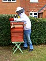 Beekeeper, Purton Stoke - geograph.org.uk - 2512640.jpg 1,080 × 1,440; 778 KB
-
 Bentham House - geograph.org.uk - 319736.jpg 640 × 480; 111 KB
-
 Bentham Lane, Purton Stoke - geograph.org.uk - 1238135.jpg 640 × 480; 174 KB
-
 Boundary stone - geograph.org.uk - 438586.jpg 640 × 480; 140 KB
-
 Bridge over a farm track by Coxhill Farm - geograph.org.uk - 1566332.jpg 640 × 427; 120 KB
-

-
 Bridleway from Newth's Lane, near Purton Stoke - geograph.org.uk - 1733340.jpg 1,600 × 1,200; 719 KB
-
 Bridleway near Coxhill Farm - geograph.org.uk - 1238499.jpg 640 × 479; 207 KB
-
 Bridleway near Lower Farm, Purton Stoke - geograph.org.uk - 1635677.jpg 640 × 480; 255 KB
-

-
 Bridleway, Purton Stoke - geograph.org.uk - 1463206.jpg 640 × 480; 197 KB
-
 Building farmer's crossing on railway - geograph.org.uk - 293421.jpg 640 × 480; 111 KB
-
 Chickens, Stoke Common Lane, Purton Stoke - geograph.org.uk - 2327175.jpg 1,440 × 1,080; 488 KB
-
 Cocklebury Stables, Common Lane - geograph.org.uk - 438536.jpg 640 × 480; 92 KB
-
 Coxhill Farm, near Purton Stoke - geograph.org.uk - 1237510.jpg 640 × 480; 116 KB
-
 Coxhill Farm, near Purton Stoke - geograph.org.uk - 1238523.jpg 640 × 480; 170 KB
-
 Coxhill Farmhouse, near Purton Stoke - geograph.org.uk - 1240157.jpg 640 × 480; 241 KB
-
 Crosslanes, Purton - geograph.org.uk - 295650.jpg 640 × 446; 81 KB
-

-
 Entrance to Stoke Common Farm - geograph.org.uk - 438538.jpg 640 × 480; 113 KB
-
 Farmland and an angler, Purton Stoke - geograph.org.uk - 2512709.jpg 1,440 × 1,080; 861 KB
-
 Grassland - geograph.org.uk - 438583.jpg 640 × 480; 110 KB
-

-
 Heifers - geograph.org.uk - 438582.jpg 640 × 480; 94 KB
-
 Home Guard memorial, River Ray, Blunsdon - geograph.org.uk - 465672.jpg 480 × 640; 137 KB
-
 Home Guard memorial, River Ray, Blunsdon - geograph.org.uk - 504112.jpg 640 × 480; 356 KB
-
 Hopeful thespians, Purton Stoke - geograph.org.uk - 2512645.jpg 1,440 × 1,080; 766 KB
-
 Lower Farm, Stoke Common - geograph.org.uk - 438580.jpg 640 × 480; 106 KB
-
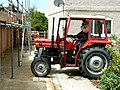 Massey Ferguson tractor, Purton Stoke - geograph.org.uk - 2512636.jpg 1,440 × 1,080; 804 KB
-
 Newth's Lane and a damp patch, near Purton Stoke - geograph.org.uk - 1733347.jpg 1,600 × 1,200; 957 KB
-
 North Wilts Canal and River Key - geograph.org.uk - 266416.jpg 640 × 480; 112 KB
-
 Part of Coxhill Farm, near Purton Stoke - geograph.org.uk - 1238520.jpg 640 × 480; 198 KB
-
 Peppa Pig, Pond Lane, Purton Stoke - geograph.org.uk - 2512737.jpg 1,440 × 1,080; 963 KB
-
 Picnickers, Pond Lane, Purton Stoke - geograph.org.uk - 2512717.jpg 1,440 × 1,080; 927 KB
-
 Plaque, Salts Hole, Purton Stoke - geograph.org.uk - 1635377.jpg 640 × 417; 205 KB
-
 Pond farm - geograph.org.uk - 324660.jpg 640 × 481; 80 KB
-
 Pond, Coxhill Farm, Purton Stoke - geograph.org.uk - 1240190.jpg 640 × 480; 256 KB
-
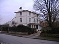 Purton Stoke House - geograph.org.uk - 324658.jpg 640 × 481; 76 KB
-
 Purton, Collins Lane - geograph.org.uk - 266493.jpg 640 × 480; 84 KB
-
 Railway from Gloucester to Swindon - geograph.org.uk - 1237497.jpg 640 × 480; 147 KB
-
 Railway to Swindon from Gloucester - geograph.org.uk - 1238507.jpg 640 × 480; 179 KB
-
 River Key, Purton Stoke - geograph.org.uk - 438519.jpg 640 × 480; 111 KB
-
 River Ray, near Tadpole Farm - geograph.org.uk - 436543.jpg 640 × 466; 80 KB
-
 Salts Hole, Purton Stoke - geograph.org.uk - 1635389.jpg 640 × 480; 300 KB
-
 Self-publicist, Purton Stoke - geograph.org.uk - 2512657.jpg 1,440 × 1,080; 975 KB
-

-

-

-
 Stoke Common Lane towards Purton Stoke - geograph.org.uk - 1635654.jpg 640 × 480; 247 KB
-
 Stoke Common Lane, near Purton Stoke - geograph.org.uk - 3860974.jpg 4,000 × 3,000; 2.85 MB
-
 Stoke Common Lane, Purton Stoke - geograph.org.uk - 1635360.jpg 640 × 480; 198 KB
-
 Stoke Common Lane, Purton Stoke - geograph.org.uk - 2036978.jpg 640 × 480; 207 KB
-
 Stoke Cottage, Stoke Common Lane, Purton Stoke - geograph.org.uk - 3860892.jpg 4,000 × 3,000; 2.84 MB
-

-

-

-

-
 Tadpole Farm, North of Swindon - geograph.org.uk - 25083.jpg 640 × 480; 101 KB
-
 Teasels near Purton Stoke - geograph.org.uk - 1463186.jpg 480 × 640; 232 KB
-
 The Bell Inn at Purton Stoke - geograph.org.uk - 317366.jpg 640 × 480; 86 KB
-
 The lady who 'does', Pond Lane, Purton Stoke - geograph.org.uk - 2512733.jpg 1,080 × 1,440; 739 KB
-
 The railway crosses the River Key - geograph.org.uk - 1566328.jpg 640 × 416; 76 KB
-
 The River Key, Purton Stoke - geograph.org.uk - 1635354.jpg 640 × 480; 265 KB
-
 The western edge of Purton Stoke - geograph.org.uk - 1635362.jpg 640 × 480; 254 KB
-
 Water level marker, River Key, Purton Stoke - geograph.org.uk - 1635346.jpg 2,816 × 2,112; 2.79 MB
-
 Bentham Farm - geograph.org.uk - 438588.jpg 640 × 480; 91 KB
-
 Bridge over the River Key - geograph.org.uk - 312505.jpg 640 × 480; 116 KB
-
 Bullocks, inside the moat - geograph.org.uk - 436577.jpg 640 × 480; 121 KB
-
 Chelworth Lower Green, from the moat - geograph.org.uk - 436581.jpg 640 × 480; 91 KB
-
 Grazing land - geograph.org.uk - 438576.jpg 640 × 480; 129 KB
-
 Hayes Knoll, Tadpole Bridge - geograph.org.uk - 266464.jpg 640 × 480; 143 KB
-
 Home Guard memorial, River Ray, Blunsdon - geograph.org.uk - 465578.jpg 640 × 480; 168 KB
-

-
 New farm - geograph.org.uk - 324662.jpg 640 × 481; 71 KB
-
 New footbridge across the River Key - geograph.org.uk - 438589.jpg 640 × 480; 139 KB
-
 Purton Crossing - geograph.org.uk - 103393.jpg 640 × 481; 62 KB
-
 River Ray near Blunsdon - geograph.org.uk - 549863.jpg 480 × 640; 272 KB
-
 River Ray near Blunsdon - geograph.org.uk - 549864.jpg 640 × 480; 380 KB
-
 River Ray near Blunsdon railway centre - geograph.org.uk - 504724.jpg 640 × 480; 295 KB
-
 Salt's Spa, Purton Stoke - geograph.org.uk - 438529.jpg 480 × 640; 138 KB
-
 Steer, Tadpole Farm, Blunsdon - geograph.org.uk - 549826.jpg 640 × 480; 300 KB
-

-

-

-

-


_-_geograph.org.uk_-_549775.jpg)
_-_geograph.org.uk_-_549776.jpg)
_-_geograph.org.uk_-_549611.jpg)
_-_geograph.org.uk_-_549685.jpg)


_-_geograph.org.uk_-_549609.jpg)
_-_geograph.org.uk_-_549610.jpg)
_-_geograph.org.uk_-_549612.jpg)
_-_geograph.org.uk_-_549613.jpg)
_-_geograph.org.uk_-_549774.jpg)