Category:Punta Nera
Jump to navigation
Jump to search
|
Punta Nera has an entry on OpenStreetMap (show). |
mountain of the Cottian Alps  | |||||
| Upload media | |||||
| Instance of | |||||
|---|---|---|---|---|---|
| Location |
| ||||
| Mountain range | |||||
| Topographic prominence |
| ||||
| Topographic isolation |
| ||||
| Elevation above sea level |
| ||||
 | |||||
Media in category "Punta Nera"
The following 11 files are in this category, out of 11 total.
-
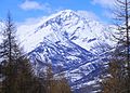
 Bardonecchia e punta Nera dal monte Colomion.jpg 3,968 × 2,976; 5.09 MB
-

-
 Grand Argentier Valfréjus.jpg 4,608 × 3,456; 2.74 MB
-
 Punta nera da chateau beaulard.jpg 2,185 × 1,567; 456 KB
-
 Punta Nera e Le Grand Argentier visti dalla Punta del Fréjus.jpg 3,968 × 2,976; 4.93 MB
-
 Punta Nera et Grand Argentier depuis Valfréjus en hiver (2003).jpg 1,984 × 1,488; 1.82 MB
-
 Punta Nera from Grand Argentier.png 976 × 1,257; 2.6 MB
-
 Punta Nera Valfréjus.jpg 4,608 × 3,456; 2.46 MB
-
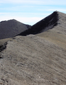
 Punta nera versante SSO.jpg 1,649 × 851; 142 KB
-
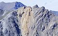 Quattro sorelle da guglia rossa sfondo punta nera.jpg 2,417 × 1,492; 365 KB
-
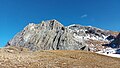 Roc de Jany e Punta Nera dal colle della Rho.jpg 4,624 × 2,604; 3.96 MB


.jpg)


