Category:Pumphouses in the United Kingdom
Jump to navigation
Jump to search

Subcategories
This category has the following 7 subcategories, out of 7 total.
D
F
L
- Langton Dock Pumphouse (11 F)
- Leawood Pump House (51 F)
- The Pumphouse, Liverpool (55 F)
P
- Pump house in Arne (2 F)
- Pumphouse Educational Museum (7 F)
Media in category "Pumphouses in the United Kingdom"
The following 132 files are in this category, out of 132 total.
-
 A bold statement of ownership, 1960 - geograph.org.uk - 1610062.jpg 640 × 427; 67 KB
-
 A glimpse of the River Thurne - geograph.org.uk - 1096257.jpg 640 × 599; 191 KB
-
 Abberton Pumphouse - geograph.org.uk - 207444.jpg 640 × 426; 65 KB
-
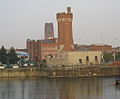
 Albert Dock scene, Liverpool - geograph.org.uk - 49861.jpg 640 × 480; 103 KB
-

-
 Autumn on the Upper Clyde - geograph.org.uk - 583410.jpg 640 × 480; 114 KB
-
 Barnt Green Crossroads - Brookhouse Road - geograph.org.uk - 1101915.jpg 640 × 480; 127 KB
-
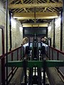 Beam engine, this end down - geograph.org.uk - 1586937.jpg 480 × 640; 68 KB
-
 Blowers Green Pumphouse - geograph.org.uk - 1109757.jpg 640 × 480; 55 KB
-

-
 Brathens Reservoir - geograph.org.uk - 1064292.jpg 640 × 480; 114 KB
-

-
 Bridge over Land Drain - geograph.org.uk - 392036.jpg 640 × 426; 120 KB
-
 St Peter's Church, Buntingford - geograph.org.uk - 1485454.jpg 640 × 480; 82 KB
-
 Carlton Nr Goole, Derelict Pumphouse - geograph.org.uk - 159632.jpg 640 × 480; 203 KB
-
 Cathedral of sewage - geograph.org.uk - 198224.jpg 640 × 480; 47 KB
-

-
 Converted Pumphouse on Wiston Estate - geograph.org.uk - 267148.jpg 640 × 480; 128 KB
-
 Crossness Pumping Engines - geograph.org.uk - 1278391.jpg 640 × 426; 109 KB
-

-
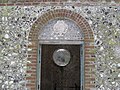
 Date stone on the pumphouse - geograph.org.uk - 1731578.jpg 1,280 × 959; 439 KB
-
 Disused mine building - geograph.org.uk - 558135.jpg 640 × 482; 87 KB
-
 Disused Weir, River Derwent - geograph.org.uk - 630403.jpg 640 × 427; 79 KB
-
 Doorway to pumphouse under restoration - geograph.org.uk - 1658916.jpg 640 × 480; 115 KB
-
 Drain outlet into River Perry - geograph.org.uk - 539975.jpg 640 × 480; 139 KB
-
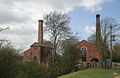
 Drax Power Station Intake Pumphouse - geograph.org.uk - 115882.jpg 640 × 458; 158 KB
-
 Drydock No.2, Alexandra Dock - geograph.org.uk - 395682.jpg 640 × 570; 86 KB
-
 Edmondsham, village pump - geograph.org.uk - 1329791.jpg 480 × 640; 88 KB
-
 Farmington Village Green.jpg 1,600 × 1,064; 395 KB
-
 Farmland, Clarendon Park - geograph.org.uk - 484720.jpg 640 × 480; 152 KB
-
 Hanbury Hall Dovecote.jpg 640 × 426; 100 KB
-
 Hydraulic Sewage Lift - geograph.org.uk - 411870.jpg 480 × 640; 67 KB
-
 Hythe End waterworks - geograph.org.uk - 948699.jpg 640 × 427; 181 KB
-

-
 King George V drydock Pumphouse.jpg 282 × 185; 25 KB
-
 Kingston village pump - geograph.org.uk - 1170762.jpg 470 × 640; 200 KB
-

-
 Looking along Pumphouse Way - geograph.org.uk - 1709531.jpg 640 × 464; 66 KB
-
 Lopwell - geograph.org.uk - 1045879.jpg 480 × 640; 120 KB
-
 Lyness Heritage Centre - geograph.org.uk - 1454841.jpg 640 × 428; 67 KB
-
 Misterton Soss pumphouses (geograph 2343706).jpg 877 × 1,280; 226 KB
-
 Misterton Soss pumphouses (geograph 2343730).jpg 1,280 × 827; 257 KB
-
 Mulben Pumphouse - geograph.org.uk - 1132987.jpg 427 × 640; 68 KB
-
 New homes - Limes Park - geograph.org.uk - 1709517.jpg 800 × 572; 89 KB
-
 New large family houses - geograph.org.uk - 1709510.jpg 800 × 575; 89 KB
-
 Norton Marsh Drainage Mill - geograph.org.uk - 1445682.jpg 640 × 480; 90 KB
-

-
 Old Gate at Wressle Pumphouse - geograph.org.uk - 175439.jpg 640 × 426; 185 KB
-
 Old pumphouse chimney - geograph.org.uk - 296968.jpg 427 × 640; 93 KB
-
 Old Pumphouse, Great Warley - geograph.org.uk - 979848.jpg 640 × 425; 73 KB
-
 Park Head Junction - geograph.org.uk - 1122574.jpg 640 × 428; 47 KB
-
 Park Head Junction - geograph.org.uk - 1122603.jpg 640 × 428; 93 KB
-
 Pottery River - geograph.org.uk - 667562.jpg 640 × 442; 117 KB
-
 Pump and power - geograph.org.uk - 664534.jpg 640 × 480; 273 KB
-
 Pump House - Bridge Road - geograph.org.uk - 175397.jpg 640 × 426; 128 KB
-
 Pump House at Wragg House Farm - geograph.org.uk - 432406.jpg 640 × 477; 73 KB
-
 Pump house Durham Cathedral - geograph.org.uk - 256516.jpg 640 × 480; 107 KB
-
 Pump House Gallery, Battersea Park - geograph.org.uk - 617243.jpg 480 × 640; 93 KB
-
 Pump house near Preston Bowyer, Somerset.jpg 4,000 × 3,000; 4.9 MB
-

-

-
 Pumphouse - geograph.org.uk - 1031720.jpg 640 × 480; 127 KB
-
 Pumphouse - geograph.org.uk - 1208321.jpg 640 × 479; 104 KB
-
 Pumphouse - geograph.org.uk - 234363.jpg 640 × 426; 129 KB
-
 Pumphouse - geograph.org.uk - 337778.jpg 640 × 480; 101 KB
-
 Pumphouse and chimney - geograph.org.uk - 1731572.jpg 1,280 × 959; 357 KB
-
 Pumphouse at Hampton Waterworks - geograph.org.uk - 476792.jpg 640 × 427; 79 KB
-
 Pumphouse at Park Head Junction - geograph.org.uk - 10152.jpg 640 × 480; 146 KB
-
-
 Pumphouse Farm - geograph.org.uk - 1206441.jpg 640 × 426; 88 KB
-
 Pumphouse Kingston on Soar - Grade II Listed Building 01.jpg 4,752 × 3,168; 8.46 MB
-
 Pumphouse Kingston on Soar - Grade II Listed Building 02.jpg 4,752 × 3,168; 8.68 MB
-
 Pumphouse Kingston on Soar - Grade II Listed Building 03.jpg 3,168 × 4,752; 9.17 MB
-
 Pumphouse Kingston on Soar - Grade II Listed Building 04.jpg 4,752 × 3,168; 10.2 MB
-
 Pumphouse Lane - Wellhouse Lane - geograph.org.uk - 1428373.jpg 640 × 480; 260 KB
-

-
 Pumphouse, New River Ancholme - geograph.org.uk - 336587.jpg 640 × 364; 101 KB
-
 Pumphouse, South Dock - geograph.org.uk - 397324.jpg 640 × 480; 83 KB
-
 Pumphouse, Stockton locks - geograph.org.uk - 1277036.jpg 640 × 475; 171 KB
-
 PumpHouse. - geograph.org.uk - 425436.jpg 640 × 480; 133 KB
-
 Pumphouse^ - geograph.org.uk - 1290496.jpg 640 × 425; 77 KB
-
 Ready for the next phase - geograph.org.uk - 1709515.jpg 800 × 567; 105 KB
-
 Recycled Pumphouse - geograph.org.uk - 1657683.jpg 640 × 428; 74 KB
-
 Red Lake clay works - geograph.org.uk - 991012.jpg 640 × 427; 67 KB
-
 Reservoir and pump house(^) - geograph.org.uk - 328420.jpg 640 × 480; 82 KB
-
 Road junction - geograph.org.uk - 1233815.jpg 640 × 360; 83 KB
-
 Rutland Water Dam - geograph.org.uk - 900407.jpg 640 × 480; 64 KB
-
 Shed, Dalfad Moss - geograph.org.uk - 1200911.jpg 640 × 480; 67 KB
-
 Shelter near Pumphouse - geograph.org.uk - 418094.jpg 640 × 480; 87 KB
-
 Show Home in Pumphouse Way - geograph.org.uk - 1709499.jpg 800 × 570; 75 KB
-

-

-

-
 South Dock, Swansea Marina - geograph.org.uk - 1483285.jpg 640 × 480; 79 KB
-
 South Forty Foot Drain Pumphouse - geograph.org.uk - 429875.jpg 640 × 477; 73 KB
-
 Southern end of Pumphouse Way - geograph.org.uk - 1771686.jpg 640 × 457; 64 KB
-
 Structure at Joyford - geograph.org.uk - 1723699.jpg 640 × 481; 109 KB
-
 The Crescent, Buxton - geograph.org.uk - 1354937.jpg 640 × 480; 71 KB
-
 The domino effect - geograph.org.uk - 1513809.jpg 640 × 480; 151 KB
-
 The Pump House - geograph.org.uk - 897717.jpg 459 × 626; 205 KB
-
 The Pump House Battersea Park - geograph.org.uk - 1119786.jpg 640 × 482; 103 KB
-
 The Pump House Restaurant - geograph.org.uk - 473242.jpg 640 × 480; 152 KB
-
 The pumphouse at the Underfall Yard - geograph.org.uk - 1578458.jpg 640 × 480; 83 KB
-
 The Pumphouse Hornsey - geograph.org.uk - 33546.jpg 640 × 480; 88 KB
-
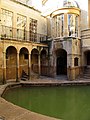 The Pumphouse, Bath - geograph.org.uk - 339185.jpg 450 × 600; 360 KB
-

-
 The Pumphouse, Swansea - geograph.org.uk - 3954543.jpg 800 × 582; 113 KB
-
 Through the Arched Window - geograph.org.uk - 1484909.jpg 640 × 480; 72 KB
-
 Victoria Park, Leamington Spa - geograph.org.uk - 1237890.jpg 640 × 480; 136 KB
-
 View downstream along the River Yare - geograph.org.uk - 1445696.jpg 640 × 480; 51 KB
-

-
 West -East Cowick Bore Hole Pumphouse - geograph.org.uk - 192410.jpg 614 × 436; 199 KB
-
 Work at Claverton Pumphouse - geograph.org.uk - 447287.jpg 640 × 480; 123 KB
-
 Balandro Pumphouse - geograph.org.uk - 512275.jpg 640 × 480; 118 KB
-
 Base of Lake Vyrnwy Dam from top - geograph.org.uk - 755360.jpg 632 × 420; 100 KB
-
 Coolcorcoran Water Pumphouse - geograph.org.uk - 514990.jpg 640 × 480; 93 KB
-
 Cooling Water Pumphouse - geograph.org.uk - 581932.jpg 640 × 401; 64 KB
-
 Davy Down Pumphouse - geograph.org.uk - 426125.jpg 640 × 426; 103 KB
-
 Heighington Fen - geograph.org.uk - 111319.jpg 480 × 640; 455 KB
-
 Iwo Jima - Claverton style - geograph.org.uk - 476854.jpg 640 × 528; 108 KB
-
 Lough Guitane By The Pumphouse - geograph.org.uk - 489975.jpg 640 × 480; 65 KB
-
 NOSWA Pumphouse - geograph.org.uk - 206747.jpg 640 × 480; 69 KB
-

-
 Pilmuir - geograph.org.uk - 450876.jpg 640 × 448; 53 KB
-
 Pump House at Rutland Water - geograph.org.uk - 160883.jpg 640 × 427; 109 KB
-
 Pumphouse - geograph.org.uk - 298787.jpg 640 × 480; 116 KB
-
 Pumphouse near Bowerchalke - geograph.org.uk - 426129.jpg 640 × 437; 85 KB
-
 Pumphouse off White Way Lane - geograph.org.uk - 361958.jpg 640 × 480; 67 KB
-
 Pumphouse^ - geograph.org.uk - 251873.jpg 640 × 480; 94 KB
-
 Thirlmere - geograph.org.uk - 814.jpg 640 × 480; 39 KB
-
 Upper Heyford - geograph.org.uk - 91903.jpg 640 × 480; 181 KB
-
 Wallgrange 'Walk-in' Cafe - geograph.org.uk - 230082.jpg 640 × 397; 111 KB


.jpg)
.jpg)


_-_geograph.org.uk_-_328420.jpg)


