Category:Pulloxhill
Jump to navigation
Jump to search
village and civil parish in Bedfordshire, UK  | |||||
| Upload media | |||||
| Instance of | |||||
|---|---|---|---|---|---|
| Location | Central Bedfordshire, Bedfordshire, East of England, England | ||||
| Population |
| ||||
 | |||||
English: Pulloxhill is a small village in Bedfordshire, England with a population of approximately 850 (2001 Census). It has a Church, a School and two Public Houses. The village shop and Post Office have closed. The Chequers Public House runs a shop selling Bread, Papers, Milk,Sweets etc. The village pond was filled in several years ago after a fire at the old Bakery and now forms part of the village green where the school holds a maypole dancing concert every May. A village news letter is published monthly called the PVN (Pulloxhill Village News).
Subcategories
This category has the following 2 subcategories, out of 2 total.
P
- Pulloxhill Marsh (4 F)
Media in category "Pulloxhill"
The following 73 files are in this category, out of 73 total.
-
 A6 towards Barton-le-Clay - geograph.org.uk - 4880769.jpg 640 × 480; 90 KB
-
 Abandoned plough - geograph.org.uk - 2315314.jpg 3,872 × 2,592; 4.8 MB
-
 Barton Road - geograph.org.uk - 4880795.jpg 640 × 480; 78 KB
-
 Barton Road - geograph.org.uk - 4880816.jpg 640 × 480; 57 KB
-
 Barton Road - geograph.org.uk - 4880824.jpg 640 × 480; 81 KB
-
 Chestnut with a flash - geograph.org.uk - 2359431.jpg 3,872 × 2,592; 3.5 MB
-
 Church of St James the Apostle - geograph.org.uk - 3745445.jpg 1,600 × 1,068; 505 KB
-
 Clear cut path - geograph.org.uk - 2498344.jpg 3,872 × 2,592; 4.49 MB
-

-
 Crop field north of Barton-le-Clay - geograph.org.uk - 4880398.jpg 640 × 480; 61 KB
-
 Cycle route and footpath on east side of the A6 - geograph.org.uk - 4236273.jpg 1,024 × 768; 162 KB
-
 Ditch and path to Greenfield - geograph.org.uk - 3745427.jpg 1,600 × 1,067; 540 KB
-
 Drain off Barton Road, Pulloxhill - geograph.org.uk - 4880806.jpg 640 × 480; 121 KB
-

-
 Entering Pulloxhill - geograph.org.uk - 4880800.jpg 640 × 480; 106 KB
-
 Farm track off Barton Road - geograph.org.uk - 4880819.jpg 640 × 480; 114 KB
-
 Farmland off Barton Road - geograph.org.uk - 4880809.jpg 640 × 480; 68 KB
-
 Farmland off Greenfield Road - geograph.org.uk - 4881383.jpg 640 × 480; 78 KB
-
 Field bridge, east of the A6 - geograph.org.uk - 4236275.jpg 1,024 × 768; 155 KB
-
 Footpath from Sand Lane - geograph.org.uk - 3745486.jpg 1,600 × 1,070; 497 KB
-
 Footpath through Rushy Meade - geograph.org.uk - 3745437.jpg 1,200 × 1,600; 801 KB
-
 Footpath to Bedford Road - geograph.org.uk - 3745502.jpg 1,067 × 1,600; 711 KB
-
 Footpath to Hillfoot Farm - geograph.org.uk - 3745484.jpg 1,600 × 1,068; 740 KB
-
 Footpath to Silsoe - geograph.org.uk - 3745459.jpg 1,600 × 1,069; 658 KB
-
 Footpath to Silsoe - geograph.org.uk - 4880828.jpg 640 × 480; 105 KB
-
 Footpath to Thrift Wood - geograph.org.uk - 3745467.jpg 1,600 × 1,068; 518 KB
-
 Footpath to Westoning - geograph.org.uk - 3745433.jpg 1,200 × 1,600; 587 KB
-
-
 Grazing off Barton Road - geograph.org.uk - 4880786.jpg 640 × 480; 93 KB
-
 Grazing off Higham Bury Lane - geograph.org.uk - 4880845.jpg 640 × 489; 62 KB
-
 Greenfield Road - geograph.org.uk - 4881387.jpg 640 × 480; 93 KB
-
 Hay field - geograph.org.uk - 3745482.jpg 1,600 × 1,068; 492 KB
-
 Higham Bury Lane, Pulloxhill - geograph.org.uk - 4880852.jpg 640 × 480; 108 KB
-
 House on Barton Road, Pulloxhill - geograph.org.uk - 4880830.jpg 640 × 426; 64 KB
-
 Path beside the A6 - geograph.org.uk - 4880395.jpg 640 × 480; 105 KB
-
 Path beside the A6 southbound - geograph.org.uk - 4880775.jpg 640 × 480; 98 KB
-
 Private fishing lake - geograph.org.uk - 3745463.jpg 1,600 × 1,067; 691 KB
-
 Pulloxhill Hill houses and the tower of St James' church - geograph.org.uk - 3533002.jpg 4,320 × 3,240; 5.26 MB
-
 Pulloxhill village green and sign - geograph.org.uk - 3745454.jpg 1,600 × 1,069; 513 KB
-
 Pulloxhill Water Tower - geograph.org.uk - 4880840.jpg 480 × 640; 64 KB
-
 Pulloxhill water tower from outside Barton le Clay - geograph.org.uk - 3532980.jpg 4,320 × 3,240; 4.17 MB
-
 Pulloxhill Water Tower, Beds - geograph.org.uk - 64367.jpg 450 × 600; 234 KB
-
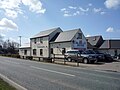
 Pulloxhill, The Chequers Inn - geograph.org.uk - 871547.jpg 640 × 480; 67 KB
-

-
 Pulloxhill, The High Street - geograph.org.uk - 871530.jpg 640 × 480; 72 KB
-
 Pulloxhill, The new village sign - geograph.org.uk - 871537.jpg 640 × 480; 93 KB
-
 Pulloxhill, The War Memorial - geograph.org.uk - 871561.jpg 640 × 480; 114 KB
-
 Puloxhill paddock and water tower - geograph.org.uk - 3745430.jpg 1,600 × 1,068; 690 KB
-
 Puloxhill water tower - geograph.org.uk - 3532999.jpg 4,320 × 3,240; 5.14 MB
-
 Rushy Meade Meadow - geograph.org.uk - 3745448.jpg 1,600 × 1,069; 645 KB
-
 Sand Lane - geograph.org.uk - 4880813.jpg 640 × 480; 76 KB
-
 Sand Lane pumping station - geograph.org.uk - 3745490.jpg 1,600 × 1,067; 528 KB
-
 Sign for the Cross Keys, Pulloxhill - geograph.org.uk - 4880837.jpg 1,200 × 1,773; 370 KB
-
 Silsoe and Wrest Park - geograph.org.uk - 5845025.jpg 2,929 × 2,197; 2.1 MB
-
 Speed the Plough, Pulloxhill, Beds - geograph.org.uk - 194185.jpg 640 × 480; 296 KB
-
 St James Close, Pulloxhill - geograph.org.uk - 4883763.jpg 3,648 × 2,736; 1.79 MB
-
 The A6 Motor Company, north of Barton-le-Clay - geograph.org.uk - 4236270.jpg 1,024 × 768; 114 KB
-
 The Chequers, Pulloxhill - geograph.org.uk - 3533004.jpg 4,320 × 3,240; 4.13 MB
-
 The Cross Keys, Pulloxhill - geograph.org.uk - 3532994.jpg 4,320 × 3,240; 4.03 MB
-
 The Cross Keys, Pulloxhill - geograph.org.uk - 4880835.jpg 640 × 480; 62 KB
-
 The Grove Restaurant, Pulloxhill, Beds - geograph.org.uk - 2500229.jpg 1,600 × 1,200; 387 KB
-
 Town Farm, Pulloxhill - geograph.org.uk - 4880834.jpg 640 × 480; 64 KB
-
 Track off Barton Road - geograph.org.uk - 4880790.jpg 640 × 480; 88 KB
-
 Tyburm Lane, Pulloxhill - geograph.org.uk - 4881381.jpg 640 × 480; 69 KB
-
 Tyburn Lane - geograph.org.uk - 2315299.jpg 3,872 × 2,592; 4.11 MB
-
 Water Tower - geograph.org.uk - 2315294.jpg 3,872 × 2,592; 3.94 MB
-
 Farmland SW of Pulloxhill, Beds - geograph.org.uk - 64357.jpg 600 × 450; 291 KB
-
 Farmland, Pulloxhill, Beds - geograph.org.uk - 63244.jpg 600 × 450; 310 KB
-
 Flitton Road, Pulloxhill, Beds - geograph.org.uk - 63252.jpg 600 × 450; 256 KB
-
 Meadhook Wood - geograph.org.uk - 437908.jpg 640 × 480; 92 KB
-
 Portobello Farm - geograph.org.uk - 437888.jpg 640 × 480; 73 KB
-

-


