Category:Puerco River Bridge (HAER images)
Jump to navigation
Jump to search
| Object location | | View all coordinates using: OpenStreetMap |
|---|
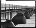
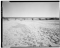
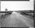
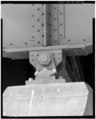
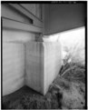
English: The Puerco River Bridge — carrying a park road over the Puerco River in Petrified Forest National Park, Navajo County, Arizona.
- Built in 1931, part of a major visitor infrastructure improvement project in the park.
Media in category "Puerco River Bridge (HAER images)"
The following 27 files are in this category, out of 27 total.