Category:Puddles in England
Jump to navigation
Jump to search
Subcategories
This category has the following 5 subcategories, out of 5 total.
Media in category "Puddles in England"
The following 112 files are in this category, out of 112 total.
-
 A farm track in the Lincolnshire Vales, South Kesteven, England.jpg 2,560 × 1,920; 3.24 MB
-
 Good Easter, Essex, England - ford over River Can east of Good Easter village 01.JPG 5,472 × 3,648; 17.17 MB
-
 Epping Forest High Beach Essex England - trees reflected in a puddle.jpg 3,000 × 2,000; 4.91 MB
-
 Mud puddle off Sedgwick Lane, Nuthurst, West Sussex.jpg 3,000 × 2,000; 6.54 MB
-
 Roadside puddle on Sedgwick Lane, Nuthurst, West Sussex 01.jpg 3,000 × 2,000; 7.13 MB
-
 Roadside puddle on Sedgwick Lane, Nuthurst, West Sussex 02.jpg 3,000 × 2,000; 7.05 MB
-
 A big puddle - geograph.org.uk - 1031001.jpg 640 × 532; 101 KB
-
 A big puddle on Belaugh Green Lane - geograph.org.uk - 1059338.jpg 480 × 640; 102 KB
-
 A flooded Kings Wood car park entrance - geograph.org.uk - 920473.jpg 640 × 480; 121 KB
-

-
 Abandoned house at Feacle - geograph.org.uk - 963720.jpg 640 × 427; 188 KB
-
 Abbess Roding domestic Emden geese - Essex England 01.jpg 4,000 × 2,666; 8.47 MB
-
 Abbess Roding domestic Emden geese - Essex England 02.jpg 4,000 × 2,666; 8.75 MB
-
 Abbess Roding domestic Emden geese - Essex England 03.jpg 4,000 × 2,667; 7.16 MB
-
 Abbess Roding domestic Emden geese - Essex England 04.jpg 4,382 × 3,286; 8.37 MB
-
 Abbess Roding domestic Emden geese - Essex England 08.jpg 3,664 × 2,748; 4.81 MB
-
 Access Track to Raggalds Farm - geograph.org.uk - 5320573.jpg 5,184 × 3,456; 5.83 MB
-
 Barrier reflections - geograph.org.uk - 639985.jpg 640 × 480; 85 KB
-
 Beaulieu Road car park - geograph.org.uk - 335109.jpg 640 × 480; 114 KB
-
 Road near Binfield Heath - geograph.org.uk - 1067141.jpg 480 × 640; 196 KB
-
 Bishops Lydeard 4566 reflecting.jpg 1,822 × 1,822; 827 KB
-
 Bleak moorland. - geograph.org.uk - 3519348.jpg 640 × 497; 83 KB
-
 Bridleway at Gernon Bushes Nature Reserve, Coopersale Essex England - tree reflections.jpg 2,000 × 3,000; 7.26 MB
-
 Bristol MMB R1 Cabot Circus.jpg 2,304 × 1,728; 1.44 MB
-
 Byway skirting Great Yews wood - geograph.org.uk - 202966.jpg 640 × 427; 272 KB
-
 Car park puddle at Coniston, Cumbria - geograph.org.uk - 1574953.jpg 640 × 480; 43 KB
-
 Clophill to Haynes 16.jpg 4,000 × 3,000; 3.46 MB
-
 Damaged Footpath. - geograph.org.uk - 570430.jpg 427 × 640; 308 KB
-

-

-
 Elland FP01 at the Binn Royd track - geograph.org.uk - 4329008.jpg 2,000 × 1,500; 1.29 MB
-
 Entrance to Goals Leeds - geograph.org.uk - 4963694.jpg 1,024 × 768; 315 KB
-
 Entrance to the Beach, Glynne Gap - geograph.org.uk - 526538.jpg 479 × 640; 120 KB
-
 Ermine Street or High Dyke - geograph.org.uk - 496832.jpg 640 × 427; 113 KB
-
 Field boundary alongside Waddenhall Wood - geograph.org.uk - 1194347.jpg 640 × 480; 131 KB
-
 Field Entrance - geograph.org.uk - 1192097.jpg 640 × 426; 138 KB
-
 Field gateway near key Bridge, Yeovil - geograph.org.uk - 666600.jpg 640 × 480; 124 KB
-
 Fields at Alderton - geograph.org.uk - 1196885.jpg 640 × 426; 80 KB
-
 Flickr - Carine06 - Reflection.jpg 2,157 × 1,274; 772 KB
-
 Footpath at Northpark Copse - geograph.org.uk - 1615051.jpg 640 × 360; 105 KB
-
 Footpath Junction - geograph.org.uk - 1160004.jpg 640 × 480; 123 KB
-
 Footpath south from Brownheath Road - geograph.org.uk - 1167704.jpg 640 × 480; 222 KB
-
 Footpath to Culford Heath - geograph.org.uk - 1163468.jpg 640 × 480; 89 KB
-
 Ford in Sporhams Lane, Danbury. - geograph.org.uk - 109616.jpg 640 × 480; 139 KB
-
 Frensham Great Puddle - geograph.org.uk - 725185.jpg 640 × 427; 112 KB
-

-
 Glastonbury Festival attendees standing in the mud (2007).jpg 3,648 × 2,736; 1.59 MB
-
 Goose Beck Ford at Burnham Market (geograph 3391208).jpg 2,913 × 2,423; 2.03 MB
-
 Halifax FP318 west of Scout Hall - geograph.org.uk - 3191959.jpg 2,000 × 1,500; 1.19 MB
-

-
 Hillcrest Drive, Townville - geograph.org.uk - 3830925.jpg 1,920 × 1,263; 354 KB
-
 Hillcrest Drive, Townville - geograph.org.uk - 3830941.jpg 1,920 × 2,540; 976 KB
-
 Lane from Tod Moor Cross - geograph.org.uk - 284702.jpg 480 × 640; 77 KB
-
 Large puddle on Winfield Lane - geograph.org.uk - 1572188.jpg 640 × 430; 203 KB
-
 Long Edge Middle Road, Sowerby - geograph.org.uk - 3117993.jpg 2,000 × 1,500; 878 KB
-
 Middle Knoll and its puddled brother - geograph.org.uk - 1658587.jpg 480 × 640; 92 KB
-
 Muddy End to Footpath - geograph.org.uk - 1075872.jpg 640 × 481; 79 KB
-
 New Brighton - Dyehouse Road - geograph.org.uk - 1462353.jpg 640 × 480; 244 KB
-
 Newport, trees in puddle reflection - geograph.org.uk - 1132774.jpg 480 × 640; 89 KB
-

-
 Oaks reflected in puddle, Brimley - geograph.org.uk - 1078335.jpg 640 × 480; 98 KB
-
 Okehampton Hamlets Footpath 8 - geograph.org.uk - 349480.jpg 640 × 480; 146 KB
-
 On Reflection - geograph.org.uk - 510383.jpg 640 × 427; 92 KB
-
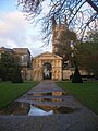 University of Oxford Botanic Garden main gateway, Oxford, England 02.jpg 600 × 800; 110 KB
-
 Path alongside an old boundary wall - geograph.org.uk - 3119600.jpg 2,000 × 1,500; 1.21 MB
-
 Path over Rocking Stone Flat - geograph.org.uk - 3144352.jpg 3,648 × 2,736; 3.64 MB
-
 Path to Harrington Hall - geograph.org.uk - 720364.jpg 640 × 480; 53 KB
-
 Playing field, Thornbury - geograph.org.uk - 3268677.jpg 640 × 480; 81 KB
-
 Potholes.jpg 1,200 × 1,600; 371 KB
-
 Puddle in Upton Park - geograph.org.uk - 1570018.jpg 459 × 640; 113 KB
-
 Puddle near The Round House - geograph.org.uk - 823918.jpg 480 × 640; 110 KB
-
 Puddle near Waddon Brakes - geograph.org.uk - 748831.jpg 480 × 640; 106 KB
-
 Puddle on Butterfly Lane - geograph.org.uk - 785176.jpg 480 × 640; 72 KB
-
 Puddle, Cathedral Close, Exeter - geograph.org.uk - 876793.jpg 480 × 640; 81 KB
-
 Puddle, Drunken Bridge Hill - geograph.org.uk - 1619846.jpg 473 × 640; 75 KB
-
 Puddle, Exeter - geograph.org.uk - 628104.jpg 479 × 640; 81 KB
-
 Puddle, green lane above Fleet Mill - geograph.org.uk - 1142422.jpg 480 × 640; 124 KB
-
 Puddle, Upton Park - geograph.org.uk - 1774802.jpg 480 × 640; 106 KB
-
 Puddles in field above Nethercott - geograph.org.uk - 741748.jpg 640 × 480; 112 KB
-
 Puddles near Stonehenge - geograph.org.uk - 1621223.jpg 630 × 640; 141 KB
-
 Puddles on Turner Lane at Dusk - geograph.org.uk - 5605796.jpg 2,000 × 1,500; 645 KB
-
 Puddles on Zeal Tor Tramway - geograph.org.uk - 1088697.jpg 640 × 480; 122 KB
-
 Puddles Sheffield.jpg 3,648 × 2,736; 1.72 MB
-
 Rain on flagstones in Greater Manchester.jpg 4,344 × 2,456; 1.63 MB
-
 Reflected Post, Hartshead Pike.jpg 1,024 × 768; 463 KB
-
 Road puddle at Creeton, Lincolnshire - geograph-289587.jpg 640 × 480; 89 KB
-
 Sign at Imber range, Wiltshire - geograph.org.uk - 537797.jpg 477 × 640; 64 KB
-
 Singleton, West Sussex 11.jpg 4,000 × 3,000; 4.52 MB
-
 Stepping in puddle (Unsplash).jpg 6,016 × 4,016; 10.25 MB
-
 Stile and pool on Sowerby Bridge FP 7 - geograph.org.uk - 4236248.jpg 2,000 × 1,500; 1.03 MB
-
 Summit of Middle Knoll in a puddle - geograph.org.uk - 1658612.jpg 640 × 480; 77 KB
-

-
 The great British Summer !! (7509414964).jpg 2,432 × 4,320; 3.25 MB
-
 The great British Summer !! (7509415290).jpg 4,344 × 2,456; 1.65 MB
-
 The great British Summer !! (7509416214).jpg 4,344 × 2,456; 1.34 MB
-
 The only car i ever owned for an instance (2296435174).jpg 3,572 × 2,636; 3.34 MB
-
 Thurgory Lane, Lepton - geograph.org.uk - 3711269.jpg 1,600 × 1,200; 411 KB
-
 To the Beach - geograph.org.uk - 1322799.jpg 480 × 640; 79 KB
-
 Track to a Lincolnshire farm - geograph.org.uk - 1139057.jpg 640 × 480; 166 KB
-
 Track to White Rock Farm - geograph.org.uk - 1169032.jpg 640 × 480; 66 KB
-
 Vacant plot - geograph.org.uk - 681210.jpg 618 × 462; 166 KB
-
 Very wet track near Exbourne - geograph.org.uk - 469052.jpg 480 × 640; 99 KB
-

-
 Water features, restricted byway - geograph.org.uk - 586562.jpg 417 × 640; 91 KB
-

-
 Wet and muddy road to East Langdon - geograph.org.uk - 660192.jpg 640 × 480; 203 KB
-
 Wet Bridle Path near Longburton - geograph.org.uk - 763854.jpg 426 × 640; 46 KB
-
 Wet field at Old Country Farm - geograph.org.uk - 757953.jpg 640 × 480; 87 KB
-

-

-
 Wrosecliffe Grove, Idle - geograph.org.uk - 2284110.jpg 2,000 × 1,501; 723 KB
-
 Yew Tree Heath car park, New Forest - geograph.org.uk - 291757.jpg 640 × 480; 92 KB


_splashing_through_puddles.jpg)


.jpg)
.jpg)


.jpg)


.jpg)
.jpg)
.jpg)
.jpg)


