Category:Puckington
Jump to navigation
Jump to search
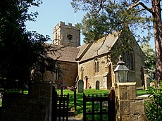
English: Puckington is a village and civil parish, situated west of Yeovil in the South Somerset district of Somerset, England. The parish includes the hamlet of South Bradon.
village and civil parish in Somerset, United Kingdom | |||||
| Upload media | |||||
| Instance of | |||||
|---|---|---|---|---|---|
| Location | South Somerset, Somerset, South West England, England | ||||
| Population |
| ||||
 | |||||
Subcategories
This category has only the following subcategory.
P
Media in category "Puckington"
The following 34 files are in this category, out of 34 total.
-
B3168 south of Westport - geograph.org.uk - 3471210.jpg 640 × 425; 58 KB
-
Bless the plough - geograph.org.uk - 5156852.jpg 1,024 × 768; 281 KB
-
Bradon Lane - geograph.org.uk - 3471170.jpg 640 × 480; 111 KB
-
Bradon Lane - geograph.org.uk - 3471195.jpg 640 × 367; 53 KB
-
Clay Lane - geograph.org.uk - 1309967.jpg 640 × 456; 90 KB
-
Clay Lane - geograph.org.uk - 4996652.jpg 1,024 × 858; 323 KB
-
Dairy herd at Clay Barn - geograph.org.uk - 4996644.jpg 1,024 × 820; 176 KB
-
Drainage channel near Clay Barn - geograph.org.uk - 3471286.jpg 640 × 459; 97 KB
-
Footbridge near Clay Lane - geograph.org.uk - 4996656.jpg 1,024 × 768; 300 KB
-
Footpath to Bradon Lane - geograph.org.uk - 4996660.jpg 1,024 × 768; 239 KB
-
Gargoyle at St Andrew's Puckington - geograph.org.uk - 2745384.jpg 1,722 × 2,360; 483 KB
-
Manor Farmhouse Puckington - geograph.org.uk - 419772.jpg 640 × 480; 184 KB
-
Mature oak tree - geograph.org.uk - 4996669.jpg 1,024 × 837; 254 KB
-
Old post office at Puckington - geograph.org.uk - 2745379.jpg 3,888 × 2,592; 923 KB
-
Path to South Bradon - geograph.org.uk - 3471220.jpg 640 × 436; 84 KB
-
Puckington - geograph.org.uk - 1309987.jpg 640 × 425; 93 KB
-
Puckington viewed from Ilford footpath - geograph.org.uk - 2745369.jpg 3,888 × 2,592; 713 KB
-
Puckington, Somerset, St Andrew - geograph.org.uk - 5914634.jpg 4,608 × 3,456; 3.99 MB
-
Puckington, St Andrews Church - geograph.org.uk - 1848096.jpg 800 × 535; 537 KB
-
St Andrew's church at Puckington - geograph.org.uk - 2745381.jpg 2,592 × 3,888; 1.25 MB
-
St Andrew's Church, Puckington - geograph.org.uk - 4999647.jpg 1,024 × 856; 284 KB
-
Thatched cottage, Puckington - geograph.org.uk - 1309975.jpg 640 × 454; 81 KB
-
A house at Walrond's Park - geograph.org.uk - 504419.jpg 640 × 480; 154 KB
-
Cross roads near Southey Farm. - geograph.org.uk - 504412.jpg 640 × 480; 154 KB
-
Farm track near North Bradon. - geograph.org.uk - 504408.jpg 640 × 480; 179 KB
-
Field near Puckington - geograph.org.uk - 510767.jpg 640 × 480; 87 KB
-
Ilton, drainage channel - geograph.org.uk - 352543.jpg 640 × 427; 183 KB
-
Lane past South Bradon Farm - geograph.org.uk - 504404.jpg 596 × 480; 173 KB
-
Puckington, Gummer's Lane - geograph.org.uk - 352538.jpg 640 × 427; 273 KB


