Category:Pubs in Dartmoor
Jump to navigation
Jump to search
Subcategories
This category has the following 20 subcategories, out of 20 total.
C
- The Church House Inn, Holne (4 F)
- Cornwood Inn (2 F)
D
- Dartmoor Inn, Merrivale (7 F)
- Drewe Arms, Drewsteignton (14 F)
E
- The Exeter Inn, Ashburton (4 F)
F
- Fingle Bridge Inn (8 F)
K
- King's Arms, South Zeal (11 F)
O
- The Oxenham Arms, South Zeal (9 F)
P
R
- The Royal Oak, Meavy (3 F)
S
T
- Taw River Inn (6 F)
- Teign House Inn (4 F)
- The Post Inn, Whiddon Down (4 F)
W
- Warren House Inn (23 F)
Media in category "Pubs in Dartmoor"
The following 40 files are in this category, out of 40 total.
-
 Bearslake Inn, Lake - geograph.org.uk - 320249.jpg 640 × 361; 60 KB
-
 Between The Globe and The White Hart - geograph.org.uk - 944410.jpg 640 × 509; 97 KB
-
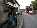 Dunsford, main street - geograph.org.uk - 1747518.jpg 640 × 480; 87 KB
-
 Forest Inn, Hexworthy - geograph.org.uk - 183632.jpg 640 × 480; 106 KB
-
 Forest Inn, Hexworthy - geograph.org.uk - 3025137.jpg 640 × 480; 94 KB
-
 Forest Inn, Hexworthy - geograph.org.uk - 3025302.jpg 512 × 640; 104 KB
-

-
 Great Doccombe Farm - geograph.org.uk - 18813.jpg 640 × 425; 155 KB
-
 Greenawell Farm - near Moretonhampstead - geograph.org.uk - 37389.jpg 640 × 425; 136 KB
-

-
 London Inn - geograph.org.uk - 1424915.jpg 640 × 428; 53 KB
-
 Lydford, The Castle Inn - geograph.org.uk - 1020386.jpg 640 × 480; 65 KB
-
 Lydford, The Castle Inn and Hotel - geograph.org.uk - 37568.jpg 640 × 434; 136 KB
-
 Mary Tavy - geograph.org.uk - 203349.jpg 640 × 480; 81 KB
-
 Palk Arms - Hennock - geograph.org.uk - 640009.jpg 640 × 480; 70 KB
-
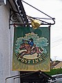 Post Inn pub sign - geograph.org.uk - 887364.jpg 480 × 640; 95 KB
-
 Princetown, The Railway Inn - geograph.org.uk - 1070820.jpg 640 × 480; 54 KB
-
 Princetown.jpg 2,009 × 2,776; 481 KB
-
 Pub in Dousland, Devon - geograph.org.uk - 1492821.jpg 640 × 430; 74 KB
-
 Ring O Bells, The Square, Chagford - geograph.org.uk - 1473525.jpg 640 × 480; 155 KB
-
 Ring of Bells - North Bovey - geograph.org.uk - 31065.jpg 640 × 425; 121 KB
-
-
 Rock Inn, Haytor Vale - geograph.org.uk - 934458.jpg 640 × 480; 72 KB
-
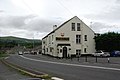
 Seven Stars Inn, South Tawton - geograph.org.uk - 1772736.jpg 1,024 × 768; 855 KB
-
 Sun Inn, Buckfastleigh - geograph.org.uk - 1124894.jpg 640 × 480; 75 KB
-
 Tavistock Road, Princetown - geograph.org.uk - 1376219.jpg 640 × 427; 67 KB
-
 The "Pack Horse" - geograph.org.uk - 1322357.jpg 640 × 427; 64 KB
-
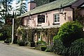
 The Abbey Inn, Buckfast - geograph.org.uk - 1361890.jpg 640 × 480; 189 KB
-
 The Bay Horse, Ashburton - geograph.org.uk - 1309012.jpg 480 × 640; 120 KB
-

-
 The Bell Inn, Moretonhampstead - geograph.org.uk - 939696.jpg 640 × 480; 88 KB
-
 The Burrator public house, Dousland - geograph.org.uk - 1714525.jpg 640 × 417; 67 KB
-
 The Cleve Inn in Lustleigh - geograph.org.uk - 1220061.jpg 640 × 427; 100 KB
-
 The Globe Inn, Bucklastleigh - geograph.org.uk - 1361844.jpg 640 × 480; 83 KB
-
 The King's Arms, Buckfastleigh - geograph.org.uk - 1361872.jpg 640 × 480; 92 KB
-
 The Leaping Salmon, Horrabridge - geograph.org.uk - 1273068.jpg 640 × 427; 90 KB
-
 The Rock Inn, Haytor Vale - geograph.org.uk - 1742049.jpg 480 × 640; 137 KB
-
 The Tors Inn, Belstone - geograph.org.uk - 933903.jpg 640 × 480; 75 KB
-
 Two pubs in Princetown - geograph.org.uk - 183733.jpg 640 × 480; 80 KB
-


