Category:Public transport maps of Tychy
Jump to navigation
Jump to search
Media in category "Public transport maps of Tychy"
The following 14 files are in this category, out of 14 total.
-
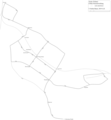
 Map of trolleybus system in Tychy.svg 1,865 × 1,654; 149 KB
-
 OBusLeitungsplanTychy2018.png 3,252 × 3,037; 480 KB
-
 OBusLeitungsplanTychy2019.png 3,252 × 3,514; 561 KB
-
 OBusNetzentwicklungTychy.png 2,439 × 2,634; 382 KB
-
 Siec trolejbusowa Tychy.svg 998 × 860; 582 KB
-
 Trolleybus line A, Tychy.svg 1,865 × 1,654; 16 KB
-
 Trolleybus line B, Tychy.svg 1,865 × 1,654; 14 KB
-
 Trolleybus line C, Tychy.svg 1,865 × 1,654; 15 KB
-
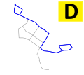 Trolleybus line D, Tychy.svg 1,865 × 1,654; 14 KB
-
 Trolleybus line E, Tychy.svg 1,865 × 1,654; 14 KB
-
 Trolleybus line F, Tychy.svg 1,865 × 1,654; 15 KB
-
 Trolleybus line G, Tychy.svg 1,865 × 1,654; 15 KB
-
 Trolleybus system in Tychy.svg 800 × 641; 700 KB
-
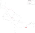
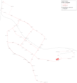
 Upper Silesia public transport system map (with stations).png 10,357 × 9,249; 41.93 MB


.png)