Category:Public transport maps of Toyohashi
Jump to navigation
Jump to search
Subcategories
This category has only the following subcategory.
R
- Railway maps of Nagoya Railroad (137 F)
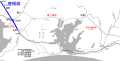
Media in category "Public transport maps of Toyohashi"
The following 6 files are in this category, out of 6 total.
-
 En-San Railroad Linemap.svg 1,361 × 687; 442 KB
-
 Linemap of Atsumi Line.svg 2,317 × 1,432; 560 KB
-
 Stadt-undStraßenbahnGleisplanToyohashi2014.png 9,357 × 7,151; 784 KB
-
 Toyohashi Railroad Linemap.svg 940 × 915; 266 KB
-
 ToyohashiStraßenbahnNetzentwicklung.png 2,938 × 1,183; 198 KB
-
 Toyotetsu AzumadaLine Map.png 1,734 × 1,209; 144 KB


