Category:Public transport maps of Rome
Jump to navigation
Jump to search
Subcategories
This category has the following 5 subcategories, out of 5 total.
Media in category "Public transport maps of Rome"
The following 11 files are in this category, out of 11 total.
-
 A handbook of Rome and the Campagna (1899) (14579124000).jpg 2,816 × 1,274; 370 KB
-
 Autcentrale.jpg 564 × 401; 33 KB
-
 Civiter public transport network.jpg 5,048 × 5,079; 1.4 MB
-
 Location of main stations in Rome.png 749 × 607; 51 KB
-
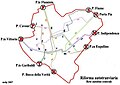
 Rete dei trasporti del settore nord-est dell'area metropolitana di Roma 2019.jpg 5,048 × 5,079; 1.29 MB
-
 Rete pre-riforma.jpg 1,991 × 1,513; 1.43 MB
-
 Riforma1930.jpg 703 × 668; 134 KB
-
 Roma metro Conca d Oro schema linea.jpg 2,592 × 1,728; 579 KB
-
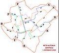 Roma, rete autobus centrale (01-01-1930).jpg 2,078 × 1,881; 342 KB
-
 U-undStraßenbahnGleis-undOBusLeitungsplanRoma2018.png 7,703 × 9,170; 2.64 MB
-
 U-undStraßenbahnGleis-undOBusLeitungsplanRoma2019.png 7,703 × 9,170; 2.64 MB
_(14579124000).jpg)


.jpg)

